


An untracked journey through the Hooker-Landsborough Wilderness Area leaves a party elated beyond measure
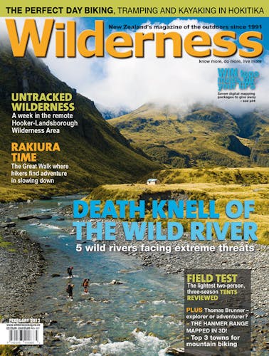
From across the open grassy expanse of the lower Landsborough Valley, Mt Hooker beckons as we hastily pack the final items for a six-day trek through south Westland’s hinterland.
The 2600m peak is an arresting sight. Its massive triangular summit, beset by glaciers on all flanks, falls sheer to the upper Clarke Valley and our destination, Marks Flat. The flat is located in the Hooker Landsborough Wilderness Area, a great swathe of protected wild country between the Landsborough and Mahitahi rivers.
Five of us have set out on what has become an annual tramp. Mike Latty, this time with his son Ben, and friend Bryce Jenkins, and Fr Antoine Thomas, a French missionary of the Order of St John whom we introduced to the wilds of New Zealand just one year earlier in the Hunter Valley. He was so smitten then that he has been urging us to plan another mini-expedition to explore the ‘Lord’s creation’, as he has coined it. We are happy to oblige.
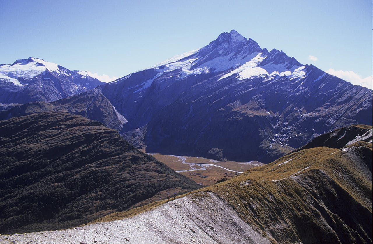
A short road walk beyond the ramshackle Landsborough Homestead takes us to the first major obstacle of the trip, a ford of the Landsborough to access the Clarke. This ford is not to be taken lightly. I know from past trips in the valley how massive this river is, even when not in flood, as snow melt from numerous glaciers often swell the flow, particularly over the summer months. The Landsborough is unique among South Island rivers in that it flows parallel to the Main Divide for 60km from its passes to the Mueller Glacier in Mt Cook National Park. As such it is a big river in every conceivable way: big catchment, big gorges, big flats, big mountains, and big flows.
Charlie Douglas and Gerhard Mueller were the first to explore the valley in 1887, describing it as a, ‘Boiling, turbulent, mountain flow’. This is what we are concerned with now as we push out into the wide, clear river just below Strutt Bluff. Relief is finding the river easily fordable, in fact only calf deep after an unusually prolonged dry spell in South Westland.
With a usable piece of the afternoon at our disposal, a warm day and easy travel ahead we make sure of our commitment to enter the wilderness area and pace up the lower Clarke under an intense blue sky, pitching camp at a large flat below Rough Creek.
The Clarke is clear and blue, easily crossed and makes a beautiful backdrop for our campsite, tucked under the overhanging branches of beech trees. A campfire completes the scene, that and a starry night under which to eat dinner before rest and an early start next day.
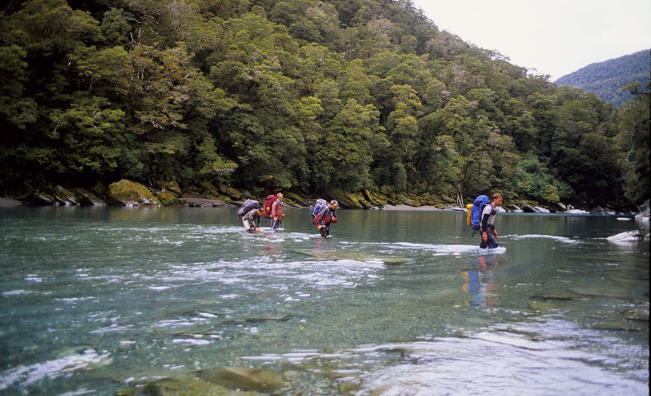
Having crossed the boundary of the wilderness area near Rabbit Flat we continue on into the upper valley over the next two days, assured that we will meet no one who has not come here on their own two feet. Officially designated Wilderness Areas are few in New Zealand, but they are certainly treasured by those who created them and those who explore them on nature’s terms. There are no tracks, huts, bridges and no air, boat or vehicle access. They are also remote, usually taking a day’s walk to even access the boundary. We are privileged visitors, blessed with settled weather and a stunning landscape as we forge on into the valley, passing west of the Clarke’s deep, dark canyons over densely forested spurs to gain the upper flats.
Fording the lower Landsborough at Harper Bluff. Photo: Bat Parrett
Davies Flat presents great sprays of tussock and tantalising views of Mt McCullaugh on the Hooker Range, its flanks wreathed in ice.
We make camp at Munro Flat on spongy mosses near the twin routes to Marks Flat: easy-angled Saddle Creek, and the fearsomely steep Cataract route, direct to Marks Flat via the Clarke River canyon.
Members of the party, led by Bryce, are lobbying for the Cataract Route, and I have the casting vote. “Let’s do it!” I say. “That was easy,” Bryce comments with a chuckle.
Though bristling with bluffs and waterfalls, Moir’s Guide assures us that the route is relatively easy and no longer than Saddle Creek.
We make a fire and prepare a solid meal. Stars flicker overhead and the mountain shoulders deepen in the night.
Easing out of camp next morning we enter the forest below the cataracts and begin the steady 600m climb up the true left of the Clarke.
Though steep in parts and guarded by numerous small bluffs, the route goes well and we reach the key point of the passage at ‘the slip’ where an old ground trail crosses and climbs the slip face to re-enter the forest. Progress slows as we traverse above the river, slowly cutting down toward the boisterous flow, as bluffs and rock prows allow, until we gain the river edge near the first of the rock bivvies located around Marks Flat. This one is more of a very large overhang that impressively frames the south face of Mt Hooker. With the river noise amplified by the rock, Mt Hooker arching overhead and house-sized boulders scattered along the banks, we feel dwarfed by the absolute wildness of the place and keen to reach the flat proper as afternoon recedes into evening.
A late lunch sustains us on warm rocks at the riverside followed by a detour to visit the Airport Bivvy Rock. The biv is near an old airstrip that was used by fixed wing aircraft until the creation of the wilderness area in 1990 and is sunless and cool. Even though it has adequate space for the five of us, the sunlit tussock expanses of the flat are a powerful enticement. Yet we don’t leave until we locate the ‘hut book’ a tin secreted in rocks near a fireplace that contains records of parties who have visited. The last entry is 15 months ago, so we update the book with our entry and depart for the flats.
Marks Flat is a vast open space secreted beneath the southern flanks of Mt Hooker which looms overhead like a great ice-rimmed pyramid. With the flats at just 950m and the summit of Hooker topping out at 2640m there is 1700m of vertical rock and ice between us and the summit and the perspective is staggering from where we stand sorting our camp in golden sunlight.
The evening is unutterably beautiful; warm, bright and still, almost somnolent. Encircled by high mountains, rolling tussocks, ridges, and the black bluffs of Kea Cliffs on the south-eastern edge of the flat, there is a powerful sense of isolation; like that of an impregnable fortress – alone in the wild. The tents are up, dinner is being readied and Fr Antoine has called those who wish to attend Mass which he celebrates on a small knoll cast in the middle of the flat from where we can gaze onto the mighty spectre of Mt Hooker. The setting is incomparable.
Night brings falling temperatures and a grand array of stars spread in glittering specks over the wedge of sky visible from the flat; there’s a good frost coming I tell myself as I settle into my sleeping bag.
Dawn is brutal. We have no fire and thick ice encrusts the tents, our boots, and cooking gear, and it’s difficult to get warm. Though we are up early, we postpone our departure to the Solution Range until the sun arrives and drives some of the cold from our bones.
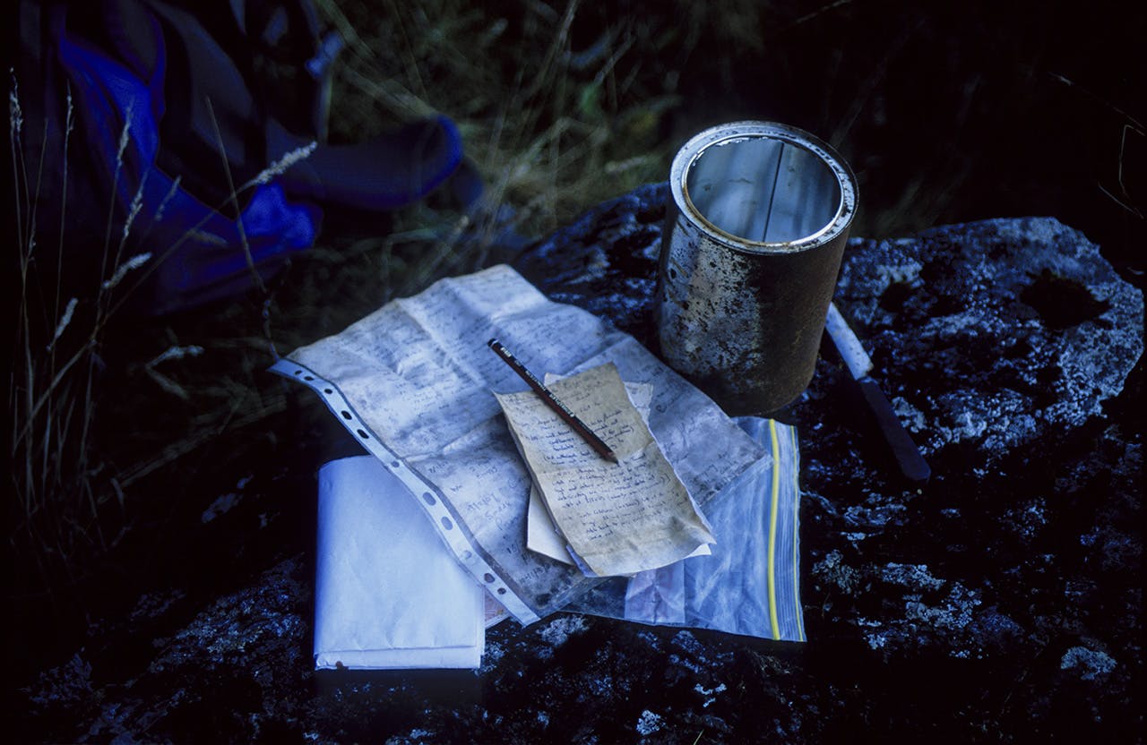
The ‘hut book’ at Airport Bivvy. Photo: Bat Parrett
We fight thick scrub to access the bush and then again to leave it as we ascend 400m to gain the range crest. At the modest summit, barely 1500m, we are greeted with a stunning scene of mountain fastnesses where the Landsborough sluices down beneath the Divide, draining all its precipitous basins from Mt Burns, overlooking the Mueller Glacier, to Mt Napoleon in the upper Hunter Valley. The Landsborough is wide and deep, and even from here the size and power of the river is evident. Some summits are truly breathtaking – Mt Hooker of course, but also Mt Dechen, New Zealand’s only ice-cap glacier and a peak I have long wished to climb, plus the frighteningly steep razor-like wedge of Mt Ward along with the towers and frozen gullies of Mt Jackson.
Beyond the Landsborough head tower Mt Sefton and Aoraki/Mt Cook – the first a gleaming ice pyramid and the latter revealing her sheer bulk and mile-long summit ridge.
Bryce captures the mood of us all when he says, “This is the best mountain view I have ever seen in New Zealand.”
The descent to the Landsborough is long but easy, the bush relenting and offering sure passage to Toetoe Flat where we begin our tramp down valley heading first to Creswick Flat and the small but usable Fraser Hut, set on the bush fringe above the river. After several nights in tents it’s superb to find the comfort of a hut and the living space to prepare dinner and relax. Later, the weather forecast comes in over the mountain radio, informing us that the good weather is to continue with perhaps a little drizzle and thickening cloud cover. We still have two days walk to exit the lower valley through the gorge where two high passages are usually required over Harper and Strutt bluffs, the latter having a particularly fearsome reputation, though there is now a much lower and safer route marked across it.
At this point I pull out a map of the ‘stoat-trap-line’ for yellow-head protection that has been run through the Landsborough from Harper Bluff to McKerrow Creek in the upper mid-valley. DOC staff at Haast gave me the map and it proves invaluable for finding our way out, especially over the high bush sidles.
Described as a rough, sparsely-marked route, we treat it with care though we needn’t have been too concerned; aside from the open flats and shingle banks, the trap line is well marked and cut and sees us through to below Harper Bluff by late afternoon.
We manage to sidle the bluff with a double crossing of the river, and thereby explore a magnificent series of turquoise-coloured pools and arrive, by surprise, at a rafter’s camp on the river edge at the base of the bluff. It’s empty and we take the opportunity to explore the set-up, finding a welcome note to use the camp if we wish, providing we respect their property and find our own wood.
So we enjoy another waypoint on this magnificent trip, cooking our final dinner over the large fireplace.
The last day of a long trip often brings mixed feelings; the desire to get out, cleaned-up and home, tempered with the pull to remain, to see and do more – to return to the wild. Thankfully our day is short, relatively easy and though the river is tumultuous in parts, we find safe passage to speed our progress beyond Harper Flat and past the small canyon above Strutt Bluff, where we manage another double crossing of the Landsborough to arrive safe and sound at the vehicle track.
Low cloud is obscuring the peaks and only ice runnels are visible below the murk as we stride up out of the river. It’s still and warm, tuis call from the bush and we’re elated beyond measure.
We’ve journeyed across the big wild in a blessed moment of tranquillity in the south-west.
