


The Bridge to Nowhere, Whanganui National Park
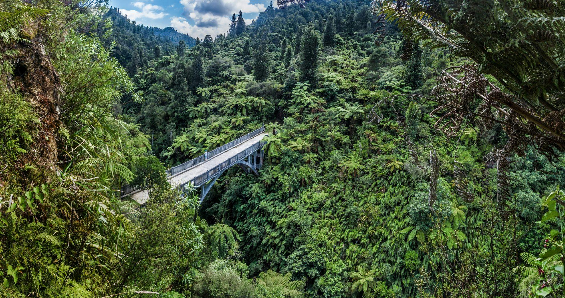
Deep in Whanganui National Park, spanning the Mangapurua Stream, sits a 40m-long arch bridge. Though built to last, the bridge has only ever supported one vehicle. Today, trampers’ boots tread its weathered concrete surface.
The simplest way to get there requires a 40-minute jet boat ride from the village of Pipiriki, some 24km to the south. The ride, through sheer, fern-clad cliffs on one of the most spectacular stretches of New Zealand’s longest navigable river, is an event in itself. Mangapurua Landing, in the middle reaches of the river, gives access to a pleasant 2.5km stroll above the Mangapurua Stream.
The bridge appears suddenly, first viewed through a clearing in the dense bush. The structure is a striking visual metaphor for the plight of those it was designed to help.
The bridge, built in 1936, was the culmination of a government scheme to settle returned servicemen in the area after the First World War. Pioneering farmers ventured up the Mangapurua Valley, breaking-in steep bush-clad hillsides. The Mangapurua Stream lies at the bottom of a deep narrow gorge, which had to be crossed to gain access to the Whanganui River Taxi, which provided a crucial link in the North Island’s main trunk line.
At its height, 35 holdings were established, but the land eventually proved too remote and rugged. By 1942, only three holdings remained and the government withdrew any further funding for road development. The land reverted to native bush, and the bridge was destined to lead nowhere.
- Distance
- 2.5km
- Total Ascent
- 176m
- Grade
- Easy
- Time
- From Pipriki to the Mangapurua Landing, 40min; Landing to bridge, 40min
- Access
- Jetboat from Pipiriki, then a 3km bush walk above Mangapurua Stream
- Map
- BJ29
