


In the southern portion of the Richmond Range, which stands between Nelson and Marlborough provinces is an area known as the Red Hills, a large zone of ultramafic rock contained within the Motueka River headwaters. This rock type is extremely high in mineral content, particularly iron, copper, and chrome, making it difficult for vegetation to grow and imbuing the entire ultramafic region with a dull red toning.
Routes into this fascinating section of the park are numerous and can be accessed from virtually any direction, making a variety of round and through trips possible.
The range is small enough in area to be included in an itinerary that traverses the more heavily vegetated Richmond Ranges to the north.
1 Red Hills Hut
A new hut has been constructed at this southernmost entry to the Red Hills, as well as a marked entry and car park off SH63, making day trips and easy exploration of the region near the hut possible for families and school groups. The hut can be reached in 2-3hr from the highway.
2 Red Hill
The region’s principle summit at 1790m is also the highest point in the entire Richmond Range. It can be reached by traversing Red Hills Ridge, a moderately challenging two day trip requiring good visibility and fitness. Views from the summit take in not only the range but a huge portion of southern Marlborough and Nelson Lakes National Park.
3 Porter Ridge
This ridge runs parallel to Red Hills Ridge and immediately to its west making a round trip of both ridges possible, a climb over Porters Knob, 1710m, and a descent back to the track above the Motueka River.
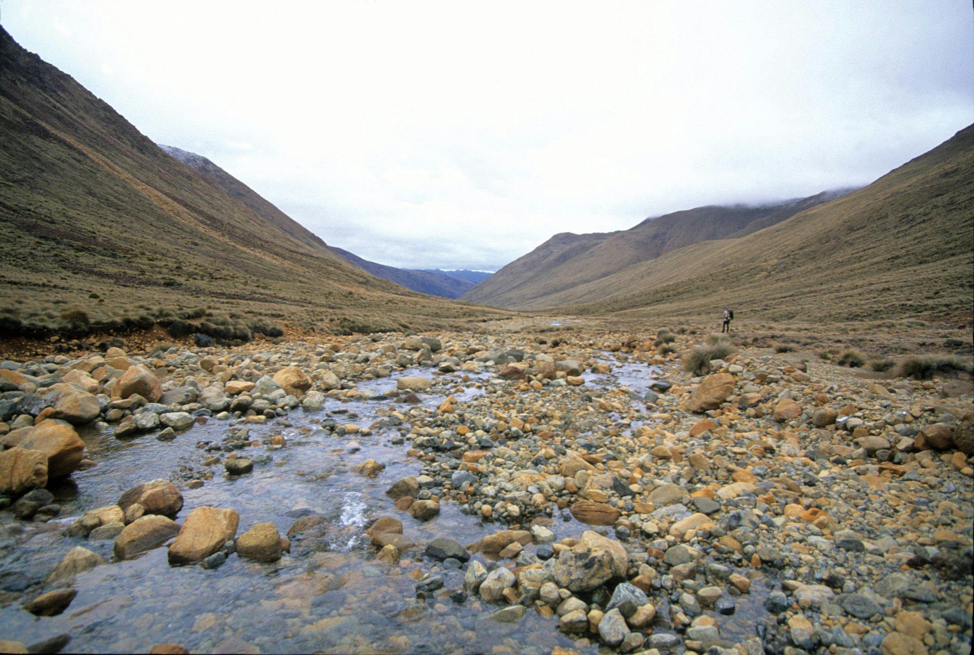
4 Motueka River Right Branch
The Motueka River Right Branch rises in the central Red Hills, flows south beneath Red Hill and then turns to the north, around the toe of Porter Ridge, to drain the range’s western flanks. A track, beginning at Red Hills Hut, traverses these western flanks along the border of the ultramafic rock to reach the northern part of the Red Hills. It is a demanding tramp cutting across the grain of the land and entering several large tributaries.
5 Porters Hut
A small shelter standing at 900m on a bench above the spectacular catchment of Lowther Creek. Though only a day’s walk from the road, Porters Hut has a remote and beautiful setting.
6 Hunters Hut
At the northern end of the Red Hills is Hunters Hut, built to replace an earlier structure washed away by massive flooding of the Motueka River Left Branch which claimed two lives in 1995. It has a grand outlook over the upper valley here and is near the intersection for several alternative tracks into the region.
7 Motueka River Left Branch
From Hunters Hut a tortuous trail descends the Motueka River Left Branch, climbing high above a gorge to eventually reach road access through Golden Downs Forest. This valley is heavily forested.
8 Gordons Knob
An easier access point for Hunters Hut is via Inwood Lookout, in Golden Downs Forest, along the Gordon Range and descending into the Motueka River. This is a spectacular and varied route into the northern end of the Red Hills.
9 Mt Ellis
At the extreme head of the Motueka River Left Branch, Mt Ellis, 1615m, offers an interesting tops route along to Ben Nevis, 1619m, and Gibbs Spur Track to reach the Left Branch of the Wairoa River. This part of the Wairoa is laced with forestry roads which are accessed from near Wakefield.
10 Top Wairoa Hut
Deep in the upper Wairoa River Left Branch, on the ultramafic boundary, is Top Wairoa Hut in a magnificent setting beneath the ranges. It’s remote, peaceful, and secluded and could be added into a route through the Red Hills, but beware it lies 500m below the marked route along the ridge line to the west.
11 Right Branch Wairoa River
Also accessed near Mt Ellis, the upper Wairoa River Right Branch has a forested track that descends to its mid-valley hut from where it climbs again to reach the forestry roads and access on to Wakefield. This track can also be linked to Gibbs Spur and Wairoa River Left Branch.
12 Head of Motueka River Right Branch
The extreme head of the valley, and centre of the Red Hills region, can be reached via a high (1600m) unnamed pass immediately south-west of the poled route that descends to Top Wairoa Hut. This pass gives unobstructed access to the valley floor which can be traversed southwards until gorging and scrub makes it desirable to climb to Red Hills Ridge, near 1646m Chrome, and descend to The Plateau.
