


- GPX File
- Mt Haast.Victoria FP (gpx, yo 8 KB)
- Your device does not support GPX files. Please try a different device.
Mt Haast, Victoria Conservation Park
Approaching Springs Junction from the east, the large pyramid-shaped summit of Mt Haast rears above its neighbouring peaks.
For Bryce, Mike, and myself, making the summit was our goal for a day trip from Christchurch. It was a fair distance to travel, but with a reasonable forecast, the lure of the western slopes of the Main Divide was hard to resist.
Mt Haast is modest in altitude, just 1587m, has a track to the bushline and a poled route from there to the top. Some might call it a highway, but let’s not presume too much – it’s still almost 1000m of altitude gain from road to summit, and those metres get steeper as you approach the top.
But first the bush. An easy angled trail begins right beside the highway just west of Rahu Saddle and continues at a pleasant gradient all the way to the bush edge. The forest is mixed and always changing, particularly when heading higher into the subalpine zone. Here, the crunchy fronds of mountain neinei – a flaxy shrub typically found at this level in the west – predominates, creating a carpet of decaying vegetation over the forest floor.
The neinei is a harbinger of the bush edge, which we reached soon after. Scampering up onto a tussock knoll, we surveyed the region spread out below in increasing detail as we ascended.
At 180,000ha, Victoria Conservation Park is New Zealand’s largest conservation park. It’s reminiscent of Fiordland with reasonably easily traversed tops surrounded by fearsome battlements consisting of forest floor to bush edge bluffs, massive scarps, skinny two-boot-width ridge crests, truncated spurs and alpine cirques. All of which are features of past glaciation and it’s what makes a visual examination of the area so arresting.
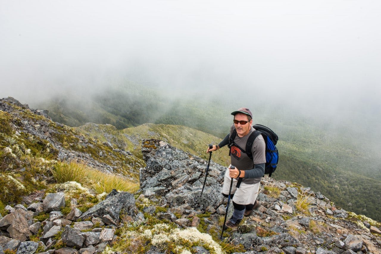
The ridge crest steepens and narrows as the summit is approached requiring extra care where over-steepened gullies spiral away beneath the track edge. The peaks were gone – for the moment.
We piled up onto the summit, found a sheltered spot below some rocks and tucked into lunch.
I’d had ideas of continuing along the ridge crest where it forms a horseshoe-shaped boundary above the Rahu River, but with the route hidden in the clouds I ruled this out.
Mike quipped that he didn’t bring enough food for that option, followed by Bryce who didn’t bring enough daylight. It was down again, but not by the same route. I’d spied an alternative: the south-east ridge of Mt Haast.
This option curves away from the summit and over a nice tussock ridge and bench followed by thick trackless bush. The first part was cruise country, with grand views and lots of photo stops where bluffs plummeted into the forest below. Then came the bush.
Open at first, we made quick time watching the altimeter, map, and compass for the best way. At 900m, we broke left, north-east, descending into easy angled terrain dominated by rapidly thickening forest, scrub, mud holes, and pole beech. A desperate hour or so of travel saw us fighting, falling, sliding, and crawling through the mess, all the time regretting the descent route – well almost, until we fell out onto the road for a quick walk back to the ute. Mt Haast – maybe not a highway after all.
Wild File
Access A signposted track 1.8km west of Rahu Saddle on SH7
Grade Moderate
Time 3-4hr to summit. Round trip 6-8hr
Distance 2.35km to summit
Total ascent 922m
Map BT22
