


Dave Mitchell guides us on an epic mountain bike journey through New Zealand
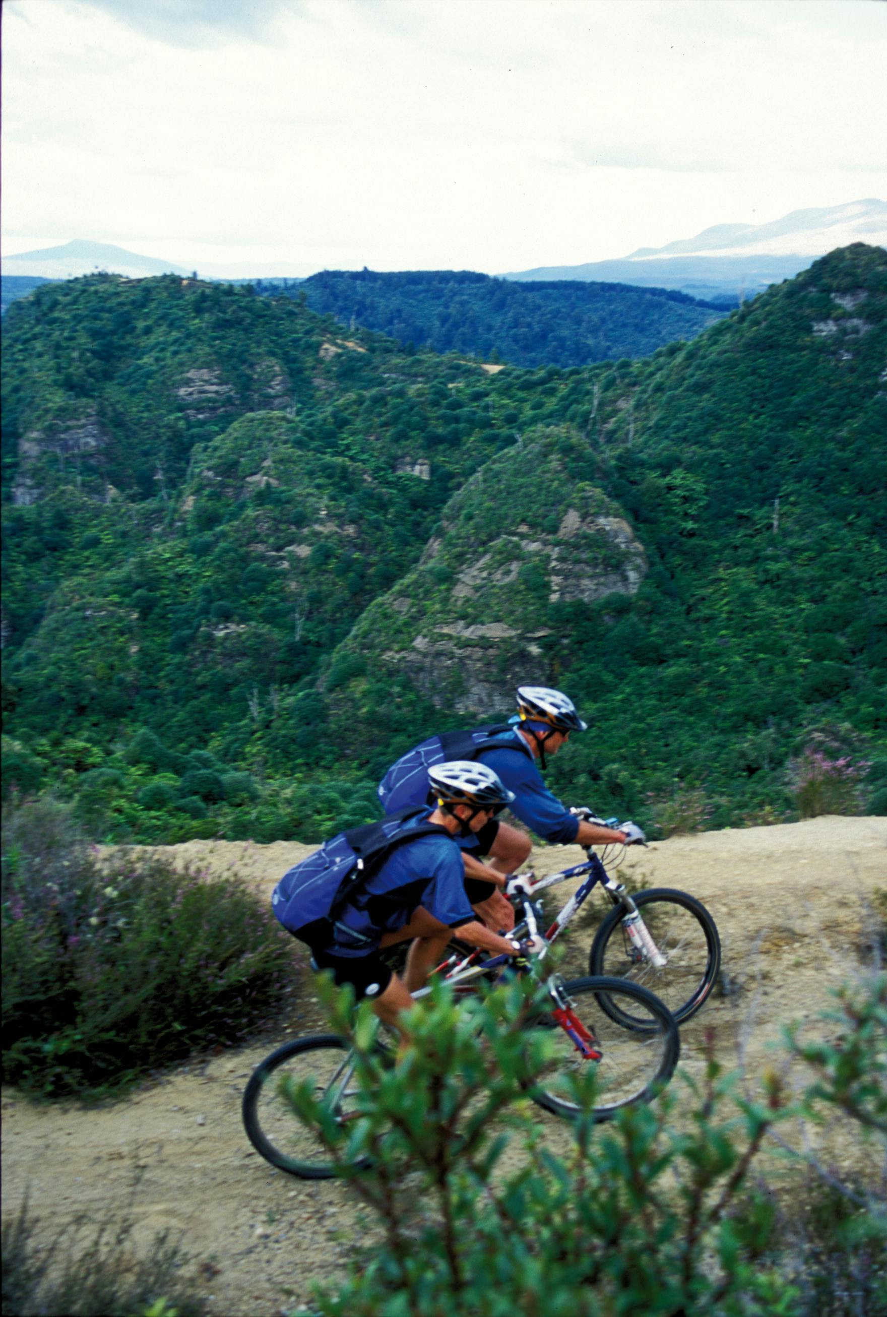
There is no substitute for turning over the pedals on dirt. A favourite mountain bike ride may be a 10-minute local downhill, or a leisurely ride with some mates in the forest. So many factors come into play that can make any track into a classic ride. This list is made up of old acquaintances and some of our long time favourites. We go back and ride them when we can, never tiring of their character and the changes that come with the seasons. They are long rides in stunning locations that challenge on a number of levels and rewards accordingly. They can be ridden fast or slow, some as an overnight experience and most can be ridden all seasons.
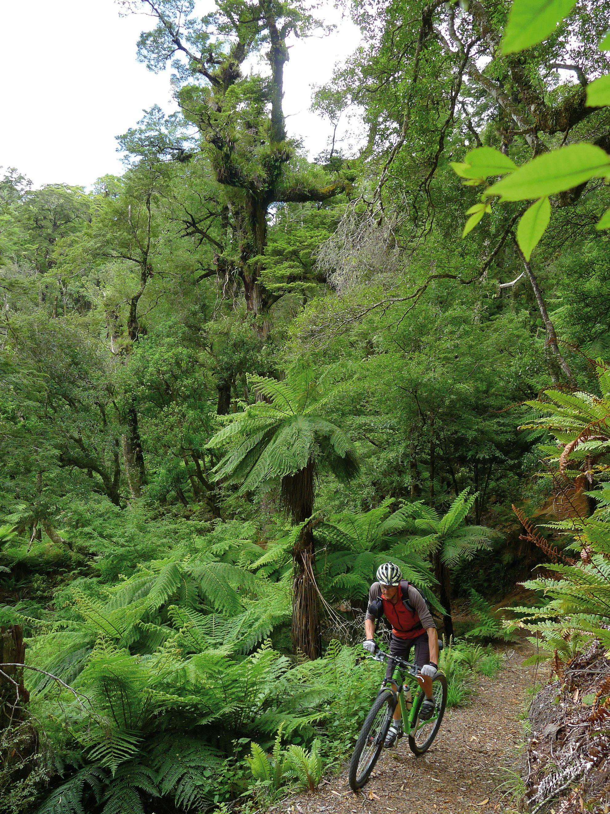
Moerangi Track, Whirinaki Forest Park
The Moerangi Track started life as a tramping track that looped around a group of three huts deep in the Huiarau Ranges which is part of the massive Whirinaki Forest Park.
DOC has re-benched the track, done up the huts and added plenty of signage and this would have to be one of the most amazing single track rides available in New Zealand. The forest is stunning and full of tall trees and lots of noisy birdlife. The track really rocks with meaty climbs that provide excellent vistas and long descents into stream valleys.
There is a huge variety of riding to challenge all level of rider. The major streams are bridged and if you want to do a return trip there are three nice huts to stay in overnight.
- Access From Minginui there are many ways to ride this track but the most popular way with the least amount of climbing starts from the Okahua Road end car park and ends at the River Road car park.
- Grade 3
- Distance 36km one way or 76km return
- Climbing Okahua to River Road one-way 800m or 2200m return.
- Map Topo50 BG38, BG39
- Notes The Jail House in Minginui has rental accommodation and does bike shuttles: www.jailhousefarmstay.co.nz
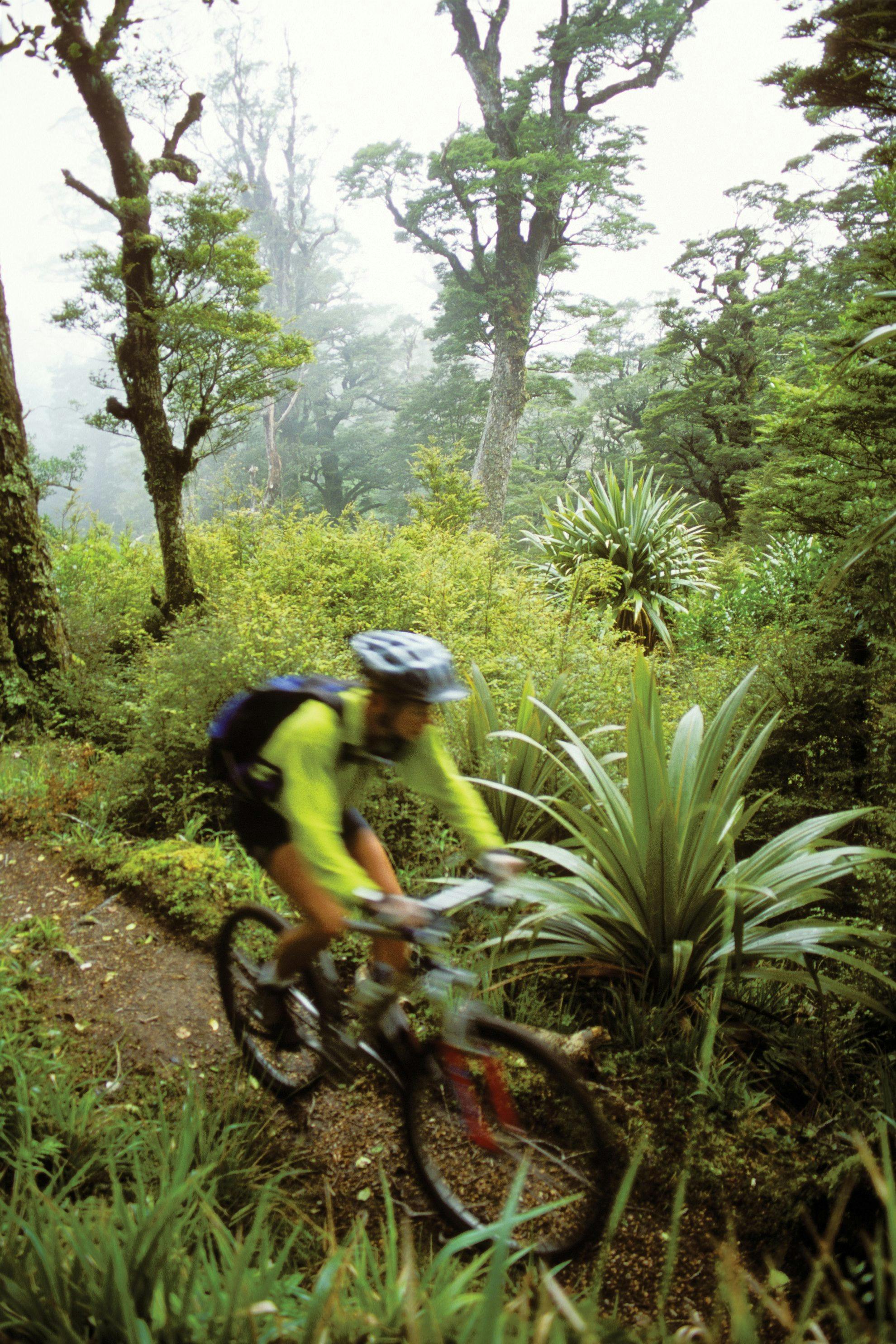
A blur of motion amongst mountain cabbage trees on Te Iringa
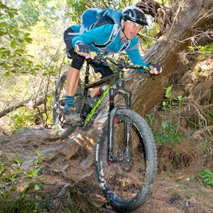
Te Iringa, Kaimanawa Forest Park
The Kaimanawa Forest Park covers an area of around 76,000ha and is situated in the central North Island south-east of Lake Taupo. Hidden in the wet and densely clad bush of the park is an old pack track called Te Iringa, which runs down the east side of the Kaimanawa Recreational Hunting Block. It’s a superb and challenging piece of single track that climbs and descends through some stunning native forest. This area was set-aside in the early days by the Forest Service to control introduced animals and a number of huts were built for the recreational user and most are still in good working order.
DOC now administers and maintains these tracks and facilities and to its credit has remarked the old track and negotiated access in tricky situations. You can lunch at Oamaru Hut perched on a high terrace at the confluence of the Oamaru and Kaipo rivers or stay the night and explore the surrounding area before the return ride back out.
- Access 43km south-east of Taupo
- Grade 4
- Distance 38km
- Map Topo50 BH37
- Climbing 1100m
Central Plateau magic: the 42nd Traverse
42nd Traverse, Tongariro Forest Conservation Area
Tongariro Forest and the 42nd Traverse is strategically wedged between the Tongariro National Park and the top of the Erua Forest. Gazetted in 1900 as State Forest 42 it was systematically logged of its totara, matai, rimu, miro and kahikatea over the proceeding decades.
There is still a vast array of excellent tracks and trails for mountain biking; many are loops or side trips off the famous 42nd traverse. They give access to some of the more remote corners of the forest, hidden in the gullies and ridges of this convoluted landscape.
The 42nd Traverse is one of the great North Island rides travelling over a mix of gravel road, 4WD track and snatches of single track through regenerating bush. Best done from east to west due to its predominantly downward direction. It starts 18km north of National Park on SH47
- Access Tongariro Forest, 18km north-east of National Park
- Grade 3
- Distance 45km one way
- Map Topo50 BH33, BH34
Bridge to Nowhere, Whanganui National Park
This is a remote jungle ride into the heart of Whanganui National Park. The track travels through some abandoned returned servicemen farm settlements to an old art deco concrete bridge that goes, well, nowhere. It finally reaches the Whanganui River at Mangapurua Landing. Thick regenerating bush covers the hills with massive tree ferns down to the Mangapurua Stream. The river has cut deep into the papa clay to form what looks almost like an alien canal while the track sidles precariously above it in places. It can be ridden as a day trip in and out, or there are plenty of tent spots along the way to enjoy an overnight stay. The Kennett brothers advocate a multi-day trip involving rafting you and your bike down the river.
- Access From the end of Ruatiti Road
- Grade 3
- Distance 84km return trip
- Map Whanganui Parkmap
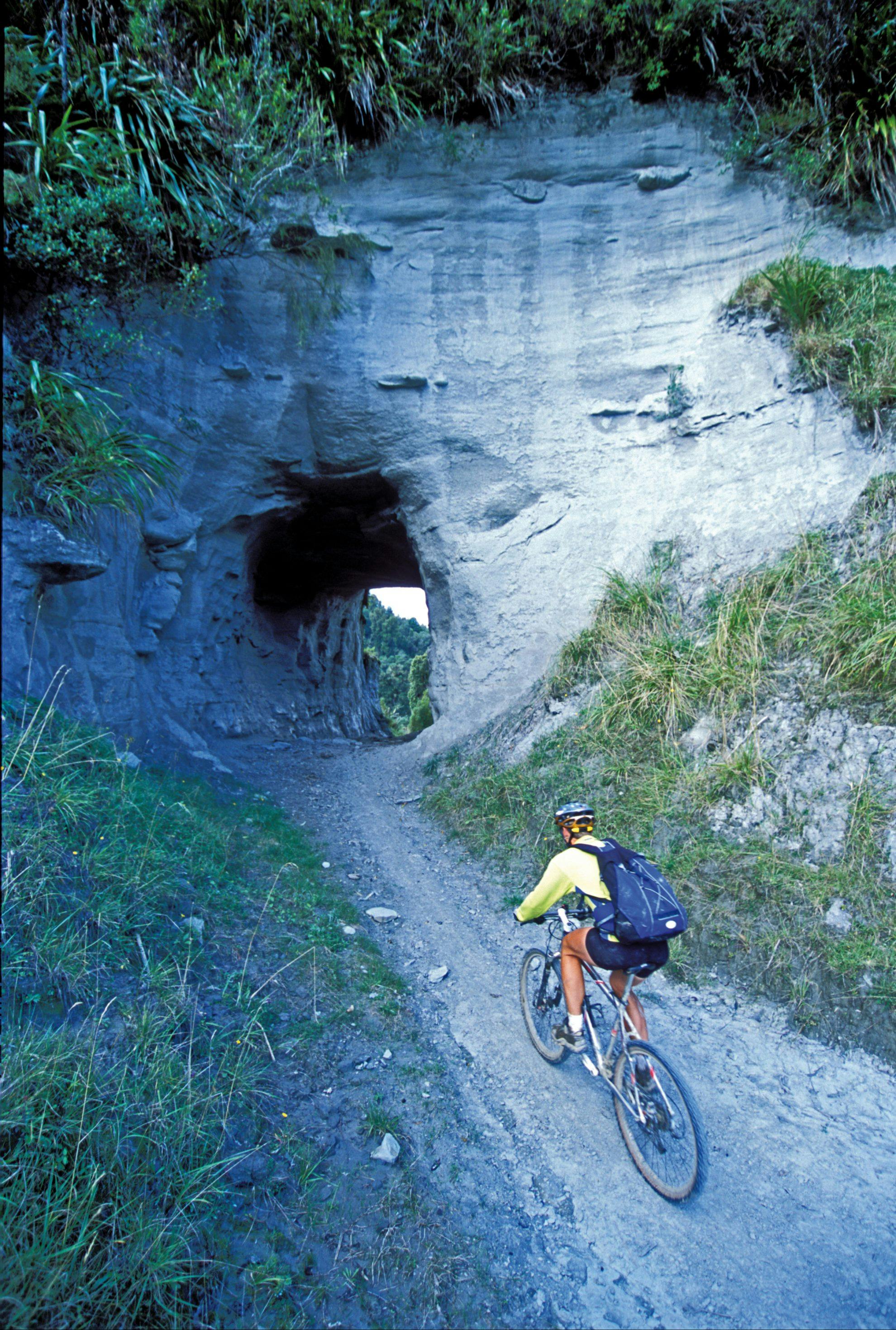
The crumbling tunnel that bypasses the Waitara River
Rerekapa Track and Moki Track, Taranaki
The Rerekapa trundles through a mix of woolly farm country and bush blocks taking a mysterious route into the back of beyond. While the Moki Track has a bit of a reputation for not existing, this may have been due to its impassable state for many years and the fact that it doesn’t join up on the topo map.
The Moki track starts out innocently enough following the Waitara River then crosses it and reverts to 4WD rocks and ruts. A collapsing tunnel bypasses the snaking river with the track continuing to the edge of the semi-developed undulating farmland. Benched single-track heads into bush where DOC has repaired and reopened the bridges and structures. This section provides some of the most enjoyable riding in the area with lots of technical lumps, bumps, bridges and beautiful bush.
Exit into farmland and follow your nose out to the gravel road with a couple of Ks to join up the loop. These two tracks can be done in isolation but are best joined to make a round trip.
- Access 85km east of Stratford
- Grade 3-4
- Distance 48km loop
- Map Topo50 BH31
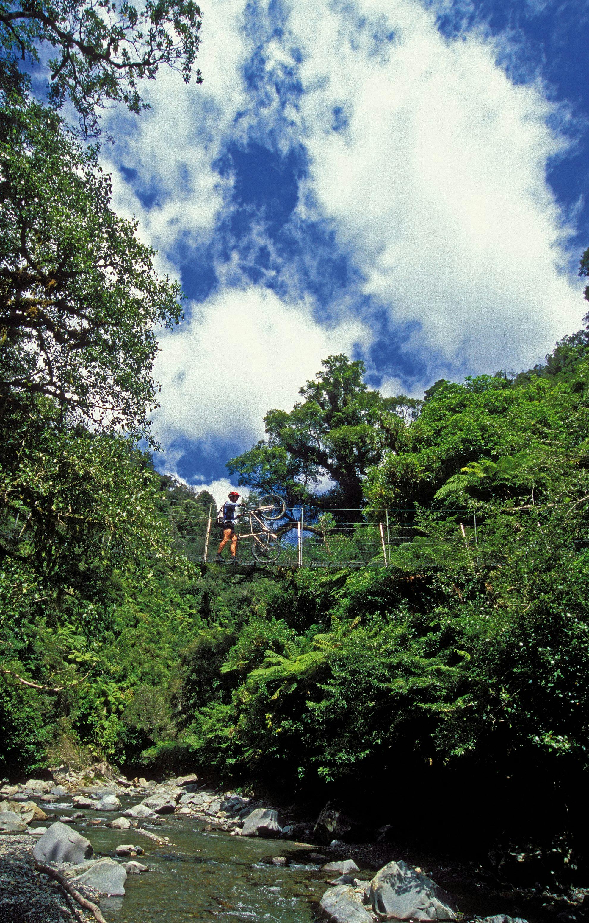
The high wire swingbridge in the remote Waotauru Valley
Waiotauru Valley, Tararua Forest Park
The Waiotauru Valley ride drops from the top of the Akatarawa Saddle east onto a 4WD track and into a South Island-like river valley. It is rugged and remote country that chills out as it crosses a high wire swingbridge and heads towards the lower north island’s east coast. The ride holds on to its best bit of flowing single track till nearing the end at Otaki Forks. From Otaki Forks head 15km to Otaki for a car shuttle or have an enjoyable ride back up to the Akatarawa Saddle to complete the circle.
Jonathan Kennett told us, in strictest confidence, that back in the eighties his teen brother Paul was keen as mustard to use the ride as “the classic race”. That’s instead of what we have come to know and love as the Karapoti Classic. No wonder its Jonathan’s favourite jungle ride.
- Access 22km north of Upper Hutt on Akatarawa Road
- Grade 3-4
- Distance 45km loop
- Map Topo50 BP33
Queen Charlotte Track, Picton
Lurking along the beautiful coastline of the Marlborough Sounds is superb benched single track just waiting to be ridden. Starting from Captain James Cook’s favourite Ship Cove, the ride heads through lush bush on a roller coaster ride that never wanders too far from the deep blue sea, but climbs high enough to provide commanding views of the surrounding islands, bays and boats.
It’s all made so easy with a profusion of water taxis providing not only drop-off and pick-up service but that can transport your pack full of luxuries from camp spot to camp spot. Private accommodation at every level is available along the way to make this the perfect trip to indulge in.
Over the years, the track has evolved from a rough-and-ready pack track into what you ride today. Continued improvements and track realignments are part of its ongoing march towards sainthood.
- Access Ship Cove, by Water taxi from Picton
- Grade 3
- Distance 63-86km
- Map Topo50 BQ28, BQ29
Heaphy Track, Kahurangi National Park
Back in 1997, Kahurangi National Park was formed and swallowed up the ground that the Heaphy Track rested upon and with it the right to mountain bike there.
There has been a long history of cyclists riding the Heaphy Track and I am sure that this tradition will continue. The ride is generally a two or three day adventure depending on the hours of daylight, weather and the riders’ relative fitness.
It’s a great track to cruise along enjoying the scenery, beaches and open tops. With a good level of fitness, the track can be knocked off in a single long day, if daylight hours permit. The riding is fantastic from either direction, but there is something special about starting from the Collingwood end and dropping down to the West Coast with its salt sea air, sandy beaches and nikau palms.
- Access From the end of Aorere Valley Road, near Collingwood
- Grade 3
- Distance 82km
- Climbing 1650m
- Map Topo50 BP23, BP23
- Notes Open to mountain bikers between May 1 and Oct 1. Check with DOC for track closure, condition and hut bookings.
Waiutu – Big River Track, Reefton
Reefton is the starting point of many a great West Coast mountain bike ride and the Big River Track through to Waiuta is one of the best. The old mining road climbs into the beech forest reaching the ghost town of Big River after passing many a miner’s tunnel on a rough and rocky surface that at times resembles a streambed. From Big River, an old pack track provides technical bench singletrack out to Waiuta. It’s beech forest most of the way, with some open tops and long sections of down hill thrown in.
Waiuta provides its own ghost town to explore, then a gravel road followed by tarseal takes you back in a circle to Reefton. An overnight stay at the DOC Big River Hut allows plenty of time to explore the old mine site and its vast array of relics. This is truly great West Coast ride to relish.
- Access At the end of Soldiers Bog River Road, Reefton
- Grade 3+
- Distance 68km loop
- Map Topo50 BT22
Big, rugged country defines Clarence Conservation Park
Clarence Conservation Park, South Marlborough
The Clarence Conservation Park covers a vast area of valleys and mountains on the Seaward Kaikoura Range, from the Palmer Stream in the south to Snowgrass Hut in the north. It’s almost 60km in length, with the Clarence River as its western boundary and the crest of the Seaward Kaikoura Range forming its eastern edge. Under DOC management new huts and signage have been erected, encouraging exploration on foot and by mountain bike.
After traversing the Seaward Kaikoura’s via Bushy and Blind saddles, follow Seymour Stream to the Clarence River and Seymour Hut. From there you can head north over Tyler Point and sidle below Limestone Hill before finally dropping into Goose Flat or a steep rugged track will take you to the top of Limestone Hill for amazing views at 1320m. From Goose Flat Hut you can continue over Dubious Flat to Stony Flat at the edge of Fidget Stream.
Going south from Seymour Hut you first go inland and visit the historic Old Willows Hut before heading out to the Clarence River and Palmer Hut. Somewhere in the middle a skyline track climbs up the north ridge of Mt Warder to 1340m, then traverses over to a fenceline. It provides stunning views after a gnarly climb. This ride takes you into some big country with landscapes of incredibly rugged beauty you rarely get to see.
- Access: From the Inland Kaikoura Rd at Mahunga
- Grade 3+
- Maps Topo50 BS27, BS28, BT26, BT27
- Climbing 1700-3200 metres.
Mt Buster – Johnstones Creek Track, Oteake Conservation Park, Otago
The 65,000ha Oteake Conservation Park contains large areas of conservation land on the Saint Marys, Saint Bathans, Hawkdun, Ida and Ewe ranges. This is mountainous high country at its best, with vast tracts of tussock- and scree-covered slopes, and river catchments with their associated wetlands hidden behind tough climbs and epic descents.
The Mt Buster–Johnstones Creek Track is one of the best and toughest of Otago’s mountain bike rides. There are a couple of DOC huts along the way with plenty of side trips to explore, old gold workings to see and mountains to climb. It’s an epic ride in anyone’s book with a surprise around every corner and three massive hill climbs to test the lungs and legs.
- Access At the end of Mt Buster Road, Naseby
- Grade 4
- Distance 58-109km loop
- Maps Topo50 H41, I41, H40, I40
- Climbing: 2600-3200m
Hopkins River Valley, Ruataniwha Conservation Park, Twizel
As river valley rides go, the Hopkins is one of the best; an adventure among awe-inspiring mountains, beech forests, tussock flats, and alpine streams. The Neumann Range and the Main Divide of the Southern Alps flank the ride until they close in and meet at Faith Col on the edge of the Hourglass Glacier, one of many that hang from these lofty tops.
Over a mix of farm 4WD track, riverbed and river terrace the ride heads up the valley and into the mountains. Strategically placed DOC huts prove a place to stay and a base to explore from. You can ride into Dodger Hut at the end of the valley, which then closes into a tight gorge. Beyond is tramping country to Erceg Hut, Richardson Rock Biv and the Richardson Glacier’s moraine lake. The return trip is downhill and often wind assisted.
On the way back, a visit to Elcho Hut and a walk up the adjacent Elcho Stream valley is well worthwhile. There are some stunning alpine plants and great views of Mt Jackson and the Moore Glacier.
- Access From the end of Lake Ohau Rd
- Grade 2-3
- Distance 70km return
- Climbing 490 metres
- Map Topo50 BY15, BY14
