


- Time
- 4–8hr return
- Grade
- Moderate
- Access
- Hooker River Bridge, Ball Road, Tasman Valley. Aoraki/Mt Cook National Park
- Map
- BX15
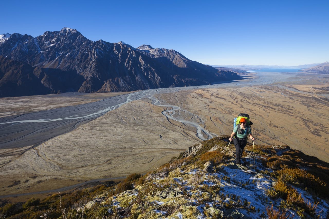
Cook Range, Aoraki/Mt Cook National Park
The name is noble, and so too are the views from the Cook Range: beneath your feet the floor of the Tasman Valley sits, riven with ancient stream braids and dotted with matagouri. Two craggy mountain ranges flank either side, like giant armies on an infinite march: the Blackburn Range to the east and the Ben Ohau Range to the west. Beyond, to the south, the water from two great rivers – the Tasman and Hooker – combines with others to feed Lake Pukaki, shimmering in the distance like a great turquoise glaze over the dry of the valley.
Accessed from Hooker Corner, the track onto the Cook Range rears straight up, and it’s quite rough at first. Even a short labour up the hill is rewarded though, as the views kick in fast and improve the higher you go.
Anywhere between the 1400m contour and Pt1566m makes a great destination for a day trip. If you’re willing to carry a bit more gear there are great camping spots along the ridge, while those with basic alpine skills can aim for Mt Wakefield, further along the range.
