


- Distance
- 40k
- Access
- From Mt Arrowsmith Station on the shore of Lake Heron. Use the Hakatere Heron Road
- Map
- J35, J36
Mt Arrowsmith Station, Lake Heron
Sharyn Miller knows a thing or three about merino wool and the high country stations the sheep grow up on. Merino sheep have been keeping the weeds down and the fire risk at bay for many generations and recently they have been producing the raw material for the high tech tramping, biking, sports and leisure clothing we have come to love.
Sharyn first introduced us to Arrowsmith Station and the great couple who manage it, Sally and Eric, back in 2004. Both Sally and Sharyn are accomplished mountain bikers. Their hospitality and the station’s stunning backdrop and challenging terrain made it one of our favourite weekend destinations.
Access is via the Hakatere Heron Road from the Mt Somers turn off and is approximately two hours drive from Christchurch.
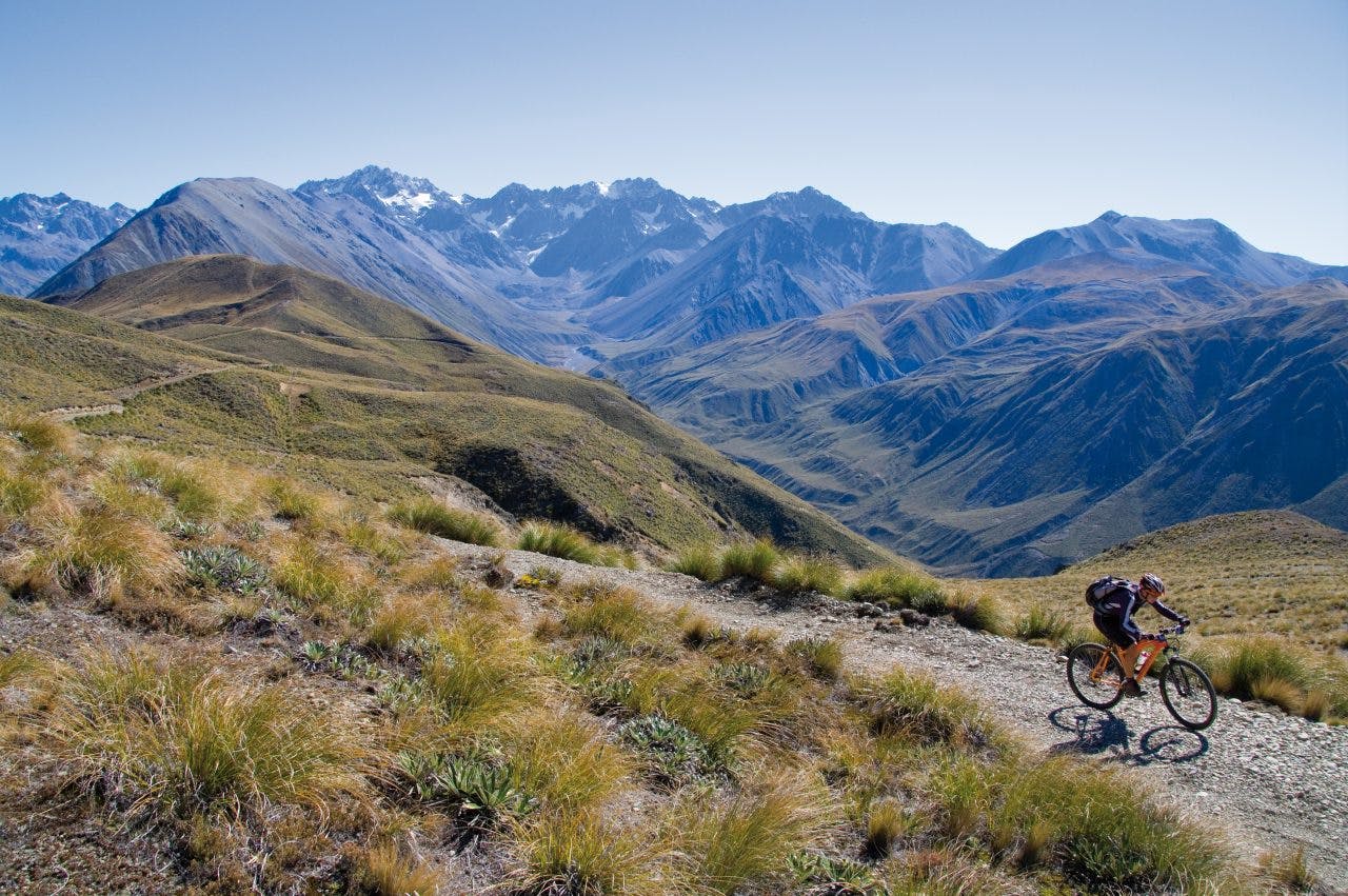
North of Mt Arrowsmith Station, the farm 4WD track leaves the Hakatere Heron Road from the western edge of Lake Heron and climbs west. Our breath caught the cool morning air only to condense and disappear in a flash. Russ, Barbara, Ditte and I climbed the lower slopes of the flat-topped Pyramid Range, sidling initially north to pick up a steep and gnarly uphill in Big Gully. Behind us, an awesome view across Lake Heron and its wetlands to the Mt Somers, Palmer and Taylor Ranges was opening up as valley mist burnt off.
The track now followed the 1400m contour below the 1600m Pyramid Peak. Way below us and heading in the same direction is the Cameron River Valley, a rough tramping track goes past Highland Home Hut to Cameron Hut at the head of the valley. It provides trampers and climbers with access to the big mountains of the Arrowsmith Range.
Wild Mans Hill loomed ahead, as the farm 4WD track wandered across tussock tops to the edge of the main ridge. We then followed a stream gully down, with tight turns and a loose surface to descend upon. There was a magic view into the South Ashburton River Valley and along its peripheral edge to the snow-capped peaks of the Arrowsmith Range. On either side of the river, the Wild Mans Brother Range and Big Hill Range march headlong and parallel towards a series of hanging glaciers.
After a great downhill, we joined the valley track and continued the short distance north to Wild Mans Hut. This is hidden below a ridge and up the very last sidestream coming from the north.
The hut was built in 1957 by Ron Scott, Alex Urquhart, Thyme and Rick Taylor, who was the manager of Mt Arrowsmith Station at the time. A coal range with wetback provides buckets of hot water for the make-shift outside shower. The hut sleeps six and provides a great base from which to explore the valley north. From the hut, a vague farm track heads upstream along the river flats before crossing the South Ashburton River. We splashed across to the true right bank and continued to the big hut on a terrace beside Stumpy Stream.
This hut was once part of Hakatere Station, but is now with DOC and offers eight bunks and a carport. We continued further up the valley, crossing and re-crossing the river and spending more and more time in the riverbed, which changes character and rearranges the furniture every time we visit.
The track finally ends just before the short upper gorge, with its prickly spaniard, tall tussock, oleria and hebes growing profusely next to the water flow. We walked to the face of the Arrowsmiths, which was well worth the effort – the height gained giving spectacular views back down the valley and the feeling of getting really close to some big mountains. The Ashburton Glacier is rapidly retreating as the years go by. The ridge behind rises from South Peak to the 2681m Mt Arrowsmith and then across to the spectacular Jagged Peak with much of the glacial morrain having collapsed onto what was once a white glacier. The return ride back to Wild Mans Hut was surprisingly fast and downhill and a good indicator of how much we had climbed.
We spent a candle-lit night in the hut with a blazing fire to keep us warm and cosy. Above the hut a galaxy of stars blanketed the sky. With no moon to spoil the show, they appeared brighter and more intense than usual.
Rather than going back over the Pyramid, we rode out from Wild Mans Hut via the Ashburton River South Branch. This initially backtracks to the Pyramid turn-off before heading down the true left bank of the river. The track climbs to avoid slips and washouts along the steep west-facing side of the Pyramid Range above.
This is a miniature Canterbury alluvial river valley sandwiched between the Hill and Pyramid Ranges. It’s mainly tussock country with matagouri, spaniard and hebes hanging around the edges. We forded a good number of creek crossings and rolled over some gnarly boulder fields as we headed for the lower short gorge.
The gorge starts where Boundary Creek joins the main flow and the whole river changes direction to head east. The track climbs away from the river and behind two 1000m hills before initiating a gnarly descent. We then returned to the river and followed it out to Harding Stream ford, then climbed away and onto the high terraces overlooking the eastern part of Mt Arrowsmith Station.
The terrace provided us with a long downhill back to the station, which in turn allowed ample time to enjoy the view. The track joins the main gravel road at the small sheltered motor camp. There, willow trees dip their branches in Lake Heron as water laps their tangled roots. The lake-edge follows the road back to our start point where we packed up, said our goodbyes and reluctantly headed home.
