


Pirongia Forest Park, Waikato
Pirongia Mountain’s distinctive summit dominates the skyline just 25km south of Hamilton. Although the forest-clad peak no longer resembles one, it was once a large volcano. Since volcanic activity ceased about 2.5 million years ago, the erosive forces of wind, weather and rivers have whittled the mountain to its present shape. Some viewpoints still show the rough outline of what was once the main crater.
The 16,770ha Pirongia Forest Park contains the mountain’s summit and forests, while an outlier of the park protects the sentinel of Raglan, Mt Karioi – another extinct volcano. First established by the New Zealand Forest Service in 1971, the park has an interesting botany. Kauri reach their southern limit just south of Pirongia and several other tree species reach their northern limits in the area.
The park provides Waikato trampers with some of their most accessible back-country tramps, as well as plenty of shorter walks.
1. Pirongia Mountain (959m)
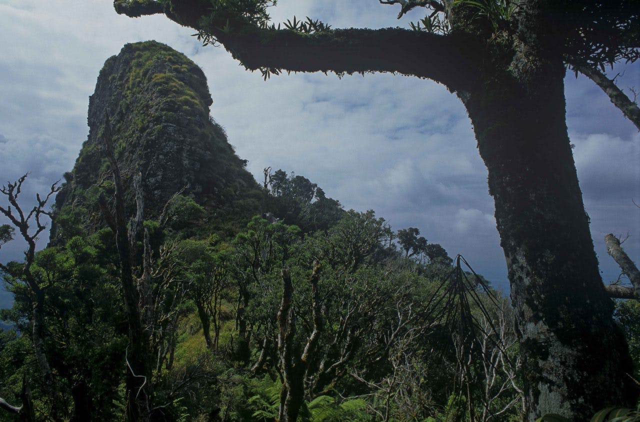
The most popular access to the summit of Pirongia lies on the Tirohanga Track, beginning at Corcoran Road. Initially the track is well-benched and gravelled. After an hour or so of climbing, it reaches Ruapanae, the first of many viewpoints. The track becomes narrower, climbing over a series of spectacular rocky tors (once the crater lip). Further up, boardwalks avoid the worst of Pirongia’s notorious mud, reaching the summit not long after. A viewing tower offers panoramic views of the Waikato. Allow about 3-5hr to reach the summit.
2. Pahautea Hut
The six-bunk Pahautea Hut sits among a grove of its namesake mountain cedar trees. Eight tent pads and a shelter offer sites for campers. A nearby viewpoint has superb dawn views, especially when the Waikato is mist-enveloped.
3. Mahaukura Track
Beginning from Grey Road, the Mahaukura Track provides a more rugged alternative to the summit of Pirongia. Taking 4-6hr, this track climbs steadily to Wharauroa (850m), perhaps the best viewpoint in the park. From here, the track traverses a series of rocky knolls, passing through groves of spiderwood to reach the summit. Together with the Tirohanga Track and Link Track, a round trip to the summit and Pahautea Hut is possible in a long day or leisurely weekend.
4. Hihikiwi Track and Te Araroa
The Te Araroa Trail traverses Pirongia Mountain by way of the Nikau Walk and Tahuanui Track to reach Pahautea Hut. From there, Te Araroa continues over the mountain’s south-western slopes over a long series of elevated boardwalks on the Hihikiwi Track, following the rough line of an ancient Maori trail that once connected Kawhia to inland destinations. It’s now the quickest route to reach Pahautea Hut.
5. Mangakara Nature Walk
This 60-minute nature walk, starting from Grey Road, provides a gentle, family-friendly introduction to the park’s forests and rivers. Ancient kahikatea and rimu tower above the smaller kohekohe, tawa and pukatea trees beneath, with informative panels detailing the area’s ecology.
6. Nikau Walk and Kaniwhaniwha Caves
Following the Kaniwhaniwha Stream from Limeworks Loop Road, the 2.5hr return Nikau Walk leads to a loop track and nearby camping and picnic spot. The track is suitable for family cycling and assisted wheelchairs. Kaniwhaniwha Stream offers pleasant summer swimming and anglers may be interested in the park’s only fishery, with both brown and rainbow trout. Lush forest studded with nikau palms lends the track a sub-tropical look. Over the last decade, about 20,000 trees have been planted here as part of a restoration project. Ten minutes beyond the Kaniwhaniwha campsite, the track leads to two limestone caves, both worth investigating – bring a torch.
7. New Zealand’s largest Kahikatea Tree
Two hours past the Kaniwhaniwha Caves, the track reaches the country’s largest recorded kahikatea – an impressive 67m tall.
8. Bell Track
Past the kahikatea, the Bell Track climbs onto the western slopes of Pirongia, eventually to reach Cone, Pirongia’s second highest summit. This is a more demanding tramp – allow 6-10hr from the Kaniwhaniwha car park to Pahautea Hut.
9. Mt Karioi (756m)
Of the two routes leading to the summit of Mt Karioi, the Karioi Track is the more dramatic, although it is steeper and more strenuous (involving a ladder at one point). The alternative Wairake Track lies on the southern side.
The Karioi Track begins from Te Toto Gorge car park, initially climbing through manuka on retired farmland until entering mature forest higher up. The first prominent knoll on the summit ridge lies at 706m, but the main summit is an undulating hour further on.
10. Te Toto Gorge
The basalt cliffs of Te Toto Gorge are a spectacular feature on the western slopes of Karioi. A viewing platform near the car park offers a giddy view over the cliffs and sea. A track descends steeply through coastal forest for about 15min until reaching Te Toto Stream, where the formal track ends. Another 15min leads to the bouldery shoreline and a view back to the cliffs.
