


- Area
- Nelson
- Distance
- 19km
- Time
- 7-9hrs
- Grade
- Moderate
- Map
- BQ26
Dun Mountain and Little Twin, Mt Richmond Forest Park
This walk consists of numerous misnamed features. Dun Mountain is actually a craggy hill rather than a mountain, Little Twin is bigger than its neighbour and looks nothing like it, Dew Lakes are small shallow pools and Rush Pool is more a marshy reed bed.
But don’t let false advertising put you off. Dun Mountain is the easiest-to-reach summit in the Richmond Range from the Nelson side. The dunite rock beneath the surface forms infertile soil, meaning despite the peak’s modest 1129m height, it has no tree growth at the top and boasts glorious views across the length of the range.
Trampers can reach the summit via the Dun Mountain Railway Track, but this is a slow ascent, probably more suited to bikers.
My friend Kat and I started at the Maitai River – a 20-minute drive from the city.
We headed along the track towards the reservoir and turned right after 200m to cross the river via a footbridge. The path led up a bank to a track which we followed upstream to the true left of the river, following signs to either Dun or Coppermine Saddle.
The wide track narrows before reaching a fork. This is easily missed – make sure you take the left fork over the footbridge, rather than continuing straight on.
We followed the rocky mountain bike trail as it zigzagged through forest, eventually turning to scant vegetation as we ascended relatively quickly, enjoying views back towards the city and the ocean.
The track levelled a little as we followed the base of the mountain towards Coppermine Saddle, which we could see in front of us. As the saddle became tantalisingly close, we were ushered left by a sign saying Dun Saddle 30min.
This path was much rougher and narrower. Parts of it looked as if it was following a stream bed and orange arrows led us through the bushes and out into the open.
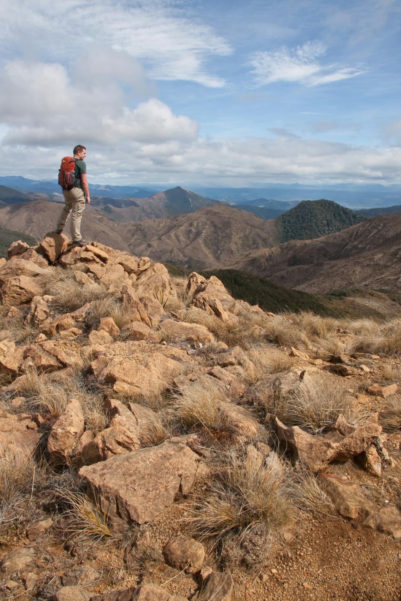
The surroundings as we approached Dun Saddle were more akin to Central Otago – golden tussock broken only by copper-coloured rocks poking up at all angles. Once at the saddle itself we enjoyed the view over towards the likes of Mts Starveall, Richmond and Fishtail – all poking their heads out of the forest and with a dusting of snow. The Arthur Range in the distance was covered in cloud – we’d picked the right side of the valley to go tramping.
The saddle actually provided the best view of the day. But that’s not to say a venture to the summit isn’t worth the effort. The climb was steep, quick and fun with plenty of rocks to negotiate and we were soon on the summit plateau following red and white markers to the tiny Dun Shelter. This little green building is very basic with a ‘French-style’ outside toilet consisting of two planks of wood over a hole.
One final short climb took us to the summit before a steep descent to a saddle where alpine forest begins once more – a relief to our sun-battered heads.
Twin Peak, 1143m, is shaped like a volcano so the ascent starts gradually before steepening. The top is bush-covered but still offers lovely views to the south.
The descent from here begins steeply and I slipped a couple of times. The gradient eased and we knew we’d reached the base when we hit a short spell of knee-high mud. The track remained boggy until we reached the track heading towards Rush Pool.
First, we took the two-minute diversion to Dew Lakes. They are only a few centimetres deep, but were very pleasant and we enjoyed a bite to eat in this sheltered spot.
The walk from here was fairly relentless. Rush Pool wasn’t much of a diversion and the track deviated from forest to open tussock several times before finally reaching pine forest and we turned left when we reached a forest track that led back to the car.
