


Fiordland is massive; 1.2 million hectares of glaciated mountains, lakes, fiords, rivers and forests, our largest national park and an essential part of Te Wāhipounamu World Heritage Area. Yes, places in the park teem with tourists but worry not; be it an easy day walk or challenging tramp, kayak or bike ride, there is still much magnificent and wild country to explore.
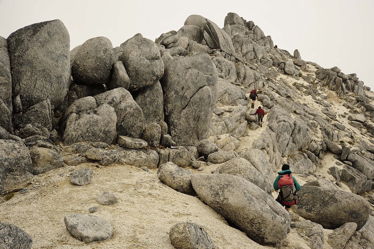
A take on Titiroa
This is the peak that looks snow-covered, even in mid-summer. In fact, it’s the white granite boulders and sandy surfaces that make the Titiroa summit look white.
Unless you buzz up by helicopter (and some do), climbing Titiroa is an off-track 3-4 day challenge for experienced folk. Head from Manapouri to Hope Arm Hut, up the Garnock Burn then climb, map and compass in hand, to the bush edge. There’s a camp spot here, with water, on the summit ridgeline. From here it’s a solid day to the summit and back, or you can continue over to the south, on a roughly-marked route to North Borland Hut. Check Moir’s Guide South.
Hike the Hollyford – or just some of it
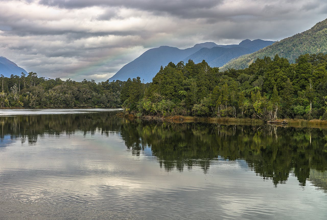
The Hollyford River, site of one of Fiordland’s oldest walks. Photo: Martin Sliva
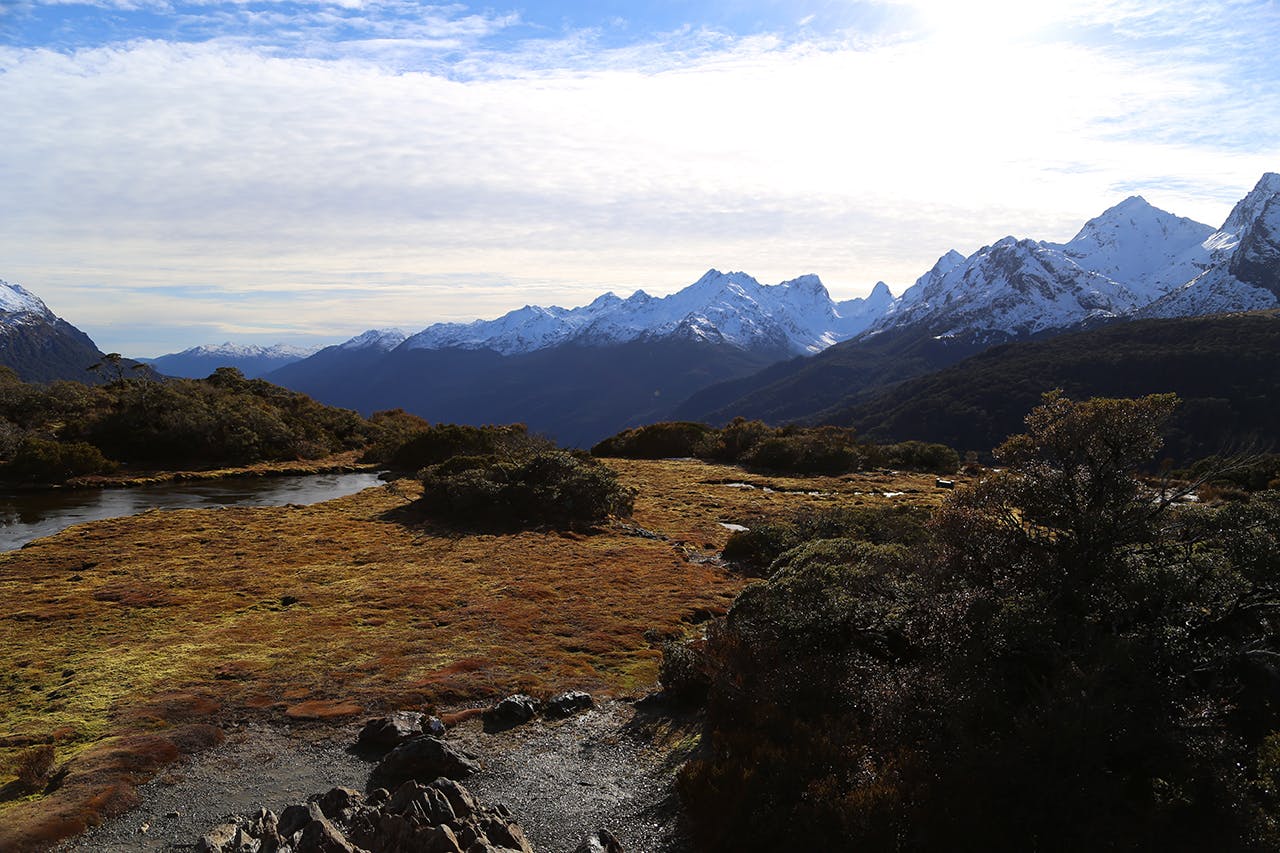
This is one of Fiordland’s oldest multi-day walks and for its grandeur and diversity, easily equal to its higher profile Great Walk neighbours. There’s some ‘tramping as it used to be’ feel about the Hollyford; huts are first-come, first-served while the ominously named Demon Trail section is rough, boggy and undulating. Landscapes are dramatic. Waterfalls, rivers and rainforest are dwarfed by the sheer granite faces of the Darrans. You’ll see brooding reflections in lakes McKerrow and Alabaster, then the primeval dunescapes of Martins Bay.
There’s no alpine section so it’s a year-round trail, the catch is access to/from the remote Martins Bay end. There are several options: walk back, complete a longer 3-4 day loop via Big Bay and the Pyke River (experience required for this flood-prone route) or simply charter a plane or helicopter.
Alternatively, invest in a guided walk (includes fully catered private lodges, Lake McKerrow jet boat crossing, spectacular Martins Bay to Milford Sound flight, and historic anecdotes, of which there are many, from the well-versed guides).
For an easier, family trip just walk to Hidden Falls Hut (9km) then a further 10km to Lake Alabaster Hut, and return. This part of the track is high quality, bridged, and very scenic.
Wander the Waiau – and more
Lake Te Anau gathers up its water from the massifs of central Fiordland and pours it through to Lake Manapouri along the Waiau River. Fringed with beech forest, with trout feeding and possibly a white heron watching, the Waiau recently starred as ‘Anduin River’ in The Fellowship of the Ring. A track (part of the Kepler Track) follows the true right from the Lake Te Anau outlet to Rainbow Reach (2hr). Here, a swingbridge crosses to the road (a shuttle bus links with Te Anau in summer). Or you can keep exploring along the Kepler Track. A further two hours or so will take you through a small wetland to Lake Manapouri’s Shallow Bay (a stunning photo spot) and on to Moturau Hut.
Back to the Waiau; on the true left a mountain bike track from Lake Te Anau to Rainbow Reach is nearing completion, it’s a great family ride. And, on the river, packrafting is becoming a thing. Whatever you do, you’ll find that the birdlife is abundant.
Get out on a Great (day) Walk
Stunning beech forest on the first section of the Kepler Track. Photo: Alistair Hall
Fiordland’s three Great Walks get booked up quicker than an All Black test match, but if you miss out don’t despair. Take a day walk. On the Routeburn, head into Lake MacKenzie for lunch, that’s a 24km round trip from The Divide on the Milford Road. You’ll pass through beech and ribbonwood forests and open country with views across the Hollyford Valley to the Darran Mountains. Water things you’ll see: Lake Howden, pretty in its forest basin, the 174m Earland Falls, all drama, and Lake MacKenzie, nestled in the mountains, simply stunning.
On the Kepler Track, Mt Luxmore is a staunch day climb from Lake Te Anau, first beneath limestone bluffs and beech forest, then over open tussock.
The 1085m summit, 45 minutes past Luxmore Hut, is a fine viewpoint. In winter, it’s a not-too-technical climb. Return distance is 31km, which you can shorten to 21km if you catch a water taxi from Te Anau to Brod Bay.
Go to Green Lake
Away (a bit) from the madding crowds, Green Lake Hut in southern Fiordland makes a great 2-3 day trip.
There are two tracks in: the shorter option (7km) starts from Borland Saddle, on the Borland Road; the other (11km) climbs in from Lake Monowai. The hut sits in tussock overlooking Green Lake. Worth exploring from here, about two hour’s walk away in the upper Grebe Valley, is historic Clarke Hut, a former deer culler’s hut built of split beech logs. Note that this track is at times indistinct.
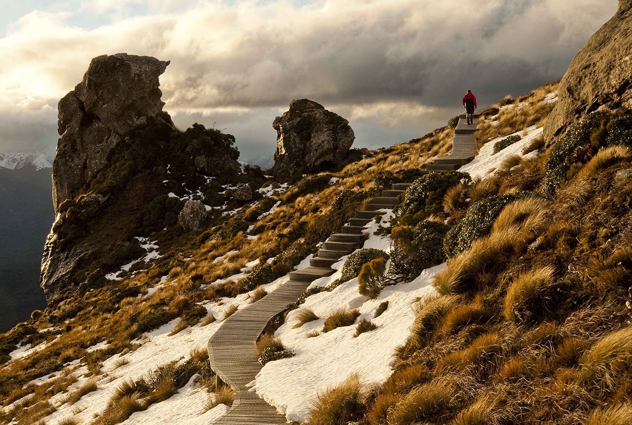
Key Summit
Mountains everywhere – the view from Key Summit is second-to-none. Photo: Alistair Hall
Simply one of the best day walks in the country and yes, there will be crowds. Even the road trip there will be frenetic, given this walk is on the Fiordland end of the Routeburn Track, starting on the Milford Highway.
If we haven’t put you off, head up the Routeburn Track about an hour, through beech forest, then turn up and above the treeline for 20 minutes to reach the tarns, wetlands and subalpine shrublands at Key Summit. Savour the mountain views. If the weather is clear, continue past the summit to a viewpoint looking into the Greenstone Valley. (From the summit, a rough track heads first through a small patch of bush then onto the open ridge. There are no marker poles.)
Bike the Borland
The Borland Road, built to service the transmission line from Lake Manapouri’s West Arm Power Station to Tiwai Point Aluminium Smelter, traverses a seldom-visited corner of southern Fiordland.
Unsealed, steep in places and scenic everywhere, it’s a great 90km return ride. You can stay lakeside at DOC’s South Arm campsite, in tiny Borland Bivvy near Borland Saddle, or at Borland Lodge at the park entrance (booking essential).
If you’re up for a bigger challenge, catch a boat to West Arm, bike up and over Percy Saddle, following the pylons, then bike/carry down a steep ‘sort of’ track that meets the Borland Road. Do your own research first, do not blame this writer! Note that cars also travel on the Borland Road and it is sometimes closed because of snow.
Tackle the Hump Ridge Track
There’s plenty of boardwalk on the Hump Ridge Track. Photo: Shaun Barnett/Black Robin Photography
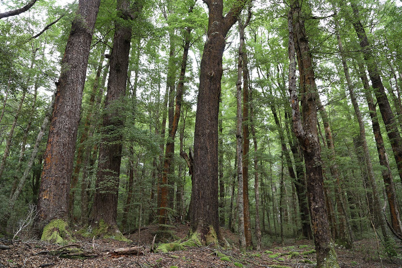
From subalpine tops to surf beaches, tarns to tidal pools, mountain kea to Hector’s dolphins, limestone tors to what have been described as the best examples of podocarp and beech forests in the country, oh and historic viaducts for bridges; are there any three-day walks in the country like the Hump Ridge?
You’ve got to work for your rewards though; a grunty climb, knee-knocking descent and many boardwalked steps are involved in the 61km circuit. The track, managed by the Hump Ridge Track Charitable Trust, was developed in partnership with DOC to provide income for the former milling region when logging ceased in the Waitutu Forest (now part of Fiordland National Park).
Those doing the ‘Freedom Walk’ pay $175 each, this covers accommodation at Okaka and Port Craig Lodges, with cooking equipment and breakfast porridge provided. Wine, beer, snacks and hot showers can be purchased, and a ‘prime’ package will get you bed linen, showers, dinner (dehy meals that you cook), and a helicopter ride for your pack to Okaka Lodge.
Hop over to Hope Arm, by kayak or foot
Beautiful Lake Manapouri is considered the birthplace of New Zealand’s environmental conscience, since the Save Lake Manapouri campaign galvanised the nation in the 1960s. Hope Arm is a handy and sheltered option for experiencing the essence of this massive glacier-gouged, forest-fringed, mountain-surrounded lake. Kayaking? From Manapouri, it’s about a three-hour paddle to Hope Arm Hut, less if you portage across from Surprise Bay. On the way, be sure to climb The Monument, a steep rocky tor with great Fiordland views.
If walking, at Manapouri grab a water taxi across the Waiau River then head over to the hut via the Circle Track (2-3hr).
Get drenched on the Dusky Track
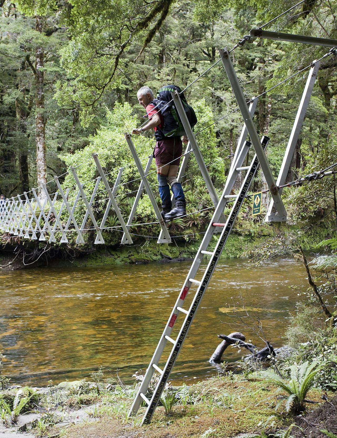
One of several walkwires on the Dusky Track – this one spanning Hauroko Burn. Photo: Ray Salisbury
That seems to be the typical experience on this 84km, 8-10 day odyssey. Knee-deep mud, rain and unpredictable river crossings should be expected. A friend recently found herself practically swimming just to get to one of the 21 three-wire bridges. That aside, the Dusky is classic tramping in classic Fiordland, with an optional overnight detour to Dusky Sound.
The southern end climbs from the head of Lake Hauroko; Wairaurahiri Jet provides a scheduled water taxi service. The northern end starts at West Arm, where Real Journeys run a daily service across Lake Manapouri. Float planes can also be chartered to Dusky Sound and Lake Hauroko. There are seven huts, and some sections become impassable in heavy rain. Watch for moose! Just joking – 10 moose were released near Dusky Sound in 1909; despite unconfirmed sightings it’s unlikely any descendants remain.
