


- Links/Files
- Download a PDF of the Geographx map (pdf, 9 MB)
Oteake Conservation Park
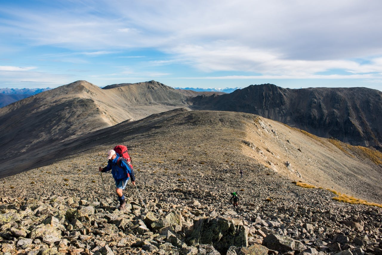
Straddling the boundary between south Canterbury, in the MacKenzie Country, and north Otago, the Hawkdun Range and its auxiliary the Ewe Range form a 50km barrier separating the Manuherikia River and Clear Stream. This boundary is very distinct where a steep escarpment on the western face of the range runs for almost its entire length, while in the east huge post-glacial basins prevail. Farther south, these morph into a virtual tableland than extends for many square kilometres at ridgetop level.
The Hawkdun is big country and will require a multi-day trip to explore fully.
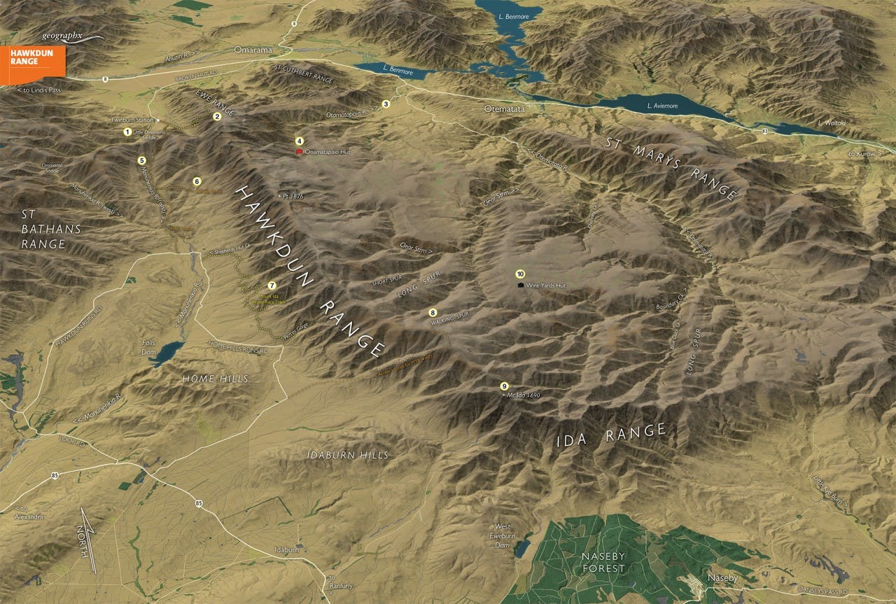
Map by Geographx
1 Little Omarama Saddle
At 1357m, this is the pre-eminent access point in the north by 4WD or mountain bike and a great jump-off point for access onto the range. The access road, closed in winter, heads up from Broken Hut Road south of Omarama.
2 Ewe Range
A marked walking track heads up from Broken Hut Road onto the Ewe Range at 1350m and then south along the range to link up with the Hawkdun Range. A return could then be made down to Little Omarama Saddle.
3 Otamatapaio River
A long route into the heart of the range, the Otamatapaio River can be followed for over 20km from SH83 to reach the large tablelands in the central section of the range and the head of the Clear Stream with its hidden lakes, wetlands, and deep ravines.
4 Otamatapaio Hut
This is the only hut on or near the range and is set in the head of the Otamatapaio River. An ex-musterer’s hut, it sleeps four.
5 East Manuherikia River
Providing the main accessway through Oteake Conservation Park, the East Maunherikia has a 4WD road running along its floor from Little Omarama Saddle all the way out to Hawkdun Runs Road.
6 Berwin Track
This is an accessway between the East Manuherikia River and the Hawkdun Range.
7 Mount Ida Water Race Track
This historic water race, cutting around the flanks of the Hawkdun Range, has been made into an easy-angled walk and mountain bike trip. It links Shepherds Hut Creek with Pierces Gorge.
8 Walking Spur
Difficult access onto the range and some steep, narrow sections in the northern portion make a full traverse by mountain bike impractical, however the southern end of the range can be accessed off Home Hills Run Road and then steeply over to Walking Spur. This route is also possible for 4WD.
9 Mt Ida
The summit of Mt Ida, 1690m, can be reached by heading south-east along the Hawkdun Range from the high point on Homestead Spur at 1658m. There are several minor summits to traverse enroute.
10 Wire Yards Hut
Situated to the east of Clear Stream on the high plateau draining into the Otematata catchment, Wire Yards Hut is an aging and derelict historic feature encountered along the Walking Spur route.
