


- Distance
- 17km
- Total Ascent
- 927m
- Time
- 6-8hr
- Grade
- Moderate
- Accom.
- Paske Hut, 6 bunks/$5
- Access
- Lake Tennyson Campsite, St James Conservation Area
- Map
- BS24, BT24
- GPX File
- paske-hut-via-paske-saddle-rainbow-conservation-area (gpx, yo 11 KB)
- Your device does not support GPX files. Please try a different device.
- Links/Files
Paske Hut via Paske Saddle, Rainbow Conservation Area, Marlborough
Maps are objects of wonder. You look at the depiction of rivers, peaks and passes, and try to form a picture of the country. A name – say Paske Hut – grabs you, and you examine possible routes. The map suggests something of the character of the Paske Valley: several high peaks, nudging over 2000m, large rolling expanses of sub-alpine grasslands, and patches of beech forest edging over the lower mountain slopes.
Maps, thankfully, don’t ever fully do justice to a place, and there are always surprises when you see it with your own eyes.
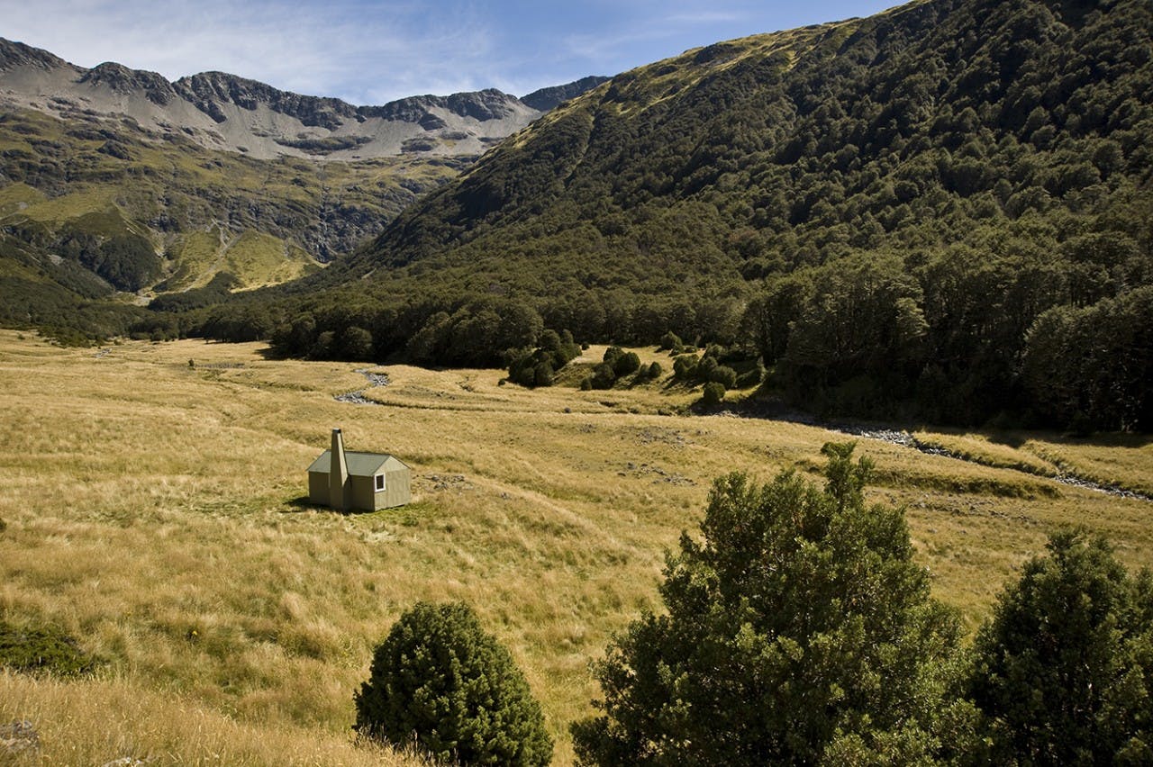
We’d chosen to reach Paske Hut by crossing Paske Saddle, near the head of the Clarence River, upstream of Lake Tennyson. Instead of climbing a steep, scrubby spur, we’d found good scrambling up a gorged gut into the basin below Paske Saddle. Once over the saddle, the Paske Valley opened out: the tiny hut looking appropriately insignificant in the great sweep of the valley, with Mt Iris dominating behind. In the warm autumn light it was a place of stark bluffs and easy flats, khaki forest and tawny grasses. A place of textures and mosaics.
Easy, pleasant travel across the grassy sward, and through open beech forest led to the river flats and the hut. Once there, we enjoyed the welcome shade inside.
Paske Hut gets a steady stream of visitors, but is remote enough to usually be empty. Once, however, in the early 1980s, some 24 people crammed into it during a storm.
