


Four places where the worst of names offer the best of tramping
New Zealand’s backcountry is full of cautionary names: Mt Awful, Desperation Pass, Big Hellfire Beach, Barrier Falls and Bledisloe (Bloody Slow) Gorge to name but a few. However, not many promise so little pleasure as the name ‘misery’.
Visits to two places called ‘Misery’ in recent months got me thinking about what sort of other places have the same off-putting name. A quick search online revealed more than a dozen sites of misery in the New Zealand countryside; curiously, all but four of them in the South Island. Otago even has two small mounds both named, somewhat overstatedly, Mt Misery. And if you like your misery in isolation, there are few more remote spots than Misery Bay, on Rakiura’s coast, south of the Lord River.
It’s not lightly that I recommend people seek out misery, but in the right weather, these four places offer excellent tramping.
– Shaun Barnett
Mt Misery tops, Nelson Lakes National Park
The three-bunk Mt Misery Hut occupies a tarn-filled basin at the end of the Mahanga Range, overlooking the Sabine Valley and Travers Range. The track to the Misery tops starts near a jetty at the head of Lake Rotoroa, and climbs very steeply up a forested face until it eases off somewhat on a ridge covered in mossy mountain beech forest. At about the 1300m contour, the track breaks onto the open tops, and follows a poled route over the ridge crest into the Misery basin, where the hut occupies a shelf next to a tarn. Just above the hut are excellent views of Mts Hopeless, Cupola, Travers and Franklin. Allow about four hours each way from the lake.
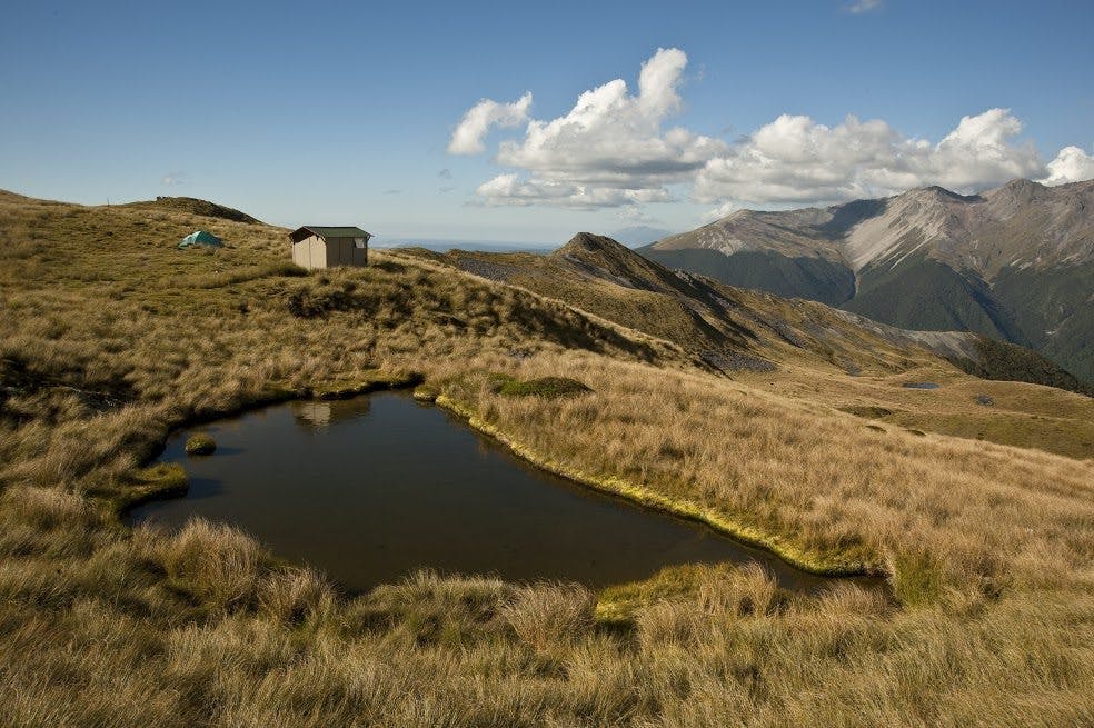
Top Misery Hut, Leatham Conservation Area
This ‘Misery’ is a tributary of the Branch River, one of the major catchments of Marlborough’s Raglan Range. While the lower Branch Valley is, tragically, full of wilding pines, the upper parts of the catchment are mercifully free of the invasive weeds. There are several options for reaching Top Misery; easiest is to walk up the track in the Branch to Bottom Misery Hut, where you can divert up Misery Stream to Top Misery Hut.
An alternative is to head up Hellfire Stream, past a delightful tarn and across an unnamed pass into the Misery headwaters. There are also high-level routes from Lost Stream, a valley to the north. Trips to Top Misery will take 3-4 days.
The Mounds of Misery, Poulter Valley, Canterbury
If you like your misery in large dollops, the Mounds of Misery offer promise. This curious area of undulating hills occupies a flat valley floor between the Poulter Valley and Lochinvar Stream, part of the leasehold Mt White Station. The mounds owe their existence to the once-extensive Poulter Glacier, which scraped over the area in past ice ages and, after it retreated, left hummocks, wetlands and small lakes.
To reach the mounds, tramp from the Mt White Rd up the track beside the Poulter River. At the forks, take the east branch through the McArthur Gorge. Where the valley opens out again, head south-east to pick up a station vehicle track. This crosses through the mounds to reach Lochinvar Hut. Note that the nearby Lake Grace Hut is private, and permission to access the area is required from Mt White Station. Allow 2-3 days.
Lake Misery, Arthur’s Pass National Park
The Lake Misery Track branches off the Dobson Nature Walk, which begins near the Arthur’s Pass summit on SH73. This shallow lake contracts or expands rapidly according to recent rain, and after a deluge the boardwalk beside it might be underwater. Allow about 20-30 minutes each way; and half a day if you want to continue up the Otira Valley.
