


- Time
- 90 minutes round trip
- Grade
- Easy/Moderate
- Access
- From SH77 take Coleridge Road, west of Windwhistle, to Harper Road and Ryton River on the northeast side of the lake.
- Map
- BW20
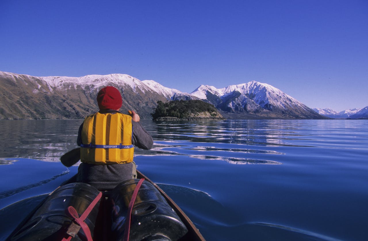
Lake Coleridge, Canterbury
Protruding from the middle of Lake Coleridge in central Canterbury, where the wind regularly howls, is an island; unnamed, virtually unknown, and seemingly inhospitable.
Yet the challenge was issued for a ‘cuppa at the island’ on a calm winter’s day when hoped for idyllic conditions were more likely, that and the magnificence of the peaks surrounding the rough trough of the lake which leads the eye back onto the Main Divide through the Wilberforce Valley.
We duly pull up at the lake shore on a day of high country splendour, when the mountain lakes assume a luminous beauty reflecting light, colour, and silence that lies like a blanket across the landscape. Our canoe slips over the lake, hovering over the modest depths near the shore where we can still see the bottom until it melts into the inky deep further out. This transition always leaves a sudden pit in my stomach – unfathomable depths are unnerving especially in a vulnerable small boat.
Setting a direct course for the island, we scythe through the reflected mountain panorama on the lake’s surface, shimmering ridges scattering in our wake as we power on. In less than 30 minutes we are just off the island’s southern tip, a rugged shelf of rock poking from the lake. We cruise past the reef to circumnavigate the scrub-covered rock of the island to locate a suitable landing place.
The north-western tip provides the answer. With low lake levels, a tiny cove is revealed which allows us to scramble ashore and then lift our canoe onto the rock shelf.
Now it’s time to kick back and enjoy our splendid isolation. The tea’s ready in a jiffy and with a light lunch and warm sunshine we’ve struck gold at the island. After lunch we head up the wind and wave scoured slope above the shelf to force a passage through manuka scrub and cabbage trees to the highpoint, just 20m above the lake. There’s scant view from here so we return to the open and are immediately aware from our height gain of how the island shoreline plunges directly to the lake bed. In aeons past the lake basin was cut by ice and this stubborn rock, a roche moutonnee, was ridden over by the ice tongue but not consumed.
The day has remained calm so we depart at our leisure, relishing the beauty of this often windswept isle.
