


Mt Charon, Hanmer Forest Park / Difficult
Ghost Gully didn’t look appealing. It was choked with some type of vibrant green scrub which at this point, high on the Hanmer Range west of Jacks Pass, I just couldn’t quite identify. Anyway, I was confident of not heading that way as the scrub looked mighty thick and the ridge crest was my destination – but even that seemed to be a mission.
Up to then I’d been travelling well, having left Christchurch in the early hours to arrive before dawn at Jacks Pass. From there I trekked up and over Dumblane, 1303m, a rounded summit directly opposite Mt Isobel; Hanmer Springs’ well known and much climbed foothill.
Dumblane offered a grand view of the Hanmer Plain and north into the Clarence Valley as well as sporting a remarkable community of alpine spaniard grasses.
Beyond Dumblane is an equally large and deep pass, about 1km across, requiring a 300m descent and another climb to gain the ridge proper, where the range winds on again over minor, unnamed points to reach Mt Charon.
The day had warmed considerably and it was absolutely still on the ridge.
At 1400m, the ridge turned more westerly and I began a slow climb over bluffy bumps to Mt Charon. Trying to conserve both water and energy in the increasing heat, I took advantage of a breeze funnelling up through the cliffs on the Hanmer side while trying to maintain a direct approach onto Mt Charon.
Pausing to consider my options, I briefly considered turning back, but with the summit less that 2km away and on such a beautiful day I chose to slog on and a few small bluffs later I was at the summit. One water bottle was empty and the other, a Thermos of hot water for tea, was being carefully conserved. It was a long way down and there was no water, other than at the mouth of Ghost Gully where it meets the Styx River on the Clarence side of the range. Not a pleasing thought.
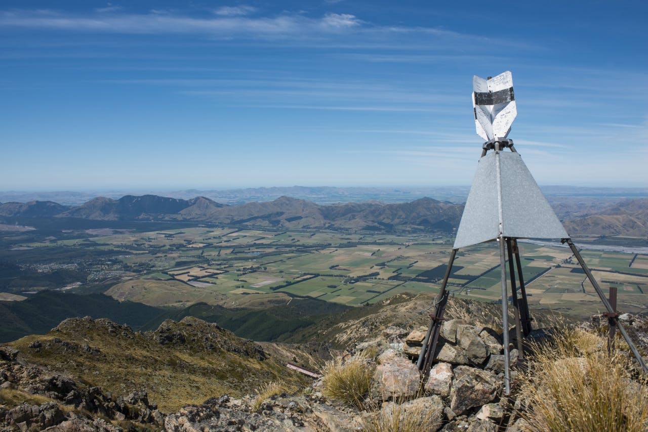
The summit view was magnificent and covered much of the Waiau Valley, Hanmer and St James ranges, parts of Molesworth and the great bare slopes of the Organ Range.
Descent was at first easy and I made good time retracing my steps, though I began to feel the effect of dehydration.
A brief rest seemed to revive me so I carried on. Dumblane was close, but as climbing it to make the descent to the road entailed a huge effort, I struck off the ridge down a spur on the edge of Ghost Gully.
The heat was appalling and I could only think of getting to water I could see below in the valley, but first there was that scrub I had seen on my way up to deal with. It was broom, massed in virtually impenetrable mats over the valley floor and walls. I managed to skirt the worst, finally entering it lower down where I clambered through the branches, poised over black holes, scratched and beaten, to be spat out down a final steep bank onto the rocky riverbed where clear, cool water flowed.
– Pat Barrett
Wild file
Access Jacks Pass, on Clarence Valley Road north of Hanmer Springs
Grade Difficult
Time 3-4hr to summit
Distance
Map BT24, BU24
