


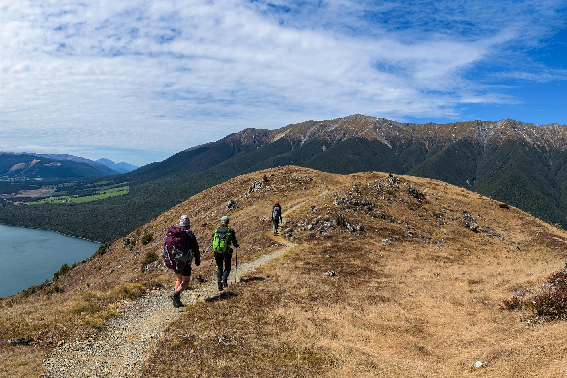

Paddys Track, Nelson Lakes National Park
Porangahau/Mt Robert is the northernmost summit of the Travers Range. Its easy access from the alpine township of St Arnaud makes for a popular day tramp. Following the Pinchgut Track is the most direct approach to the 1421m summit but, unsurprisingly, it’s something of a gut buster.
Paddys Track provides a gentler alternative. It winds over the north-facing slopes of Porangahau, climbing gradually and offering grand views over Lake Rotoiti. The final push to Bushline Hut is steeper, but is softened by a number of switchbacks.
The hut makes a fine place to enjoy lunch before pushing on over the tops to Mt Robert. En route historic Kea Hut is passed. It was built in the 1930s by men who later formed the Nelson Ski Club and has been beautifully restored in recent years.
From Relax Shelter, it’s downhill on the Pinchgut back to the car park.
So who was Paddy? To reach Porangahau/Mt Robert back in the 1940s, trampers and skiers had to first cross Lake Rotoiti by boat. According to the book Rotoiti Recollections, Paddy Allison and his son were Murchison men who built the track in the 1940s to provide better access. The present road came later.
- Distance
- 8.04km
- Total Ascent
- 738m
- Grade
- Easy / Moderate
- Time
- 4-5hr round-trip
- Accom.
- Bushline Hut ($15, 14 bunks)
- Access
- Mt Robert car park, St Arnaud
- Map
- BS24
GPX File
- Paddys Track.Pinchgut Track (gpx, 10 KB)
GPX File
- Your device does not support GPX files. Please try a different device.
