


In the seldom-visited Raglan Range, Sam Harrison finds dreamy tramping through forested valleys and tussock tops
Glacial lakes, lush beech forest and snow-capped mountains have endowed Nelson Lakes National Park with a reputation for supreme beauty. Few, however, venture a short way over the St Arnaud Range, crossing the Rainbow Road into the Rainbow and Leatham conservation areas. These seldom-visited places hide beautiful bush-clad valleys with names like Hellfire and Misery, the valleys themselves being surrounded by the alpine wonderland of the Raglan Range. It’s a spectacular playground for adventure beyond the well-trodden trails over the hill.
The trip over the Rainbow began with waves washing over the bow of the Awatere, part of a ritual familiar to North Island trampers crossing Cook Strait to Te Waipounamu.
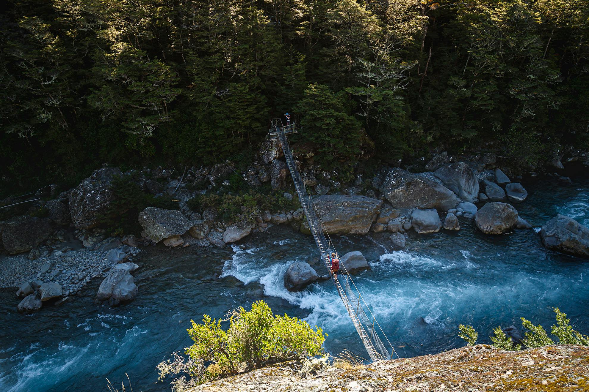
Our van bounced through the fords and potholes of the Rainbow Road towards the Wairau Swingbridge. By the time we’d parked and crossed the swingbridge, it was well and truly dark. Legions of stars marched across the sky and the moon illuminated our path down the river. It took about an hour to our campsite, near the confluence of Hellfire Stream.
The following morning, the stars had been replaced by dark clouds and the first order was crossing Hellfire Stream, before following the track that clings to the side of the valley. We were careful on the thin ribbon of trail, aware of the steep slide to the stream below. When the path wasn’t high above the stream, it was practically in it; requiring us to scale wet moss-covered boulders to continue. The cold bite of the water in our boots did little to dampen our spirits though: we were all pleased to have escaped Wellington for this primeval landscape.
The stream relaxed to a slow-moving lull and the dense forest gave way to clearings of stumpy tussock. After pushing through one final steep section to the bush edge, we stopped for lunch and were treated to spectacular views of the head of the valley. We all agreed there were much worse places to have lunch.
We then made our way towards the head of the valley by climbing a series of ledges. Drizzle began to fall as we approached the steepest climb, which would take us to the cusp of Hellfire Tarn. We crawled and dragged ourselves up, making good use of tussock handholds to fight the slippery slope. Finally, at the top we were greeted by emerald green waters. There was an option of camping next to the tarn, but with daylight left we pushed on over the range to Top Misery Hut, drawn by the thought of a warm fire.
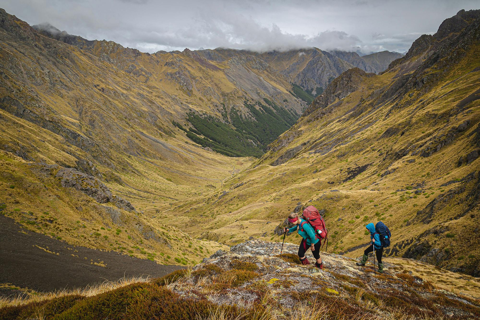
We gained elevation quickly, and with a lot of puffing, by following a grassy ridge. A breather wasn’t a bad thing as it gave us the opportunity to turn around and admire the grandeur of the valley below.
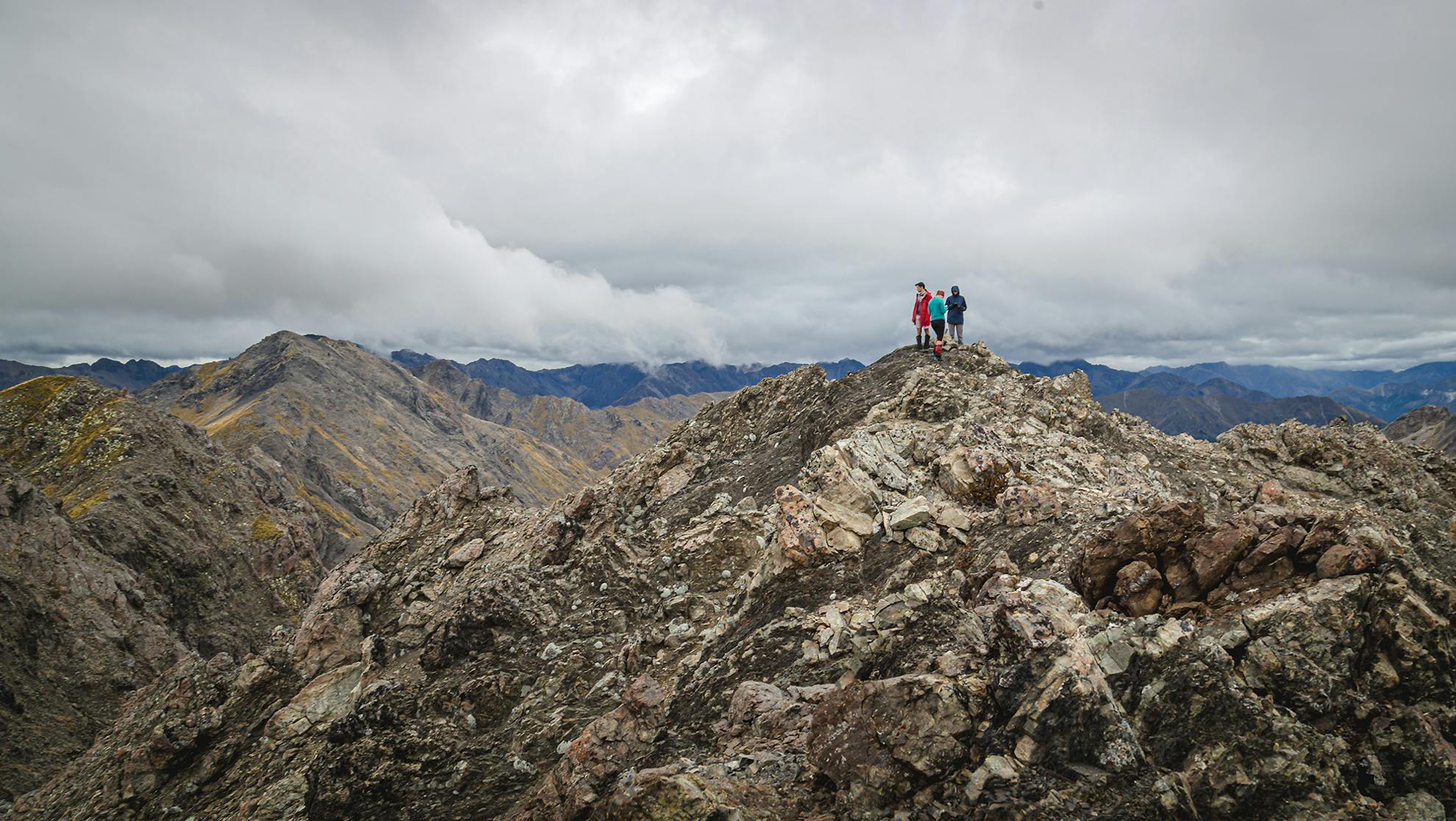
Our path met with the clouds as we began to trudge over the shattered rock of the Raglan Range. We weren’t sure of the best way over the rocky spine dividing Hellfire and Misery valleys, but with a bit of investigation and one misadventure, we were soon standing astride the range feeling on top of the world.
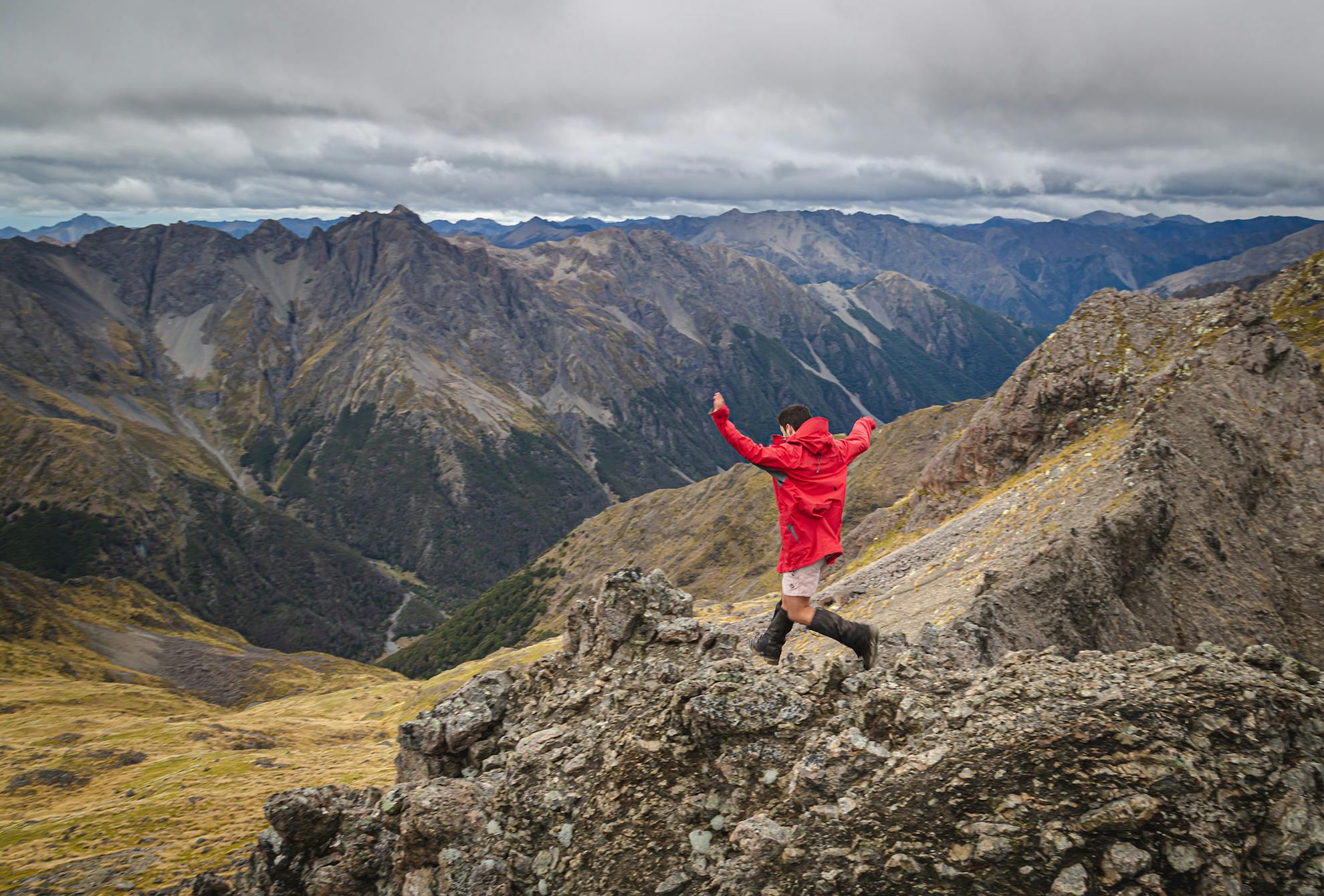
The clouds began to scatter and burn off, so we dropped our packs and took a detour to Pt1988 to admire the Wairau Valley and the surrounding ranges. From this point, we were also able to use our phones to check the weather forecast: two more days of good weather before a storm rolled in. Equipped with this knowledge, we descended towards the hut. On our way, we discovered a mysterious green cylinder which turned out to be a smoke canister from the nearby RNZAF bush-skills training base at Dip Flat. The flat was originally a stop on the west to east stock route where animals would get their ‘dipping’ to protect against parasites. It later became a base for the New Zealand Forest Service before being handed over to the airforce.
Our descent was quick in a rough south-easterly direction. Initially scree-covered, this transitioned into tussock and speargrass (and plenty of it). There is an art to avoid being skewered but it’s one I’ve not yet mastered. We were soon following a stream that enabled us to avoid the bluffs that dotted the slopes to reach the bushline. At first, the stream ran down with open ground beside it. The upper sections of bush were open with a network of animal-trails weaving down the slopes. But lower down, the bush became dense, forcing us to plunge headfirst into a mesh of young twiggy trees. It didn’t last long and we soon broke out onto the river flats where the hut came into view and we began dreaming of the vegetable goulash that we had planned for dinner.
The next day, under bluebird skies, we found the track down the Misery to be anything but; it was of a much higher-standard than the route of the previous day. We came across a stand of douglas fir: the vanguard of an army of exotic pines that were marching across the hillside, devouring the native beech forest. These pines were relics of a Forest Service experiment in stabilising hillsides. Unfortunately, they worked a little too well.
After a couple of hours we reached Bottom Misery Hut, which is superbly situated on a terrace above the confluence of the Misery and Branch rivers. It commands a view right down the valley.
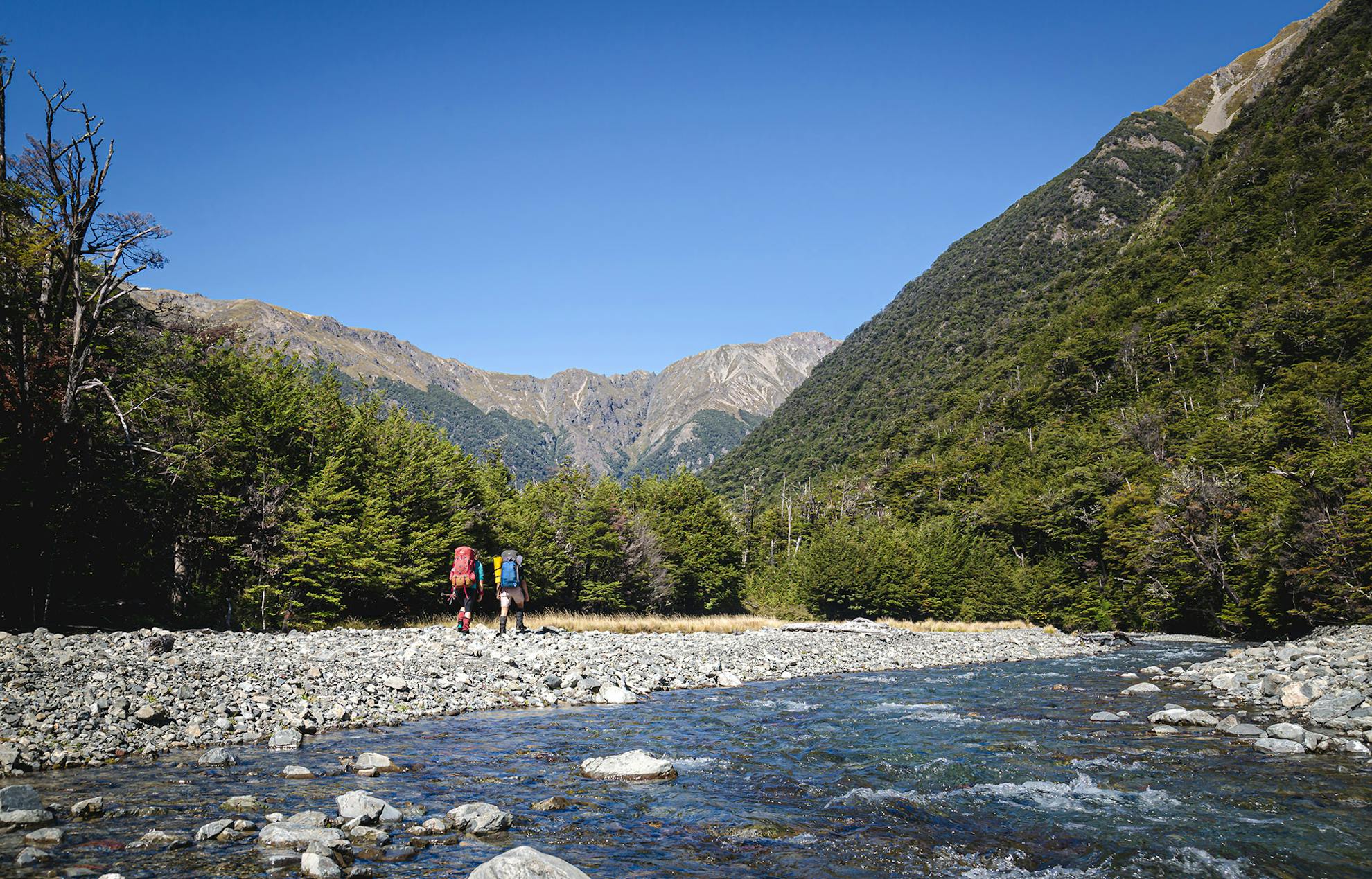
We then turned up the Branch and it became apparent we were on a lesser trodden trail. We attempted an ‘adventure route’ straight up the boulder-choked river but this soon became impractical and we scrambled up a bank to the track on the true-right. As the river curved to the west, the bush opened up, soon giving way to grassy flats. This made for a good lunch stop before we continued on our way to Branch Bivvy. Surrounding us in the valley were impressive cascades of water flowing down giant cliffs, accompanied by enormous scree slides cutting paths through the forest. Not far from the largest of these slides was the bivvy, sitting at the confluence of the north and south tributaries of the Branch. The hut book proudly displayed a Forest Service logo, and its first entry dated to 1986.
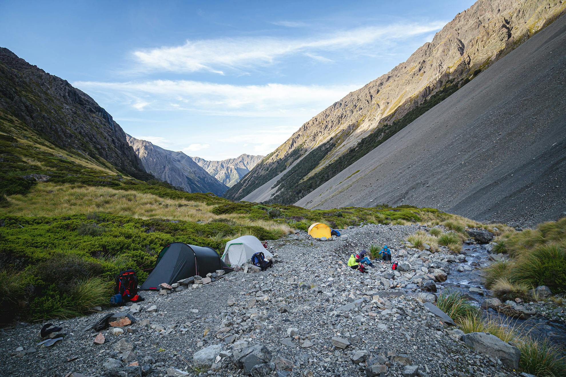
With a surplus of daylight and knowing a storm was coming to ruin our fun, we decided to push on so we could avoid being caught out on the tops. We couldn’t find a track alongside the south tributary, so had to forge our way beside the river. When this became impossible, we headed into the bush on the true-left, bashing through some steep forested country. Branches whipped us from every angle; the forest fighting hard to slow our progress. After a long sweaty battle, we emerged beside a large slip which made travel much easier. Soon, we rejoined the river and followed it up crossing from bank to bank as obstacles demanded. Keen eyes scanned for possible camping spots but we pushed on as the sun still hung in the sky. At the bushline, we wearily debated what to do next. In the end, a few of us went on without packs to scout a campsite, whilst the others had a break.
A few hundred metres upriver was a rocky clearing just big enough for our tents. From this campsite, massive rocky bluffs loomed above, a seemingly impossible barrier to our route the next day. With a slither of sunlight left, two of us looked for a path through the bluffs. We scrambled and clawed our way up, finding a chink in the bluff that enabled us to crawl onto a spur. Following this led to a higher terrace that seemed to provide a way onto the saddle.
We were under way at sunrise and began the trudge up the scree slope to the ‘chink’ identified the night before. There were a few scrapes and bruises as we hauled ourselves up on pathetic-looking scrub. Each solid handhold was appreciated, as were helping hands from friends. Finally, at the end of the steep section, it became relatively plain sailing, on large scree, to the saddle between Pt1938 and Pt1965.
It was blowing a gale on the saddle, so we only paused briefly before descending into the headwaters of Lees Creek.
Much to our delight, a scree slope of perfection was before us and we skipped down gleefully. Beyond the slope, the going was easy, being tussock with the odd clump of spaniard. Just above the bushline, on the stream’s true-left, we picked up a trail that evolved into a cairned route through the bush. The stream alongside went through a spectacular series of cascades, racing us to the bottom of the valley. Our marked track continued at Lees Creek proper, making our lives much easier.
Not far from Lees Creek Hut, the track leaves the creek to avoid a gorged section before emerging at the far end of the hut clearing.
The Lees Creek Track was pedestrian compared to what we’d been on over previous days. The valley topography was gentle, being dominated by large grassy clearings and the idyllic Lees Creek. After quick travel through the bush, we reached a bridge over the Creek and it wasn’t long before we reached the Wairau swingbridge. With a euphoria particular to multi-day tramping trips, we caught sight of the van, signalling the bitter-sweet end to several days of hard yakka.
Beginning the journey back to Wellington and work was like waking from a tramping dream. But it was good to know that dreams can come true somewhere over the Rainbow.
- Distance
- 47km
- Total Ascent
- 2750m
- Grade
- Difficult
- Time
- 4 days. Wairau swingbridge to Hellfire Tarn, 8-9hr; To Top Misery Hut, 3-4hr; To Bottom Misery Hut, 2hr; To Branch Bivvy, 3-4hr; To Lees Creek Hut, 6-7hr; To Wairau Swingbridge, 2-3hr
- Accom.
- Top Misery Hut ($5, four bunks); Bottom Misery Hut ($5, six bunks); Branch Bivvy (free, two bunks); Lees Creek Hut ($5, four bunks)
- Access
- Rainbow Road
- Map
- BS25
