


Dave Mitchell rides the Moerangi MTB Track which he says is the best mountain bike trail in the North Island
The Moerangi Track started life as a tramping track that looped around a group of three huts deep in the Huiarau Ranges. But in 2009, the trail was upgraded by DOC into an amazing mountain bike track.
The trail passes through the towering ancient podocarp forest of Whirinaki Te Pua-a-Tane Conservation Park. Environmentalists saved Whirinaki from clear felling in the early 1980s. Its tree ferns, crystal clear water catchments and prolific birdlife still await walkers and bikers.
The best direction to ride the Moerangi MTB Track is clockwise, starting from the remote Okahu Road end. It delivers long magical descents with the least amount of climbing. For more singletrack riding, try the return trip for a whole new set of climbs, descents and stunning vistas. This can also work with an overnight stay in one of the track’s three huts. Whichever way you do it, this is the best backcountry mountain bike track in the North Island, full stop.
From Te Whaiti, we hitched a ride with Jailhouse Shuttles along the dusty winding Ruatahuna Road to the rough and rugged Okaha Road end. We pedalled the short and steep climb that leaves the Okahu Valley. An undulating section of trail then flows beside the energetic waters of the Whangatawhia Stream, crossing countless side-streams that bucket down from the towering bush-clad peaks of Te Horo, Pukekaikakapo and Pourewa. A number of the older footbridges proved too narrow to ride with our wide enduro-style handlebars.
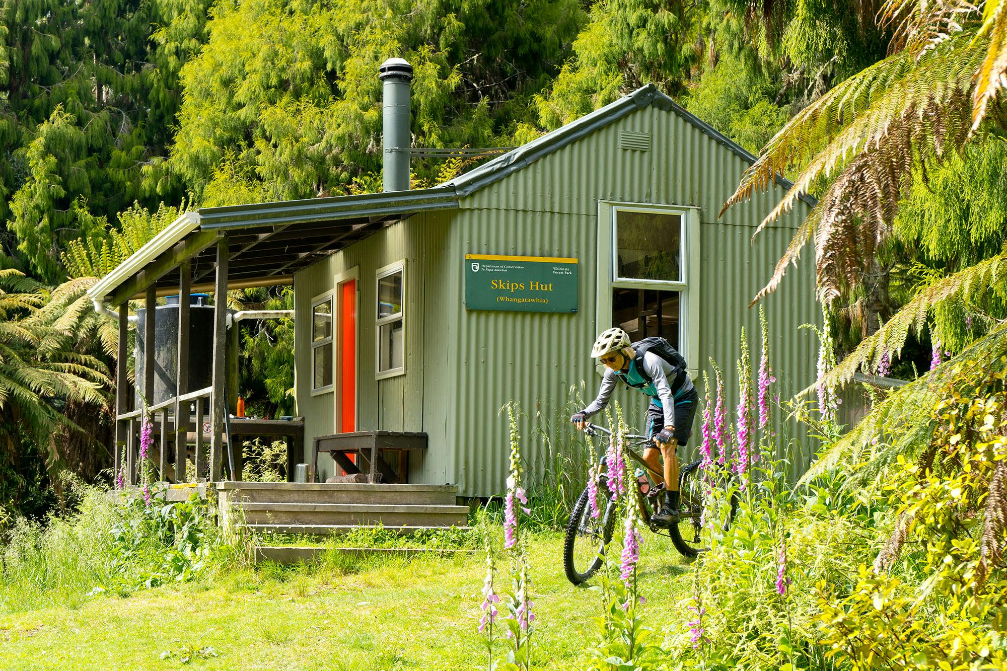
After 7km we spied Skips Hut. Its picnic table and wide deck are well primed for relaxing on a wide green terrace surrounded by foxgloves.
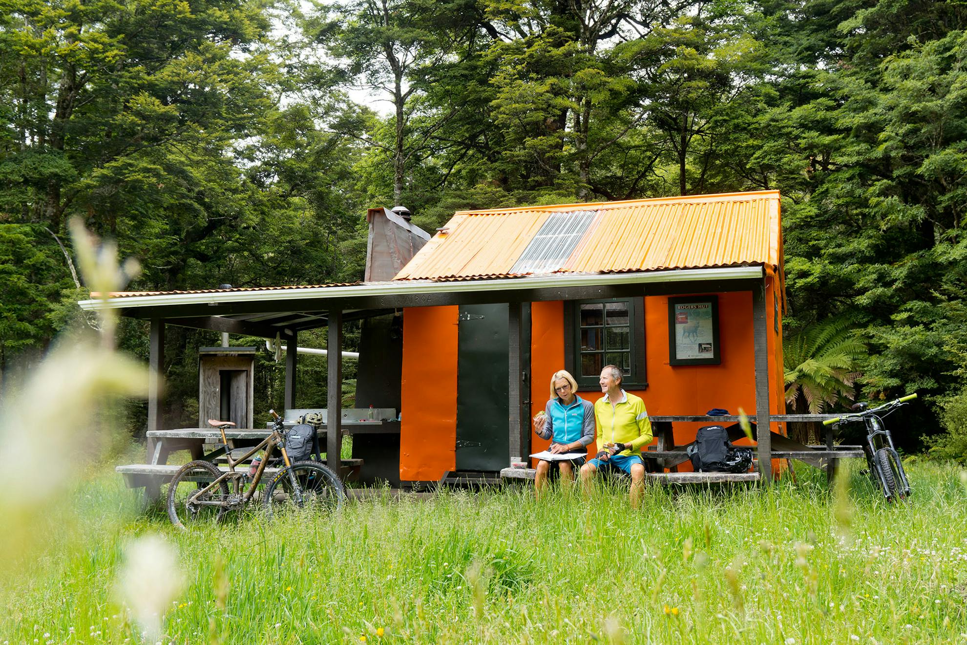
From Skips, we embarked on a sustained climb away from the Whangatawahia Stream over to the Moerangi and Wairoa catchments. The downhill was fast and flowing with shafts of sunlight and every shade of green bouncing around the lush bush. In no time, the historic bright orange Rogers Hut was upon us. This historic masterpiece is constructed of timber covered in flat tin with a corrugated iron roof. The walls and rafters are adorned with named and dated tin lids from last century.
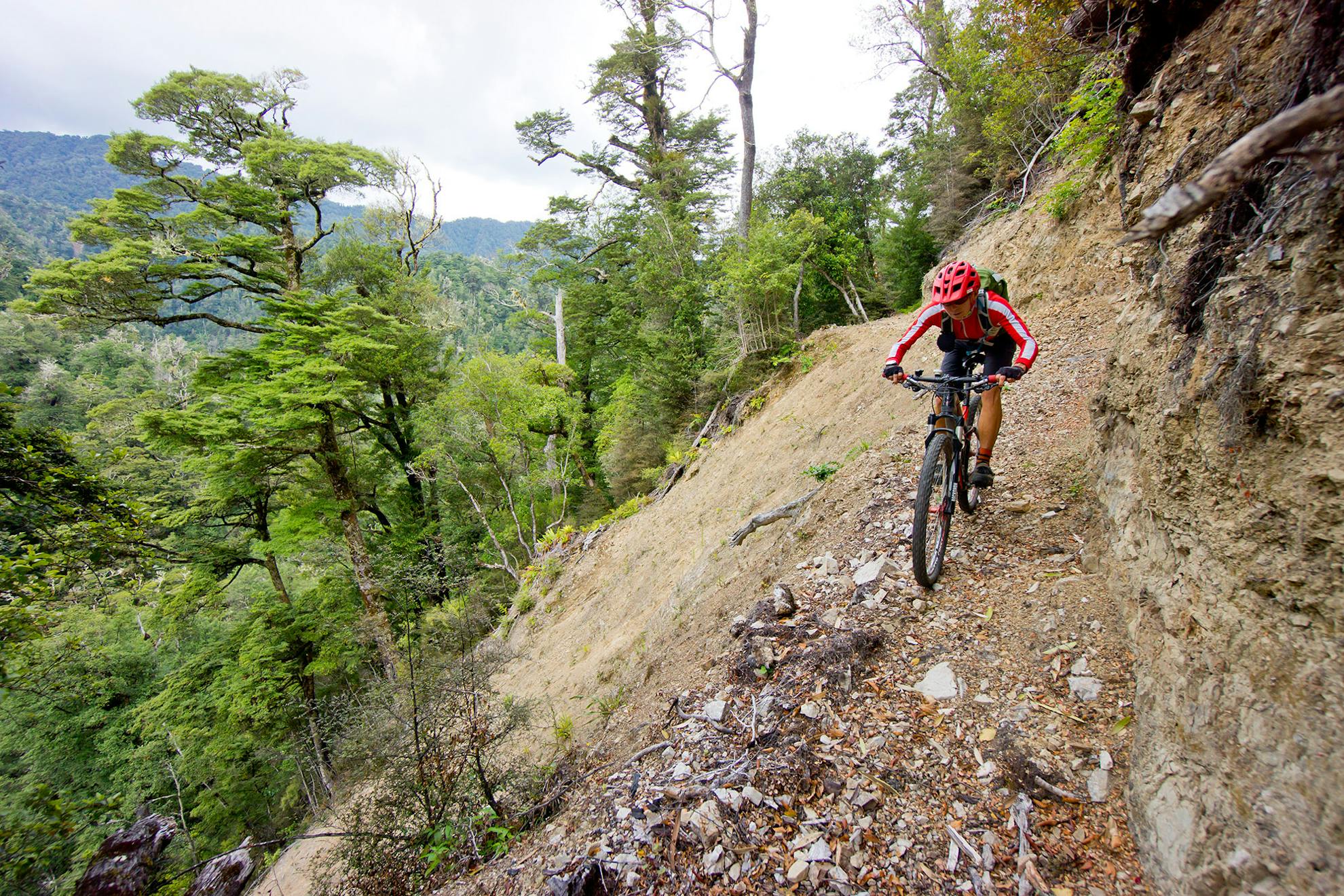
The track now snakes west, climbing gradually above the Moerangi Stream. It’s a spectacular section of trail with open views across the vast primeval forest that dominates the park with steep drops that plummet to the stream below.
The Moerangi Hut intersection is at the top of a short gorge. We rode the few hundred metres to reacquaint ourselves with the six-bunker which is in a sunny location on a broad clearing high above the clear water of the Moerangi Stream.
The trail then climbs upstream towards Moerangi Saddle and any pretense of a gradual climb ends at the final footbridge where it gets grippy. We managed to keep the wheels turning over some steep pitches and were soon cresting the highest point at the 940m contour. Massive beech trees and tall rimu dominate the mountain slopes with vines and epiphytes hanging from the lichen-covered rafters. This cloud forest followed us down this most excellent descent into the lowlands.
A dense canopy of tree and ground ferns greeted us at the bottom. A short climb then drops steeply back onto single-track where Mangamate Stream leads to the final section through the Te Whaiti-Nui-a Toi Canyon to the River Road end car park.
- Distance
- 35km
- Total Ascent
- 800m
- Grade
- Moderate / Difficult
- Accom.
- Skips Hut ($5, nine bunks), Rogers Hut ($5, six bunks), Moerangi Hut ($5, nine bunks)
- Access
- Okahu Road end, 16km from Te Whaiti
- Map
- BG38, BG39
GPX File
- Moerangi MTB Track (gpx, 33 KB)
GPX File
- Your device does not support GPX files. Please try a different device.
