


Lake Tennyson, Lake Tennyson Scenic Reserve
Lake Tennyson and its luminous basin set amid the high and mighty bastions of the St James and Crimea ranges is one of my all time favourite tramping destinations. Isolated, wild, beautiful, and often windswept, it conveys for me a great sense of space and adventure. More often than not, no one else out there – it’s hidden part way along the inland hydro road that links Hanmer Springs with Lake Rotoiti and so by virtue of this fact and the usually rough nature of the road and the open treeless landscape, there are relatively few visitors unless it’s a holiday weekend when a few more like-minded souls may venture out here.
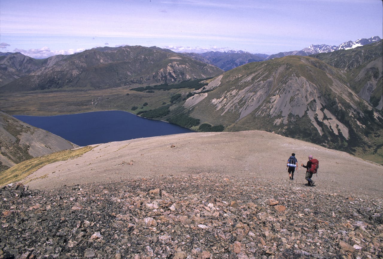
On this particular occasion I had been tramping with a couple of mates in the back blocks behind the lake, where we had enjoyed a solid three-day trip, taking in a couple of passes, a hut, and a wonderful fly-camp. To exit the region and gain the lake and our vehicle we had climbed from the Wairau Valley over the shattered backbone of the Crimea Range and then along the range from Mt Maling. This rounded summit is not much of a climb as summits go but it does have a great sense of space and elevation. This is enhanced by the sea-blue slash of Lake Tennyson filling the depression to the summit’s south-west and creating a great spectacle amid the drab surroundings.
My tramping mates had gone on, keen to get to the lake and refresh themselves after a hard hot climb, and they gave me a great opportunity to put some additional perspective in the picture – that and the drop-off coming up beyond the curvature of the ridge crest.
Wild File
Access Lake Tennyson is reached by driving over Jack’s Pass from Hanmer Springs and then up the Clarence Valley road to Tophouse Rd
Grade Easy
Map BT24
