


Apias Creek, Ruahine Forest Park
After a trip to Ruahine Corner Hut, our tramping team had descended to Ikawatea Forks Hut, and from there assumed it would be a couple of easy days out via the Apias Creek.
Although the creek, a tributary of the Ikawatea Stream, is gorged with a waterfall in its lower reaches, the map indicated it would be reasonable going upstream. Plus, there were two bivouacs I hadn’t visited before, and there was the possibility of seeing whio, which are protected by a volunteer trapping programme.
Most of the creek is typical boulder-and-gravel river tramping, requiring numerous fords, and we did see pairs of whio.
After enjoying a night at Rockslide Biv, we visited Mistake Biv; both are standard dog-box designs modified over the years.
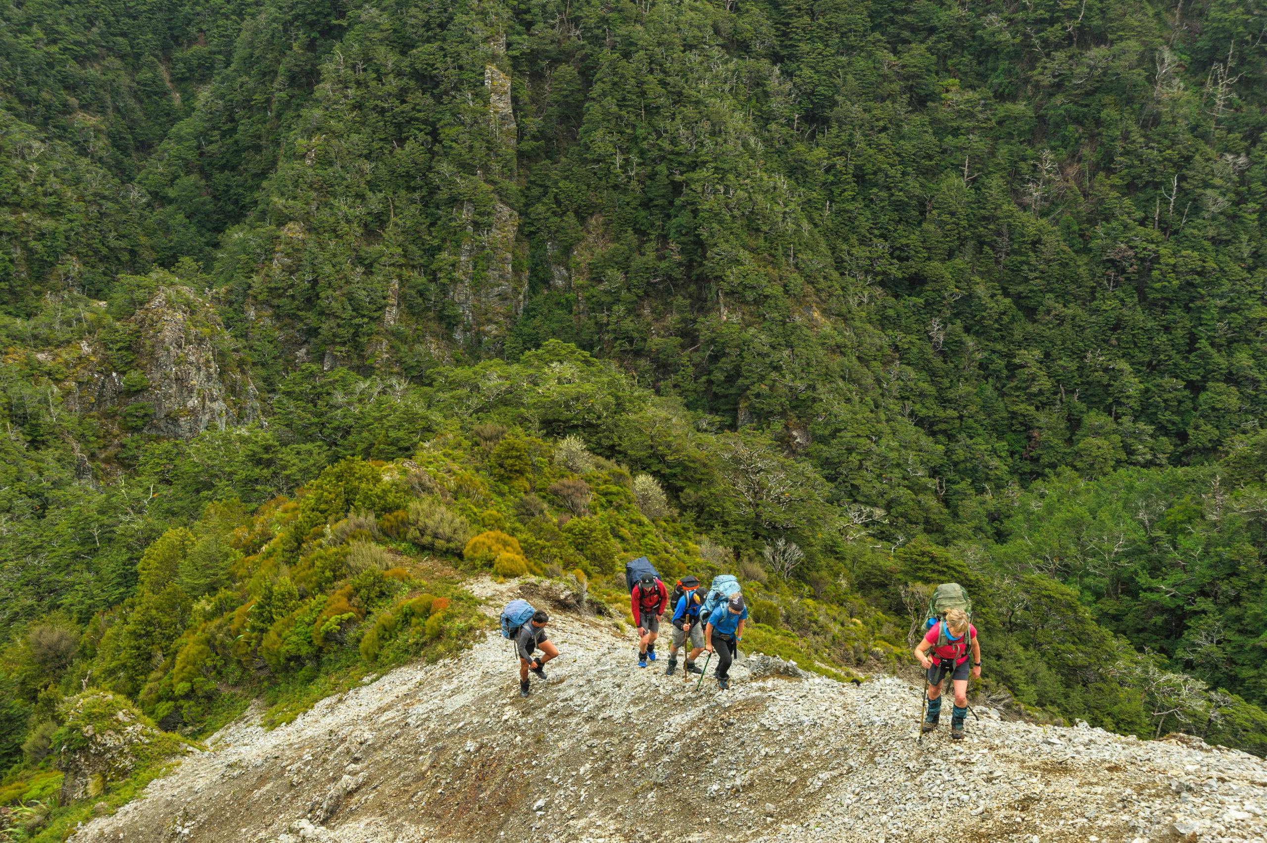
However, our plans to follow Apias Creek the whole way up onto the flat tops at its head were soon thwarted by an unmarked waterfall, situated at a prominent forks. This was steeper and more rugged country than we’d anticipated.
Salvation came in the form of a steep scramble up the spur pictured, which gave us access to the tops and the Golden Crown Track.
A better route might have been the spur that rises northeast from Mistake Biv – although by using that we’d have missed half the adventure.
- Distance
- 46.1km
- Total Ascent
- 3508m
- Grade
- Difficult
- Time
- 4-5 days. Mangleton Road to Aranga Hut, 4-5hr; To Ruahine Corner Hut, 4-5hr; To Ikawatea Forks Hut, 4hr; To Rockslide Biv via Apias Creek, 3.5-4hr; To Mangleton Rd, 6-8hr
- Accom.
- Ruahine Corner Hut ($5, six bunks), Ikawatea Forks Hut ($5, seven bunks), Rockslide Biv (free, four bunks)
- Access
- Mangleton Road
- Map
- BK37, BK36
