


New to tramping and want fresh ideas? Done the Great Walks and looking for the next level? Shaun Barnett suggests 10 trips to progress your tramping career.
1. Tama Lakes/Ngā Puna a Tama, Tongariro National Park
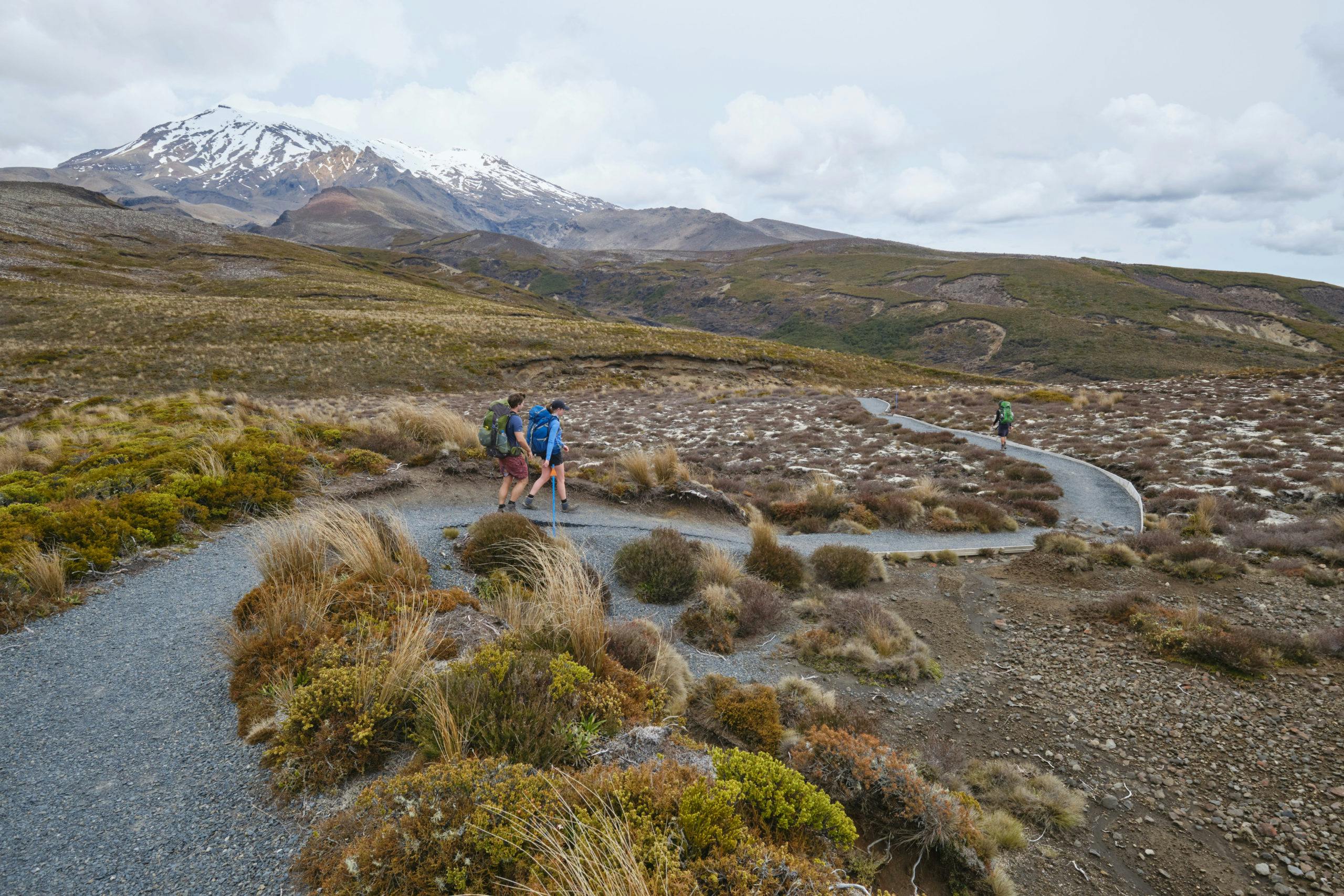
Many New Zealanders get their introduction to tramping among the volcanoes, craters and emerald-coloured lakes of Tongariro National Park. An alternative to the popular Tongariro Alpine Crossing is the tramp to the Tama Lakes/Ngā Puna a Tama – two large tarns set in old explosion craters south of Ngāuruhoe.
From Whakapapa, take the Upper Track to Taranaki Falls, then head east towards the Tama Lakes on a section of the Northern Tongariro Circuit. Blue poles mark the exposed terrain, with increasingly good views of Ngāuruhoe and Ruapehu. At a prominent signposted junction, take the Tama Lakes Track. Flat travel leads to a viewpoint over the Lower Tama Lake after about 10 minutes. The Upper Tama Lake viewpoint is a further 30 minutes. (For a more advanced loop excursion to the lakes, see p36.)
Grade Moderate Time 5.5–7hr.
2. Te Paki Coastal Track, Northland
Cape Reinga/Te Rerenga Wairua is a place of surreal beauty, of craggy headlands and even craggier pōhutukawa, offshore islands, and where two oceans converge. Beginning near the famous lighthouse, this overnight tramp explores the dunelands and coastal landscapes as far as Ninety Mile Beach, with a camp at Twilight Beach en route.
A well-benched track descends beside coastal cliffs to Te Werahi Beach, which is followed to Herangi Hill and its fine views of Cape Maria van Diemen. Beyond, the track swings south-east to follow cliff tops until descending to Paengarēhia/Twilight Beach, and the campsite at the far end. The following day, the trail crosses a headland over Pukekarea, before descending to Te Oneroa-a-Tōhē/Ninety Mile Beach. Follow the coast until the Te Paki Stream, and head upstream. Enormous sand dunes rise here, and are well worth exploring. The trip ends at Te Paki Stream Road where pre-arranged transport can shuttle you to your vehicle.
Grade Easy-moderate Time Two days/10hr.
3. Sandy Bay Hut, Te Urewera
An overnight tramp to Sandy Bay Hut offers a more intimate experience than the nearby Lake Waikaremoana Great Walk. In contrast to its larger neighbour, Lake Waikareiti has sheltered, island-studded waters, overhung with beech trees.
The lake lies in the heart of Te Urewera, the largest extent of forest in the North Island, and the ancestral home of Ngāi Tūhoe, who manage the area in conjunction with DOC. Birdlife is generally good, with a high chance of hearing kākā and kākāriki.
From Aniwaniwa, take the well-benched path through forest that gradually climbs to the lake edge and shelter. From here to Sandy Bay Hut, the Lake Waikareiti Track sidles away from the lake, passing a turn-off for the Ruapani Circuit Track, to reach Tawari Bay, with views of the islands. Beyond, a long sidle through forest leads to Sandy Bay. The hut can also be reached by hiring rowboats.
Grade Easy-moderate Time Overnight/3-4hr to hut.
4. Rangiwahia Hut, Ruahine Forest Park
Like other ranges in the North Island mountain axis, the Ruahine Range is a favoured place for tops tramping – even if access is usually hard-won up steep spurs with punishing ascents.
How beguiling then, to have the well-graded, relatively gentle and accessible ascent to Rangiwahia Hut, helped by the 800m altitude of the car park.
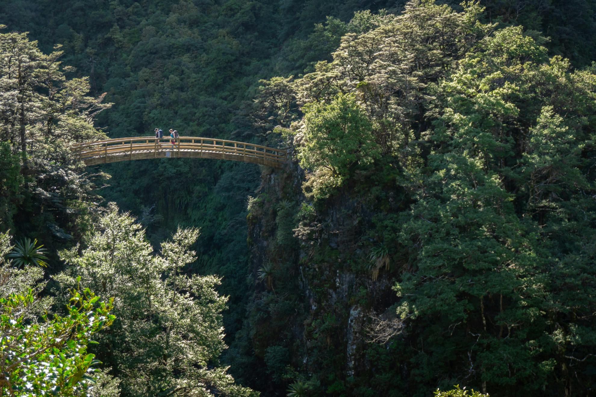
Initially, the track ascends steadily through mixed forest, studded with tōī/mountain cabbage trees. The one steeper section climbs steps to avoid an old slip, then the track crosses an attractive arched bridge with giddy views over a deep gulch. Higher, the conical pāhautea (mountain cedar) forms distinctive shapes in the forest before the vegetation diminishes and the first tussock appears.
Rangiwahia Hut offers fine views over the Rangitikei River and Mt Ruapehu. Marked routes lead onto the tops of the Whanahuia Range beyond. For experienced trampers, it’s possible to complete a circuit back to Renfrew Road on Deadmans Track.
Grade Easy-moderate Time Overnight/2-2.5hr to hut (Deadmans Track to Renfrew Road, 4-5hr).
5. Youngman Stream Hut, Puketeraki Forest Conservation Area
New Zealand’s westerly weather often means the Southern Alps experience wet weather while to the east the foothills lie in a rain shadow.
If Arthur’s Pass is soaked in, why not try this delightful tramp in the high country of the Puketeraki Range? This circuit begins in the Lees Valley, north of Oxford township.
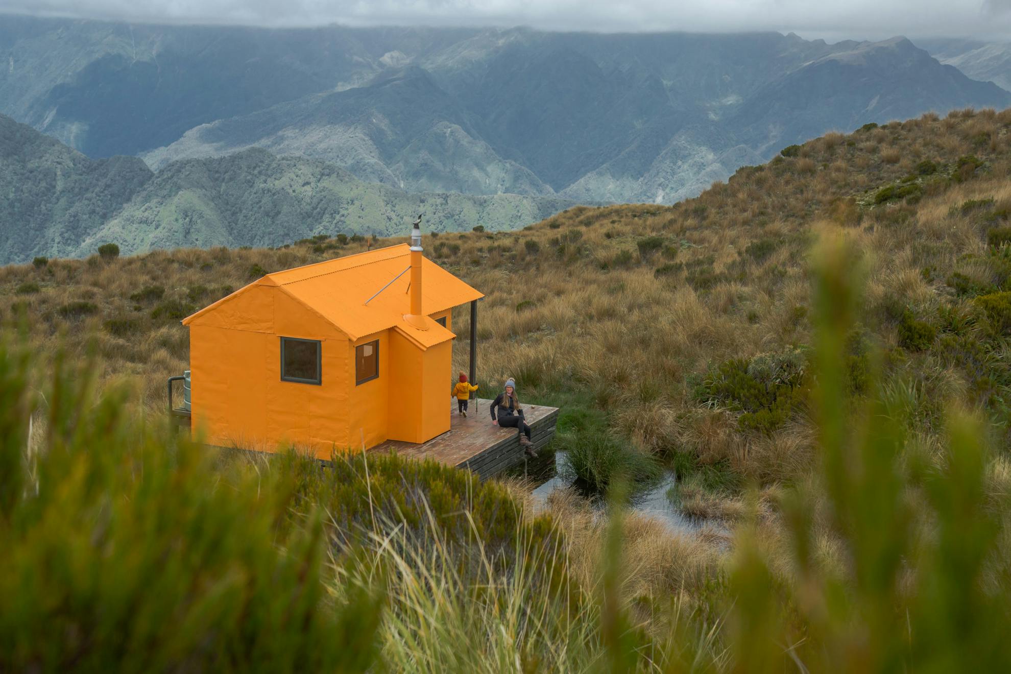
Follow a farm vehicle track for an hour or so into the Ashley River until the junction of the Lilburne and Youngman streams.
Climb the old farm track onto the tops to reach the delightfully situated Tarn Hut. Next day, traverse Lilburne Hill before descending to Youngman Stream Hut, another superbly located shelter in a beech-fringed clearing. On the last day, follow the valley track downstream, back to the Lees Valley Road.
Grade Easy-moderate Time 2-3 days.
6. Salisbury Lodge and the Tableland, Kahurangi National Park
This area makes an ideal introduction to South Island tramping: rolling tussock lands with beech enclaves among the intriguing marble mountains of the Arthur Range.
From the convenient height of 950m at Flora Saddle, the tramp begins on a benched trail to Mt Arthur Hut, passing through rattling groves of mountain neinei. A poled route leads onto the tops, with a side-trip to the summit of Mt Arthur (1795m) possible.
The route to Salisbury Lodge traverses the potholed limestone landscapes of Horseshoe Basin, and over Gordons Pyramid before a descent to the hut. It’s worth planning a day here, exploring this Tableland, perhaps with a day trip to bag Balloon Hut.
The final day sidles beside Flora Stream, en route passing the unique rock shelters of the Gridiron.
Grade Easy-moderate Time 2-3 days.
7. Mt Brown Hut, Lake Kaniere Scenic Reserve
Mt Brown saw few visitors before members of the Kokatahi Tramping Club relocated a hut onto its rolling tops. Since then, Mt Brown Hut has become a popular destination, despite the steep climb up a rooty, rough track. This is a good test of your progression from plodding paths to real old-school tramping routes, complete with some muddy sections.
The trail begins from the Dorothy Falls Road, near the shore of Lake Kaniere. It’s gradual enough at first, and well-marked, but steepens considerably as it ascends on the solid 800m climb. Hands required in places! The small hut forms a welcome sight, especially with the grand views over Lake Kaniere and the nearby Southern Alps.
Grade Moderate Time Overnight/4hr to hut.
8. Travers-Sabine Circuit, Nelson Lakes National Park
Nelson Lakes is a park of U-shaped valleys, craggy mountains, alpine lakes, good tracks and substantial huts. The Travers-Sabine Circuit offers an opportunity for aspiring trampers to have a relatively gentle introduction to the Southern Alps, on their first weeklong tramp.
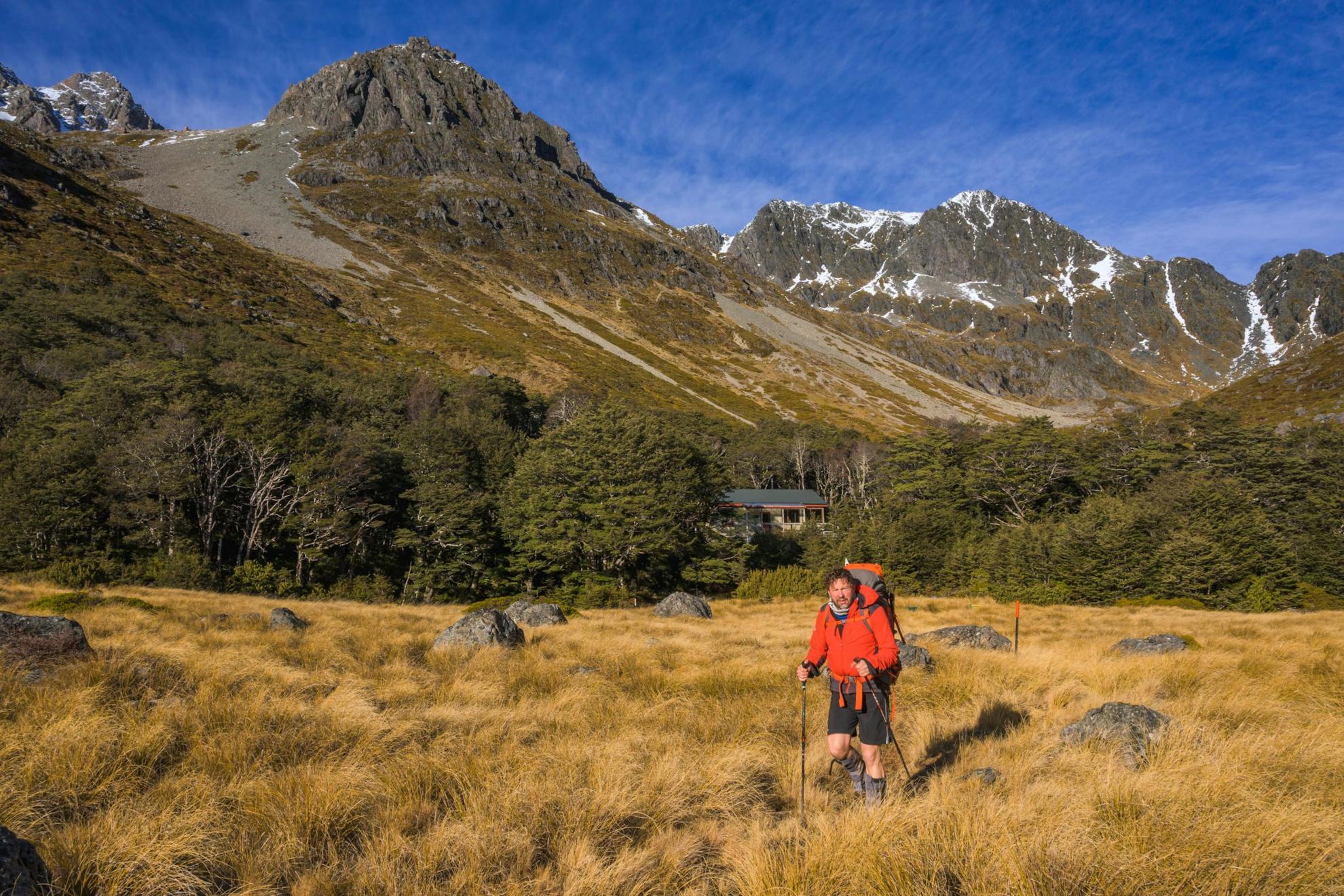
Begin with an easy stroll around Lake Rotoiti to Lakehead Hut, then continue up the Travers Valley to John Tait Hut. The valley narrows and steepens en route to Upper Travers, set in a beautiful valley head beneath Mt Travers.
The next day is the most strenuous of the circuit, beginning with a steady climb to Travers Saddle/Poukirikiri, then a knee-crunching descent to West Sabine Hut. Nelson Lakes’ famed red beech forest provides pleasant, shady travel down the Sabine Valley, often with bellbirds chiming, before reaching Lake Rotoroa. Watch for eels by the jetty.
The final two days involve more travel through forest, with a stop or night at Speargrass Hut.
Grade Moderate Time 5-7 days.
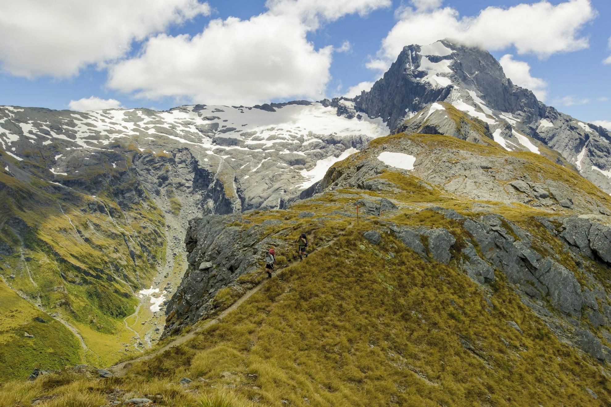
9. Gillespie Pass Circuit, Mt Aspiring National Park
The 53km Gillespie Pass circuit is a classic and a good challenge for trampers wanting to extend themselves from overnight trips.
It begins near the tiny township of Makarora, and crosses the Makarora River (a wet weather alternative begins at the Blue Pools) before travelling up the Young River to Young Hut.
The following day is a big one, with a steep but exhilarating climb to Gillespie Pass, under the imposing form of Mt Awful. After traversing a section of tops, the poled route descends beside Gillespie Stream to the broad flats of the Siberia Valley and Siberia Hut. A worthwhile side-trip climbs to the exquisite Lake Crucible.
From Siberia Hut, a well-graded track leads into the Wilkin Valley where pre-arranged jet boat pick-up is possible (or walk several hours back to Makarora).
Grade Moderate-difficult Time 3-4 days.
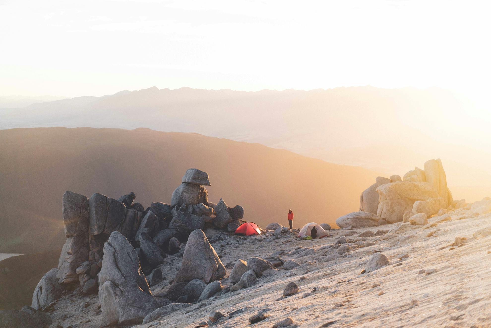
Mt Titiroa, Fiordland National Park
In the right light, Titiroa glistens, giving the illusion of a snow-clad summit. This mountain features granite of a peculiar kind, which reflects sunlight in a manner that mimics snow. While that’s a reason to admire it from afar, up close trampers will find its granite formations even more fascinating – tors, pillars, eggs, boulders, blocks, giant cairn-like mounds; Mt Titiroa (1715m) has them all – often cemented in place by coarse, yellowish sands.
This geological wonderland does however take some tramping nous and navigation to reach, with the best approach on an unmarked route.
From the township of Manapōuri, either charter a boat across the Waiau River, or pay a bit more to be transported to Hope Arm Hut. If tramping, an easy flat track through forest leads to Hope Arm Hut, from where the Snow White Clearing Track climbs a low bush saddle into the Garnock Burn. Ford the river, and head upstream for 500m, when a climb begins on an unmarked route up a forested spur to Pt915m. Although there is no track, the bush is open enough to offer reasonable travel. Carry water, and camp just below the bushline near Pt1125m.
From there to the summit is a mind-blowing ascent past tors, along granite ridges with the immensity of Fiordland laid out to the west and north.
Grade Difficult Time 2-3 days.
