


Mountain Safety Council hopes to revolutionise trip planning with a new online tramping tool, Plan My Walk.
The platform will be available on a website or via a free app, and will compile track information, alerts, MetService weather forecasting and gear lists compiled by MSC, into one place.
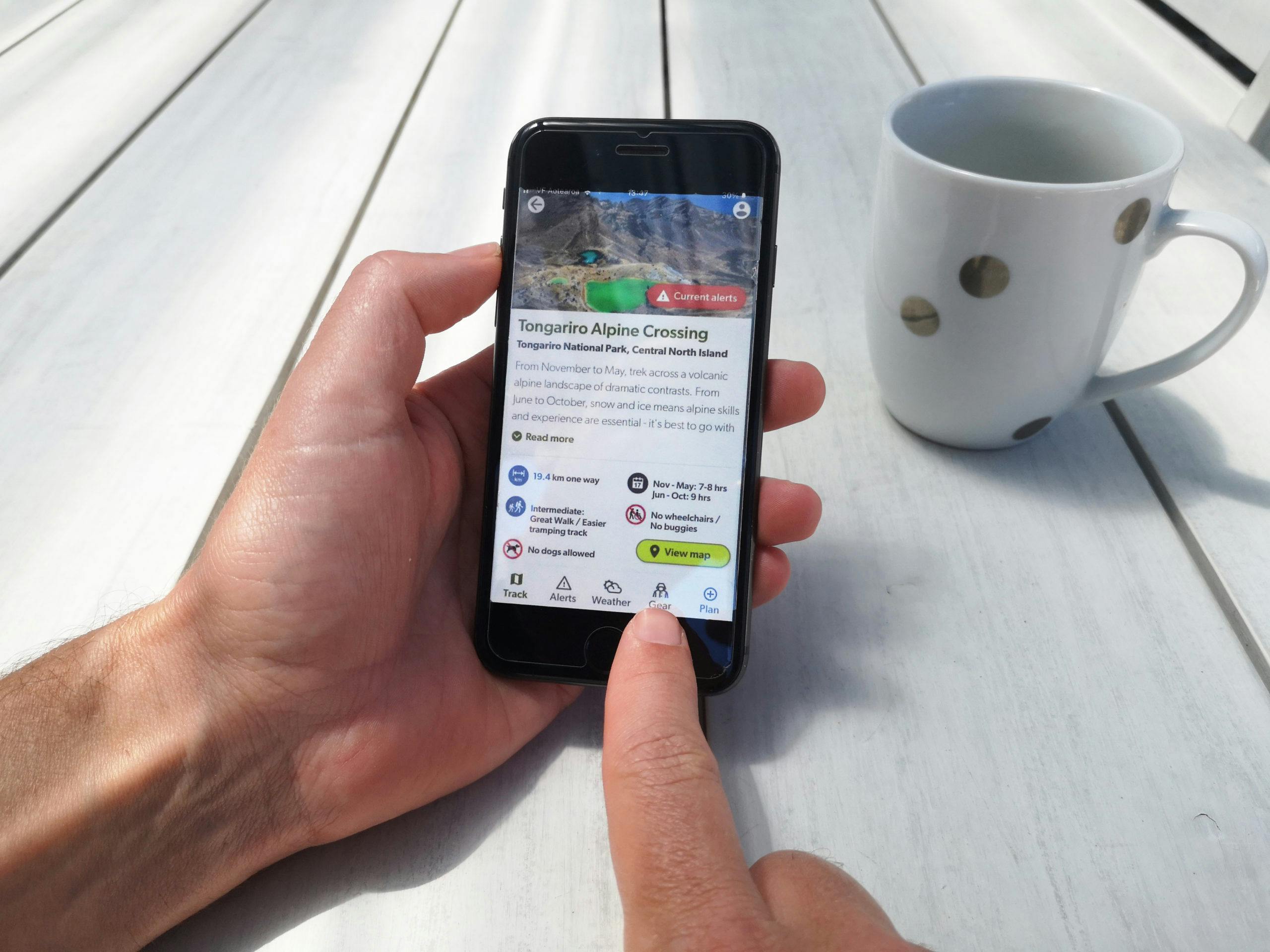
Users will be able to select their track of interest and the dates they intend to walk it, and all relevant information will be tailored to their specific trip. This may include user reviews, difficulty ratings, accessibility information and safety videos. The most relevant weather forecast for the intended walk will be added upon release by MetService.
DOC’s entire database of tracks (over 1000) will be available, in addition to a number of regional council and Walking Access Commission walks.
“This tool is designed to make the planning process more efficient and effective, and bring together a range of sources for people,” MSC’s Nathan Watson said.
The website and app do not require a sign in, but benefits for registered users include email updates for weather and track alerts and the ability to save and share trips with group members and emergency contacts, making it simple to share detailed intentions.
Trip notes are fully customisable, and users can upload documents such as maps or route information.
“You can add trip notes to tell someone not to forget the cooker, or tell the group what time to meet up,” Watson said.
Beta testing of the tool will run through March in anticipation of a full launch in April.
