


Peak-bagging the North Island’s 12 highest non-volcanic mountains.
North Island trampers are often considered impoverished by their southern counterparts, and to some extent that’s true. We northerners don’t have anywhere near the selection of summits, the range of ranges, nor the mightiest mountains.
But that doesn’t mean the North Island doesn’t offer a considerable number of interesting mountains. Of course we can always brag about the volcanoes, something the southerners don’t have, but what about the non-volcanic peaks?
The author of a recent book claimed that the Ruahine’s Te Hekenga (1695m) was ‘among the 10 highest non-volcanic peaks in the North Island’. That didn’t seem quite right to me, so I consulted my maps, and came up with a definitive list of peaks over 1700m. At first, I thought this came to the convenient total of 10 peaks. But after the article was first published in Wilderness February 2021, an email from reader Jonathan Astin pointed out I had missed a significant summit: Patutu (1718m) in the Kaimanawa Range. And there is an unnamed section of ridge just topping 1700m so I’ve included that as well.
You’ll see from reading the descriptions below that you don’t need 12 trips to climb them all. Planned carefully, you might be able to ascend the full complement of 1700m peaks in as little as five tramps.
While researching, I also browsed back issues of Wilderness and came across an interesting letter from Martin Geddes outlining the curious names ascribed to peaks in the British Isles. As well as the well-known Munros (Scottish peaks over 3000ft (914m)) and Wainwrights (peaks over 1000ft (304.8m) in the English Lake District) a whole host of other names exist: Corbetts, Donalds, Grahams, Hardys, Furths and Marilyns – assigned for various characteristics, mainly to do with height.
That got me thinking: perhaps we need a collective name for the non-volcanic 1700m summits in the North Island. Any ideas?
1. Hikurangi, Raukumara Forest Park, 1752m
First to see the sun, Hikurangi is a singular summit lying on the heights of the Raukumara Range, one of the most rugged in the North Island. Sacred to local iwi, Ngāti Porou, the mountain can be approached from Pakihiroa Station, inland from Ruatoria.
A long climb ensues up a farm vehicle track to a carpark, where nearby are some magnificent carved whakairo, representing the story of Māui. Hikurangi Hut lies 30 minutes beyond and must be booked well ahead of your trip.
From the hut, a rugged route leads to the mountain’s summit, through forest at first, then sidling steep slopes, to where a final scramble leads up a rocky gully onto the narrow summit ridge. Significant drop-offs in a few places mean the route requires a good head for heights. Ngāti Porou offers guided trips to the maunga.
2. Mangaweka, Ruahine Forest Park, 1731m
Curiously, the highest peaks in Ruahine Forest Park are not on the main Ruahine Range, but the Hikurangi Range lying to the west. The large, rounded summit of Mangaweka is broad and easy, although in recent years access has become problematic. Seek permission well before your trip from the farmer at the end of Mangakukeke Road to cross his farm to reach the Purity Hut Track. Purity Hut is a comfortable six-bunker, set above the bushline.
Beyond the hut, a poled route climbs through tussock to reach Wooden Peg, then Iron Peg (see no.10), marked by a cairn and waratah. From here, strike north, with the summit of Mangaweka about 30 minutes away, past a sizeable tarn.
3. Makorako, Kaimanawa Ranges, 1726m
This is the most difficult to access of all the 1700m peaks, and the only one to lie on private land. Permission to climb the peak involves booking the Makorako hunting block through Heli-Sika, which manages access to the area from Poronui Station, east of Taupo.
For a price, Heli-Sika will fly you into the landing/camping site in Ecology Stream, from which Makorako can be climbed in a day (there are no tracks and navigation skills are required). As the block is popular with hunters and fishers, trampers will need to book well in advance.
4. Kaweka J, Kaweka Forest Park, 1724m
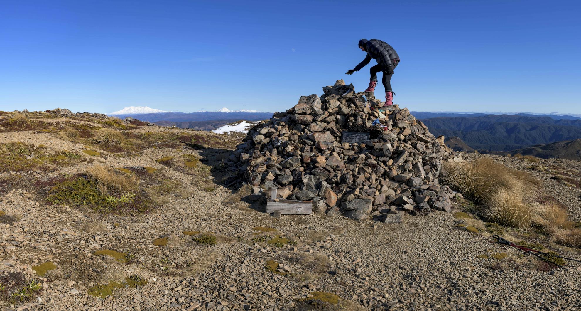
The flat expanse of Kaweka J, which is more like a rocky plateau than a mountain, seems rather unassuming for the highest peak in the Kaweka Forest Park. However, the panoramic views are magnificent, reaching across the Kaimanawa Ranges towards the Tongariro volcanoes. And Kaweka J does boast one of the country’s largest cairns – a memorial built to members of the Heretaunga Tramping Club who lost their lives in the Second World War.
Reaching the summit is possible in a day trip from Makahu Saddle, by climbing the steep Makahu Spur, or as an overnight tramp with a stay in Dominie Biv (two bunks) en route.
5. Patutu, Needles Block, Kaimanawa Range, 1718m
Paututu is a rounded summit, lying considerably higher than any of the surrounding peaks, on what is known as the Needles Block, in the southern Kaimanawa Ranges. As this is private land, you’ll need to arrange a permit with HeliSika (info@helisika.co.nz), who manage access. The most direct access is up a forested spur from the Waipakihi River, although trampers can also approach using the Southern Access Corridor.
6. Unnamed peak, Ruahine Forest Park, 1718m
Lying between Hikurangi and Mangaweka, this unnamed peak is a lofty but otherwise undistinguished summit on the Hikurangi Range. It’s best climbed as part of an overnight trip to bag all the other 1700m peaks along this high range (nos 2, 8 and 11) staying at either McKinnon or Purity huts.
7. Unnamed peak, Trig A6G4, Ruahine Forest Park, 1715m
As this peak lies just a kilometre from Rangioteatua (no. 10) it’s well worth bagging both peaks on the same trip. From North Block Road, follow the tramping route to Middle Stream, then across a ridge to reach Smith Creek Hut (four bunks).
From here, a track climbs through forest onto the tops and follows a route onto the unnamed summit, marked by an old trig beacon. If the weather allows, traverse the tops northwards, bagging Rangioteatua (no. 10) and descending the Waipawa River from Waipawa Saddle. Allow 2-3 days.
8. Hikurangi, Ruahine Forest Park, 1710m
While Hikurangi can be reached using the Purity Hut access, another approach is via McKinnon Hut (allow two days). From Upper Kawhatau Road, head up the Kawhatau River (presently no access is possible on the Rangitane Road to Kawhatau Base) for 2-3hr, before gaining the McKinnon Hut Track. This climbs very steeply onto the northern end of the Hikurangi Range and then follows a poled route towards McKinnon Hut.
From Pt1625m, divert south for an hour to reach the summit of Hikurangi. Backtrack, then descend to the nicely positioned six-bunk McKinnon Hut for the night.
9. North Kaweka, Kaweka Forest Park, 1707m
Unlike its flat near-neighbour Kaweka J, North Kaweka actually looks like a peak, with some adjacent bluffs lending it the shape of a real mountain. Lying only 30 minutes north of Kaweka J, it is also reached as a day-trip from Makahu Saddle.
Alternatively, it can be traversed as part of an overnight circuit to Ballard Hut, Camp Spur and Kaweka Flats.

10. Rangioteatua, Ruahine Forest Park, 1704m
Rangioteatua is a rounded, helmet-like summit near the head of the Kawhatau River. It can be reached on a two-day circuit, beginning from the North Block Road.
Tramp up the Waipawa River to Waipawa Saddle, and then climb onto the western shoulder of the Three Johns. Head south-west, watching out for some vicious patches of speargrass, before the final ascent to Rangioteatua.
11. Iron Peg, Ruahine Forest Park, 1703m
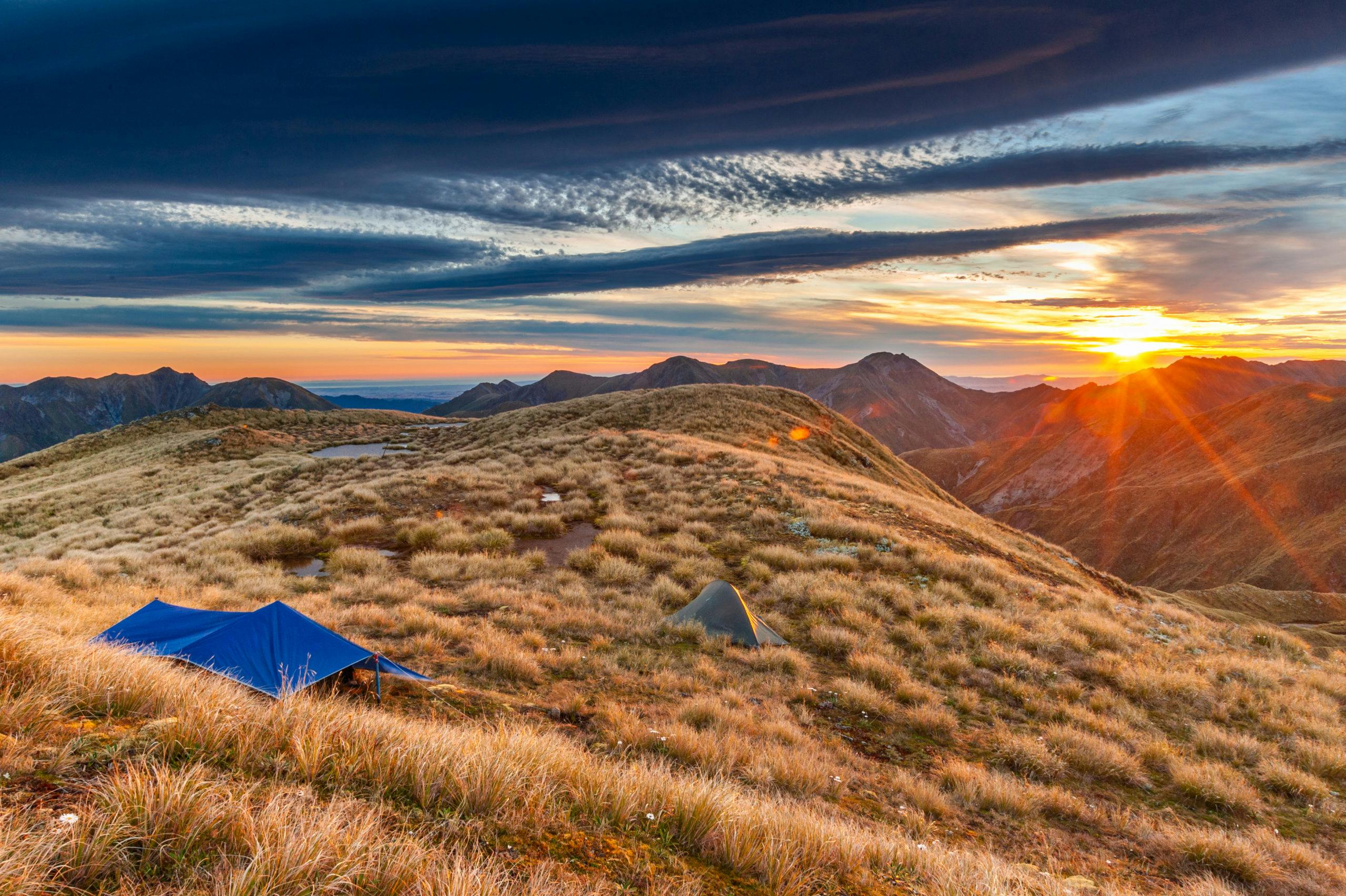
As already described, Iron Peg is reached en route to climb Mangaweka (no. 2) and the two other 1700m peaks on the Hikurangi Range (nos 5 and 8). Tarns near the summit of Iron Peg make it an appealing place to camp, although it is exposed.
12. Unnamed flat, Kaweka Forest Park, 1700m
Although probably not distinct enough to call a summit, this position just nudging 1700m can, happily enough, be bagged en route between Kaweka J and North Kaweka (nos 4 and 9).
– This article has been updated to include a ‘forgotten’ 17er – number five on the list, Patutu, had been excluded from the original article.
