


The Remutaka Rail Trail is an easy mountain bike ride along a feat of railway engineering.
For Wellingtonians, the 22,000ha Remutaka Forest Park makes for an easily-accessed outdoor playground with dozens of tracks and family-friendly huts.
Among the park’s many attractions is the historic Remutaka Incline. The railway line between Wellington and Upper Hutt was completed in 1874. The big engineering challenge was to get over the Remutaka Range and into the Wairarapa. The steep gradients the construction crews were forced to work with were too much for the everyday steam trains of the time. The solution was to install a newly invented system designed by John Fell, that added a third centre rail to the track to provide extra traction and braking.
By 1878, the line was up and running, but proved costly to maintain and was prone to slips and tree fall due to the heavy rain and high winds that often batter the range. In 1880, a huge gust on an exposed corner nicknamed Siberia, blew two carriages and a brake van off the rails. They plunged down the hillside and three passengers were killed.
Eventually, the high cost of maintenance and the desire for a faster, safer route, saw the construction of the longest tunnel in New Zealand, straight under the range. It bypassed the entire incline and by 1955, after 77 years of service, the incline was quietly closed down.
The rail-trail came into being during the 1980s, providing a great alternate route to Featherston and the Wairarapa for walkers, runners and cyclists – the relaxing gradients make it an enjoyable family ride.
From the trailhead on Incline Road, the trail offers a pleasant 1:30 grade that climbs adjacent to Pakuratahi River and through an old pine plantation and then regenerating native bush. The track turns south-east at the tunnel ventilation shaft building – it’s astonishing to think the 8.8km long Remutaka Rail Tunnel is buried somewhere deep below.
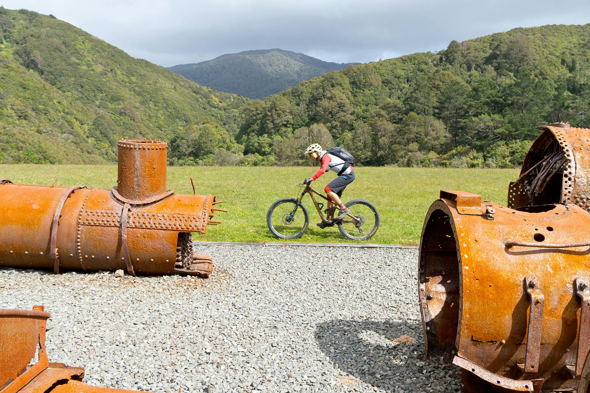
Soon after, the trail crosses a tributary of the Pakuratahi River adjacent to a large forestry block and climbs to its high point, Summit Station at 348m. Here, there is an impressive collection of red rusty boilers, steam pipes and train cabs. Interpretation panels bring the whole industrial spectacle to life with informative photos and text.
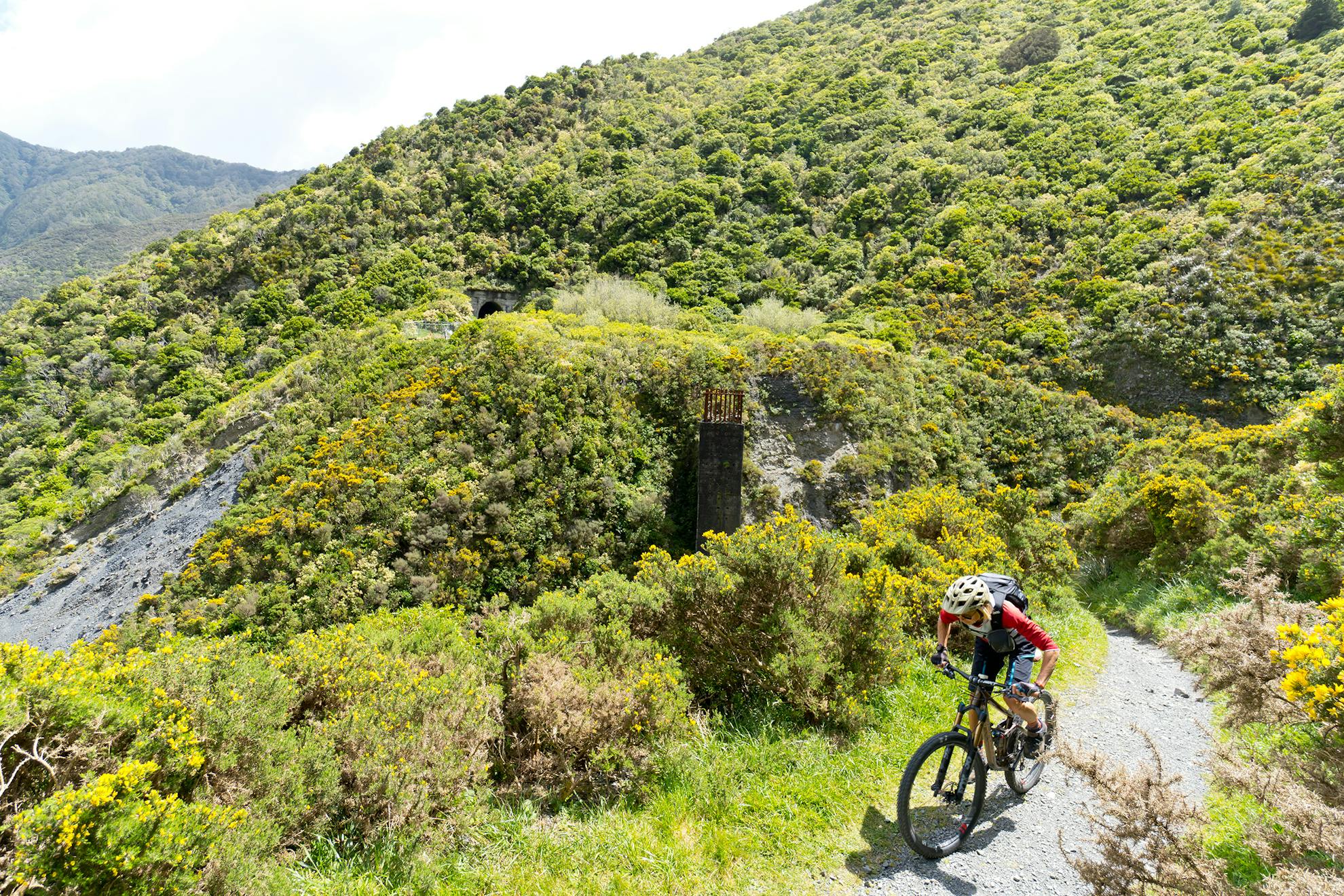
Beyond the summit, a very cool and dark 580m tunnel is cycled. A torch is necessary to navigate its full length.
Out the other side of the tunnel, the descent begins. It’s twice as steep as the climb but still gradual in mountain biking terms. The trail traverses high above Cross Creek, sidling around the ridge before heading due east. The native bush is slowly returning to this south face, vigorously pushing over the gorse.
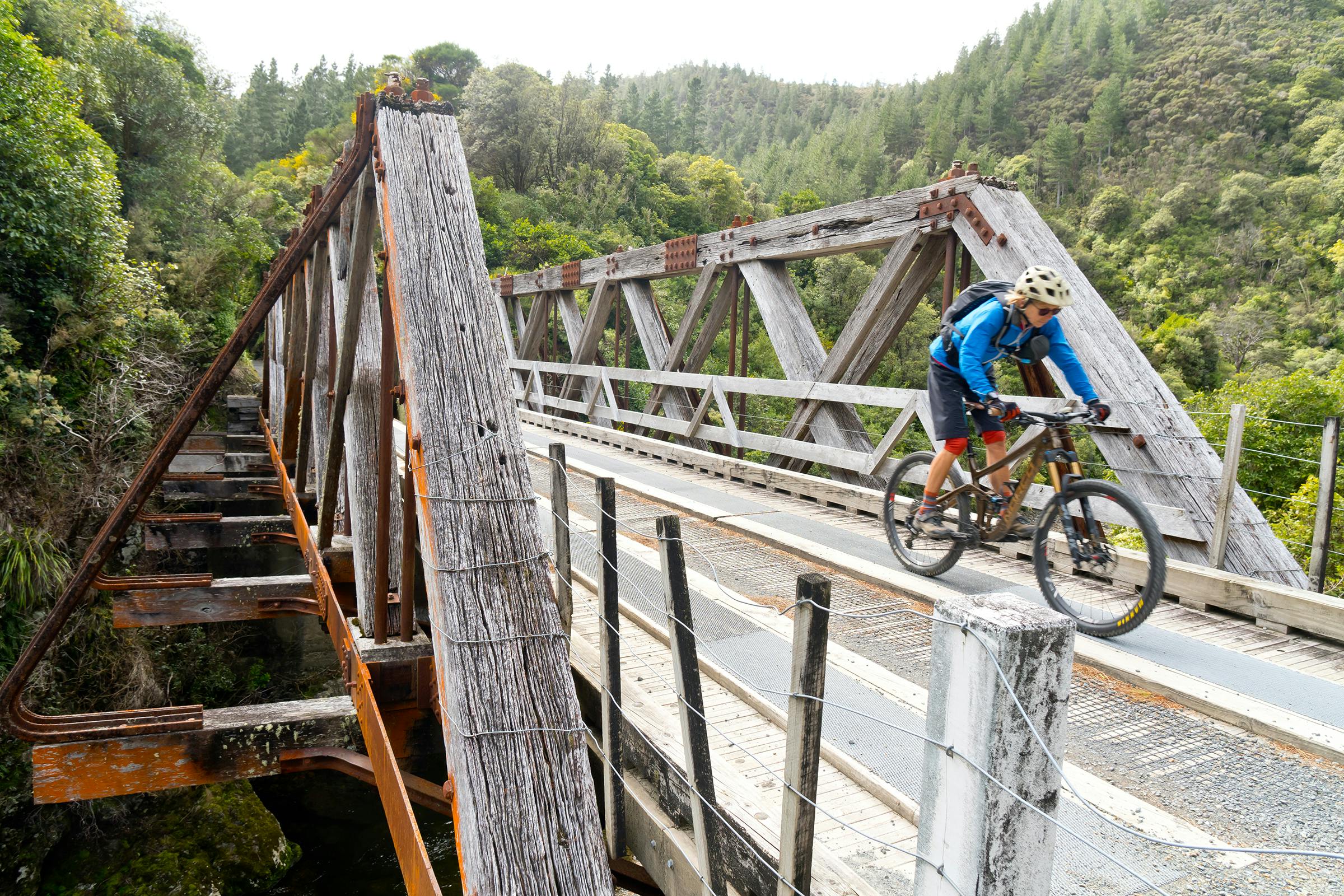
Just after the second, short, Siberia tunnel, is a slip where the Siberia Gully Stream washed out a curved earth rail embankment in 1967. A beautiful 90m swingbridge has been built to bypass the mess and provides a bird’s-eye view of the old concrete rail structure and slip below.
The last tunnel – Prices – has been dug through the difficult country on steep terrain.
The bottom section of the trail soon meets the site of the old railway yards that were once part of the Cross Creek Station and settlement. Even though this was one of the most remote postings railway staff could be sent to, it was a flourishing settlement until 1955. There is plenty to explore here and some good spots to relax before the final descent.
The excellent Cross Creek single-track winds its way through tall mānuka and broadleaf on the true right of Cross Creek to the road end car park and railway station. It’s possible to carry on to Featherston for an ice-cream or lunch before reversing the ride, or simply organise a shuttle.
- Distance
- 17km one way
- Total Ascent
- 838m
- Time
- 1-2hr (riding), 4.5hr (walking)
- Access
- Access From SH2, turn right at Kaitoke onto Incline Road
- Map
- BQ32
GPX File
- Remutaka Rail Trail (gpx, 12 KB)
GPX File
- Your device does not support GPX files. Please try a different device.
