


One of the easiest ways to experience a South Island alpine environment within a couple of kilometres of civilisation is to walk the Coppermine Trail, a breathtaking 40km loop near Nelson’s city centre. By Naomi Arnold
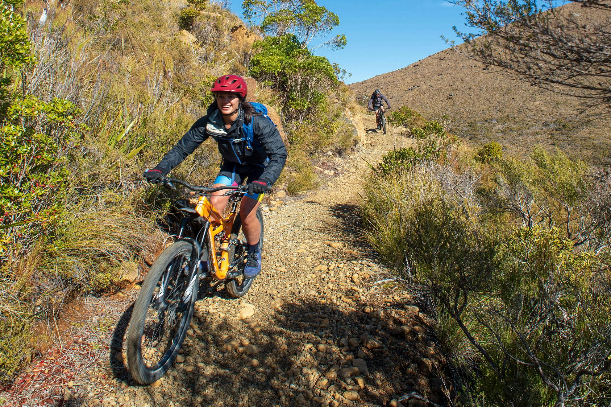
The Coppermine Trail is a purpose-built mountain bike trail that traverses Nelson’s mineral belt. It’s one of New Zealand’s Great Rides, so is not always thought of by locals and visitors as a prime walking destination. That’s also because Nelson is spoilt for choice; typically, if you want alpine scenery, you drive 90 minutes to Nelson Lakes National Park; if you want bush, you head to Kahurangi National Park; and if you want beaches, it’s an hour to the Abel Tasman.
But the Bryant Range, out the back of Nelson, and the Richmond Range that separates Nelson and Marlborough, are so accessible and spectacular that they shouldn’t be overlooked, and the Coppermine is the easiest way to experience this special alpine area in a day. It makes for great walking on a beautifully-crafted track that includes lush bush, fascinating history and stark, stunning red-brown rock gardens. It’s also very close to town for a post-walk beer.
In this area, Māori quarried argillite or pakohe, using fire and water to crack the rock faces and hammering down smaller boulders. The stone was used for adzes and tools, with sharp flint-like pieces useful for carving wood and preparing food. Later, in 1862, European settlers built the Dun Mountain Railway to transport chromite ore to Port Nelson for export, but the deposits didn’t last long. Most of the horse-drawn tramway closed in 1866, but there was a town remnant until 1901, transporting locals through the streets to the Port.
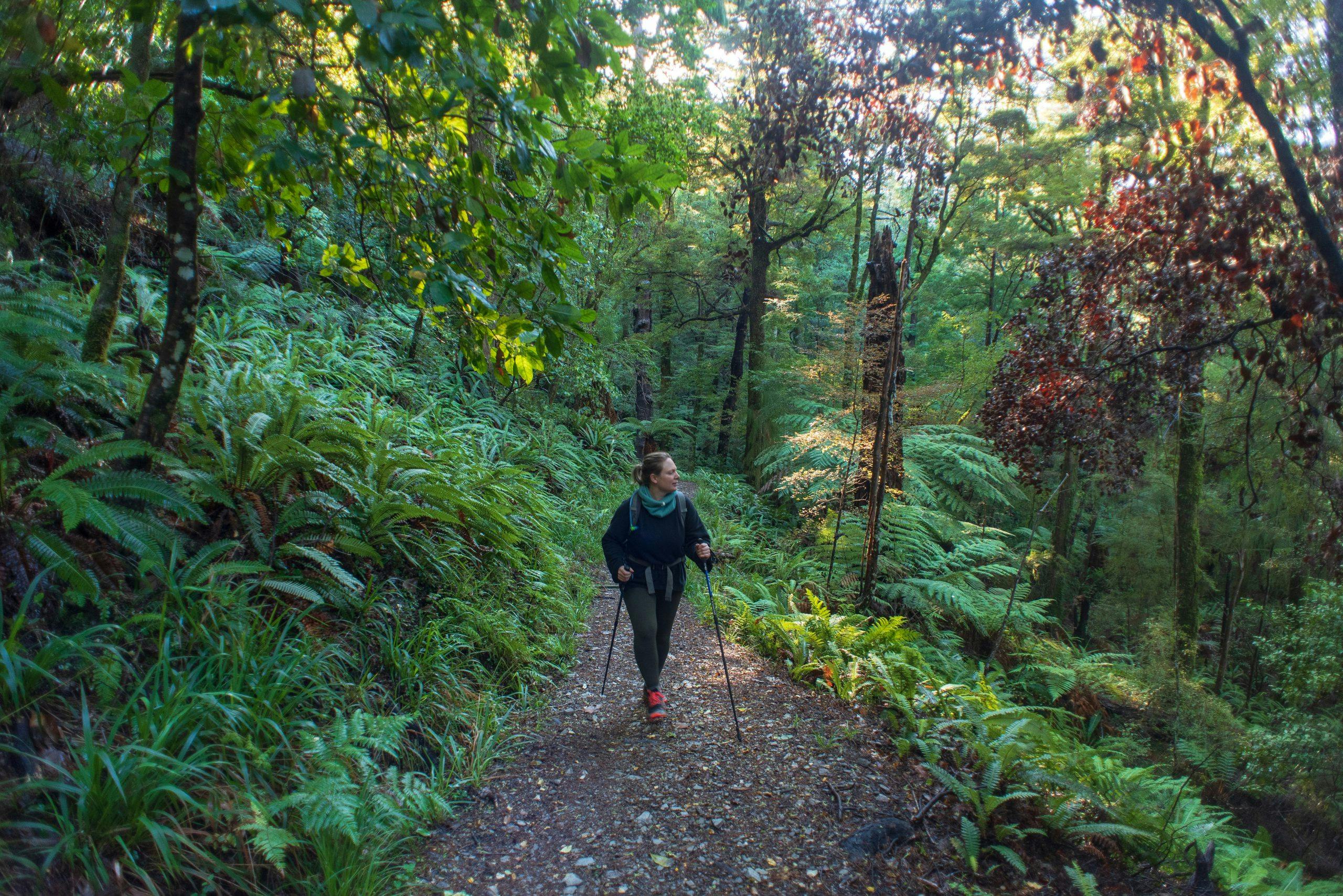
Whether you’re going by bike or foot, the full 40km loop begins from Nelson’s Brook Street and rises gently up the benched, historic Dun Mountain Railway (New Zealand’s first), then along the Brook Waimarama Sanctuary’s predator-proof fence. It then climbs through native beech forest before emerging into the scrub of Nelson’s mineral belt, from where there are amazing views.
Once the Coppermine Saddle (878m) is reached, the rest of the walk consists of a wonderful flowy downhill mountain bike track in the Maitai Water Reserve. It’s also known as the Dun Mountain Trail, which was built and renamed in August 2019. It’s scattered with chunks of the area’s characteristic red-brown ultramafic rocks.
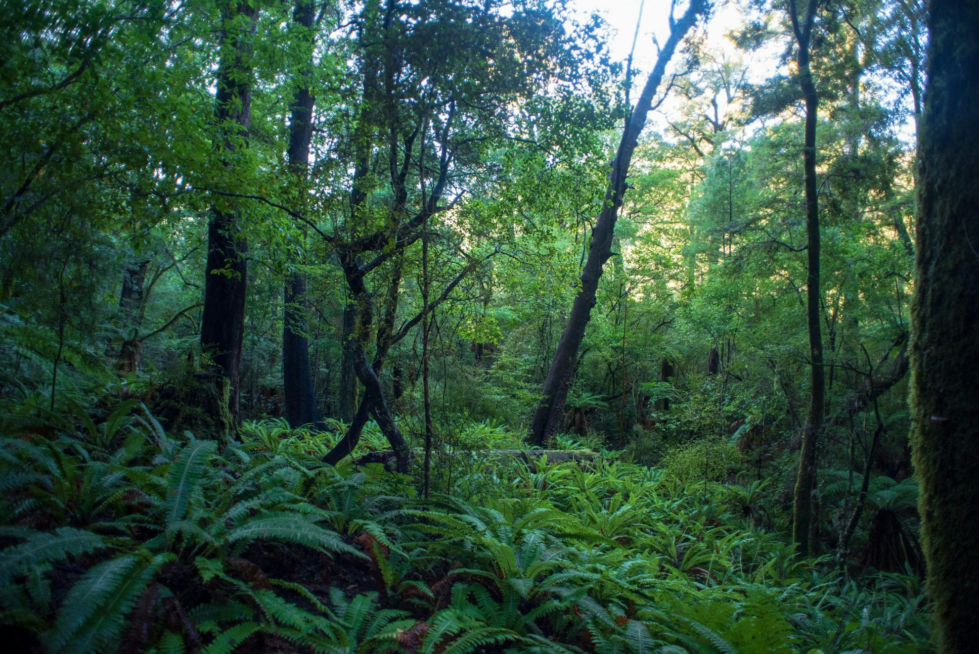
After leaving the mineral belt and heading back into beech forest, it becomes a beautiful benched track beside the river that takes you past Nelson’s water supply at the Maitai Dam, and from there back into the city centre.
The Coppermine is rideable in a day, but 40km is a bit much for most people for a day walk. However, there are plenty of options for half-day, full-day, overnight and multi-day trips starting from either end.
Recently, Nelson Tasman Cycle Trails Trust committee member Andrew Macdonald and I went for an out-and-back walk one late-autumn morning weekday. Level 3 Covid-19 restrictions, combined with my physiotherapist’s cautions for a hip injury, meant we had to keep the day reasonably low-key. We walked the reverse of the official bike loop, beginning a few minutes from home at the Maitai Dam end and heading nearly to the Coppermine Saddle and back, about 20km with 760m of ascent. (This being Nelson, the first downhill mountain biker we met as we were walking up was, of course, my physio-therapist).
Macdonald actually joined the trust because he loves this area so much. He calls the Coppermine “the mini Old Ghost Road”.
“I’ve always had a soft spot for this area because it’s so underrated,” he says. “It’s a journey, not just an up-and-back like climbing a peak. The thing I love about it is that you feel like it’s so remote, but it’s really not.”
Indeed, your coffee will still be hot by the time you get to the car park.
“It’s also a journey through geological history and human history,” Macdonald says. “Early Māori looked for argillite, which was like gold. Then came early Europeans looking for minerals, and then it became a water reserve. It reflects the growth of a country.”
It was a bracing morning when we left the dam; the winter’s first snow had dusted the tops the day before, but it was gone by the time we began at 8am. Our cheeks still pinkened walking through the chilly alluvial lowland forest that borders the Maitai River. Emerging into the sun, we began passing through kānuka and mānuka forest and up the rocky, well-drained, graded track, which has had its rough and steep bits taken out and features lovely flowy corners.
The Nelson Mineral Belt extends from D’Urville Island in the north to the Red Hills in the south, and this ultramafic soil means the area is home to many endemic plants. We saw tiny mistletoes clinging to mānuka, cream-coloured ultramafic gentians in bloom – one of the latest flowering alpine plants in New Zealand – and delicate Pimelea prostrata, New Zealand daphne. This sort of open scrubland is also the preferred habitat for the Nelson green gecko, hardly ever seen but which produces a barking noise that makes it one of the world’s loudest.
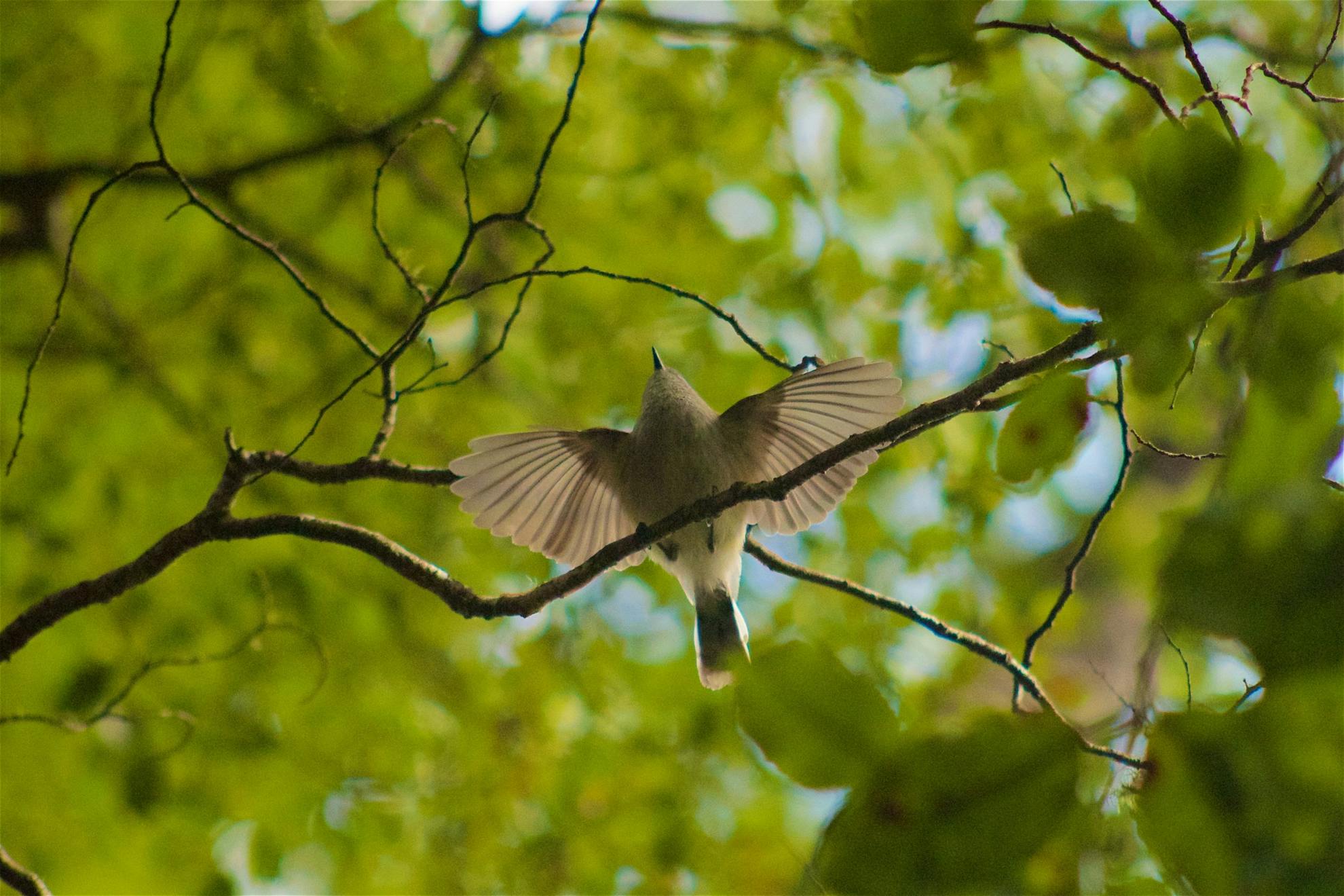
You may also be able to spot some more of the 28 plant species that grow in this uniquely toxic, low-fertility soil with its high mineral content and harsh climate, such as the Dun Mountain forget-me-not, (Myosotis monroi). It’s also home to Powelliphanta and forest ringlet butterflies.
As the bush thins and the mineral belt is reached with bare tops ahead, the views become distinctly sweeping, especially for such a straightforward walk so close to town. Ahead is the summit of Dun Mountain (1129m), and opposite, the abandoned workings of the historic ore chutes and mines; copper lode was found first, but was eventually deemed worthless.
With tops bare of trees, you can see for miles across the valleys below, across sparkling Tasman Bay, swathes of forestry, and the bluish folded ridges of native bush leading to the Doubles (Saddle Hill), the familiar backdrop to Nelson city centre.
Walkers and cyclists don’t always get on when they’re on the same trails, but we saw about 10 over the course of a leisurely five hours, and easily heard them and stepped aside (they were also polite enough to say hello and thanks, and tell us how many more were coming behind them). We took our time, but it wouldn’t be too hard to get to Coppermine Saddle in two hours, and then it’s a pleasant stroll downhill and home.
That’s one option, but there really are many ways to enjoy the Coppermine. With two cars, a longer day walk could create a loop between the Maitai Valley and the Brook Valley over the Tantragee Saddle. Making it the two-day full 40km circuit could mean staying at nearby Rocks Hut (16-bunks) in Mt Richmond Forest Park, which is also on the Te Araroa Trail. Exploring the trails around Dun Mountain and the Richmond Ranges will add many options to extend your walk, such as heading over to the Hacket or Pelorus Valleys.
Technically, if you’re a traveller to the region, you could arrive in the city and walk from the centre of town straight up to Rocks Hut, which is just 11km from sea level in central Nelson and would take around five to six hours. There can’t be many stunning alpine destinations in New Zealand where you can say that.
– Wilderness has partnered with the Nelson Tasman Cycle Trails Trust to publish this article.
- Distance
- 30km (full loop)
- Total Ascent
- 2680m
- Grade
- Moderate
- Time
- 4-6hr(mountain bike, 8-10hr (walking the full loop)
- Accom.
- Rocks Hut ($5, 16 bunks)
- Access
- Maitai Dam or Codger Mountain Bike Park
- Map
- BQ26
