


Dave Mitchell rides two Banks Peninsula trails, including a long and short option along the Te Ara Pātaka Walkway
The long craggy fingers of Banks Peninsula were formed by two massive volcanic eruptions between six and 11 million years ago. The resulting overlapping volcanic cones rose to over twice the height of the present-day hills, but erosion has whittled down their summits and formed deep valleys with steep sea cliffs at the exposed headlands.
Akaroa and Lyttelton harbours formed around 7000 years ago when the sea rose and flooded the valleys. James Cook mistook the landmass for an island and named it Banks Island, after the expedition’s naturalist, Joseph Banks. The mistake was not corrected until 1809.
The Te Ara Pātaka Walkway provides excellent views over almost the entire peninsula, including its beautiful northern bays, Akaroa Harbour and Lakes Forsyth and Ellesmere, and even across the Canterbury Plains to the foothills of the Southern Alps.
The peninsula was once completely covered in native forest, but Māori began the process of clearing it and early settlers milled the timber to supply industry and building material for Christchurch and Canterbury. Most of the remaining scrub was cleared for farming, but some large patches of bush still remain.
Little River Loop, 31km
There is a number of ways to do this ride. The most popular starts and finishes at the township of Little River, utilising its excellent café at ride’s end. From town, veer north away from the main Akaroa Highway and head along Western Valley Road. It winds through picturesque farmland then starts to climb. The first steep section is sealed then it goes gravel all the way to the top at Port Levy Saddle. It’s a long, mixed climb on a narrow but well-surfaced gravel road. Stunning views south are just the beginning.
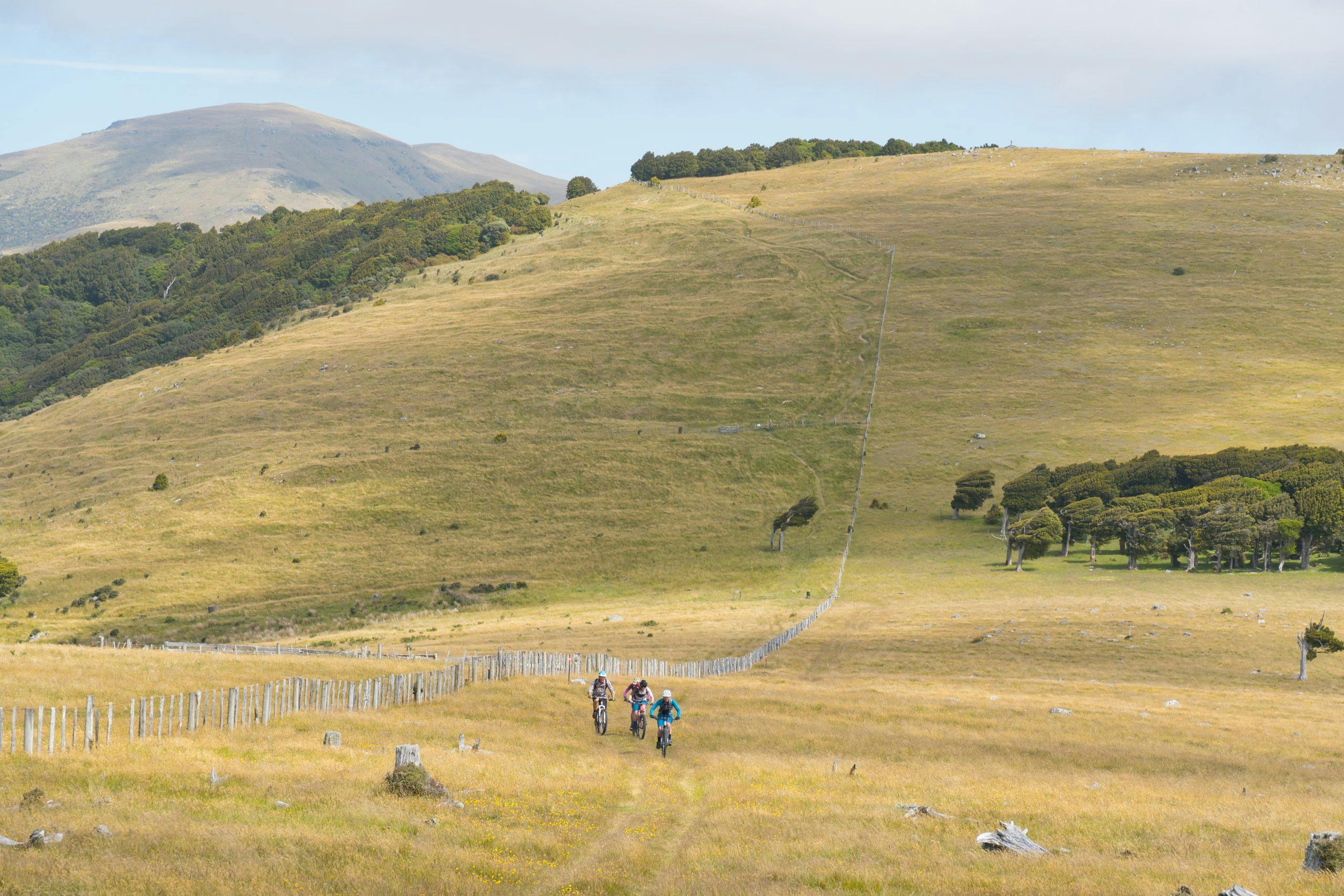
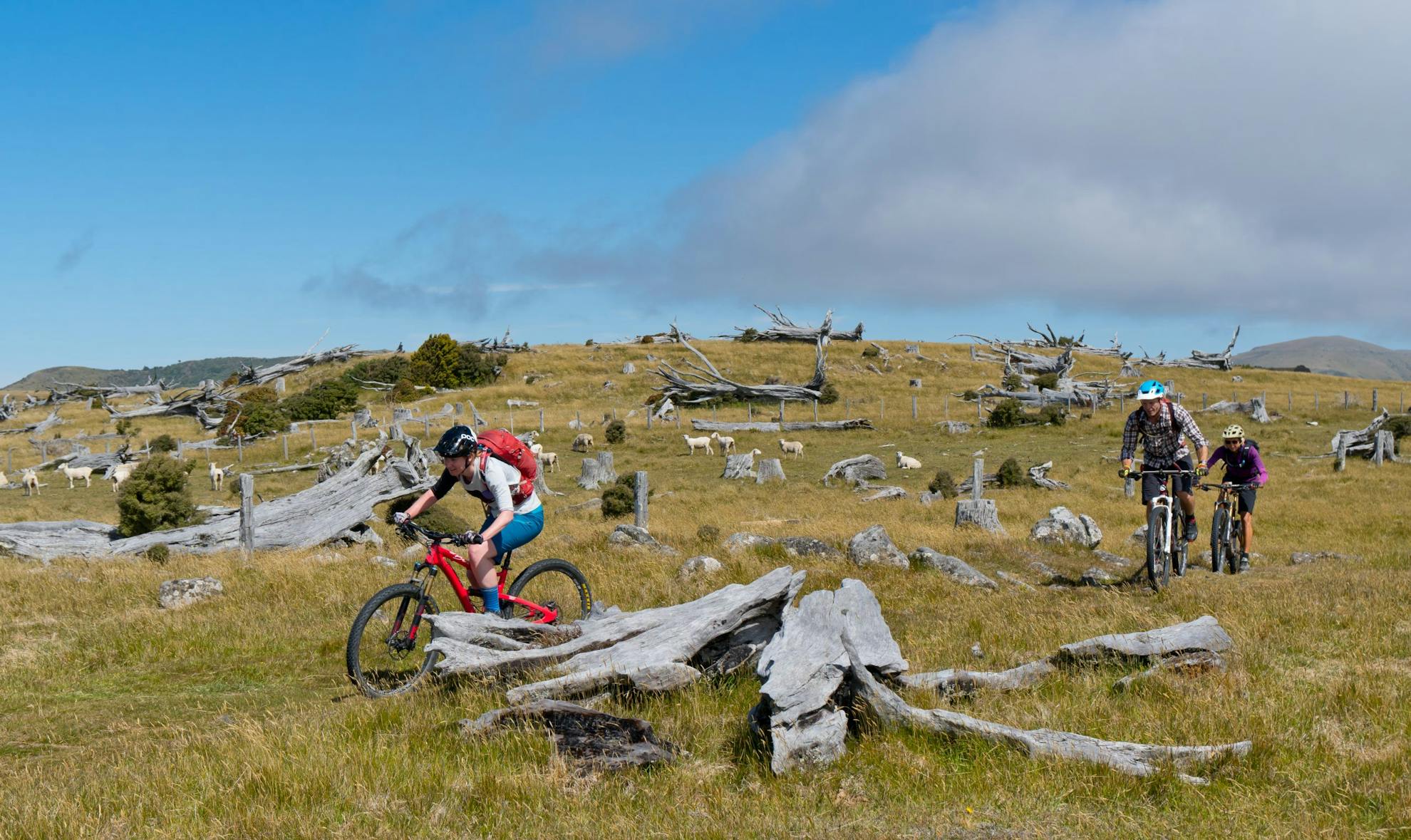
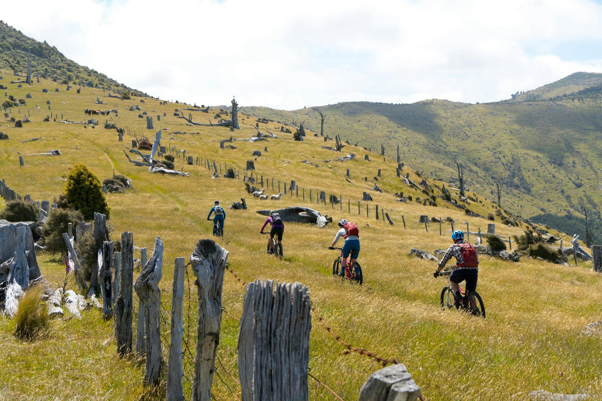
Port Levy Saddle sits at 660m and is the cross-over point of the Te Ara Pātaka Walkway. Follow the signposted route going east. This track traverses the northern rim of Akaroa’s volcanic cone following a mix of farm track, single track, stock track and double fence line. There’s an initial climb to just below Pt738 and then the trail drops to Waipuna Saddle. A healthy group of totara huddle on the northern side of the saddle, shaped by the prevailing wind. The track then climbs up to a distinctive section of double fence line and wanders along the tops among the fallen and bleached skeletal remains of felled totara trees.
The climb to Mt Fitzgerald, 826m, is steep and gnarly, as is the descent and traverse to the Mt Sinclair Reserve at the high point of the track (841m). The reserve is made up of large blocks of bush, with forest remnants of totara, kahikatea and matai making the most of the damp southerly aspect and the easterly cloud that hangs around at this altitude.
The trail now drops onto a good 4WD track to Whatarangi Totara Reserve and through a tunnel of bush to its far side.
Cross the open paddocks to a boundary fence line and follow the DOC sign through farm paddocks to the gravelled Pettigrews Road and head east to the Summit Road and then turn west to the Hilltop intersection where the Harmans Track is joined. This is a gnarly old stock route which, in 1986 hosted the very first mountain bike race in New Zealand. This exits back on the main Christchurch Akaroa Road at Cooptown and shortly after Little River is reached.
Port Levy Loop, 44km
This route incorporates much of the Little River trail, but starts from Port Levy at the opposite end of Western Valley Road.
Head South up the valley road towards Port Levy Saddle. It’s a long, gradual climb on a narrow but well-surfaced metalled road and passes through hill country with patches of mānuka and kānuka. The streams and waterways here are lined with fuchsia, broadleaf and ferns. The top section of the road enters a large pine plantation that climbs almost to the ridge top, providing welcome shelter during cold weather and shade during the hot, windless summer months. A couple of decent streams from the open tops cross the road, providing treatable water all year round.
At Port Levy Saddle, join the Te Ara Pātaka Walkway and head east to Pettigrews Road as described in the Little River Loop description.
Descend north along Pettigrews Road on good gravel, though this can be steep and loose to ride if recently graded, to Kukupa. It’s then a ride with small rises and long descents on the sealed road to Pigeon Bay for lunch or a snack by the sea.
The gravelled Holmes Bay Road crosses a small peninsula to Holmes Stream and the start of the last big climb of the day, to the 500m saddle just below Wild Cattle Hill on the Port Levy–Pigeon Bay Road. It’s a narrow road but has an excellent surface and a relaxed gradient.
The downhill to Port Levy is fast and open with good views across the bay to the Seaward Kaikoura Range. The circuit ends on a short section of sealed road with 2000m of climbing and 44km under your belt.
- Distance
- Little River Loop, 31km; Port Levy Loop, 44km
- Total Ascent
- Little River Loop, 1352m; Port Levy Loop, 2162m
- Grade
- Moderate / Difficult
- Time
- Little River Loop, 3-5hr; Port Levy Loop, 5-7hr
- Access
- From Little River or Port Levy, Banks Peninsula.
