


Wilderness asked New Zealand tramping legends, authors and guides if they had a favourite walk – here’s what they said.
It’s not easy to choose favourites.
In fact, I was nervous to even ask the question: ‘What’s your favourite tramp?’
When you’ve walked hundreds of tracks – as some of these contributors have – how can you possibly single out just one?
For me, choosing a favourite tramp wasn’t too difficult, but my tramping CV is hardly impressive.
I’ve always been a beach bum at heart.
While mainland kids were outgrowing their ski boots, I was slipping into my next pair of hand-me-down flippers to snorkel the warm waters of Northland.
Although I’ve grown to love mountains, they’ve never felt like home the way the ocean does – I didn’t get to tramp in the South Island until my late teens.
I’ll agree the Alps are unbeatable in their majesty, but to me, mountains are lonely, inhospitable places where mother nature always feels on the verge of hostility. Humans simply don’t belong there.
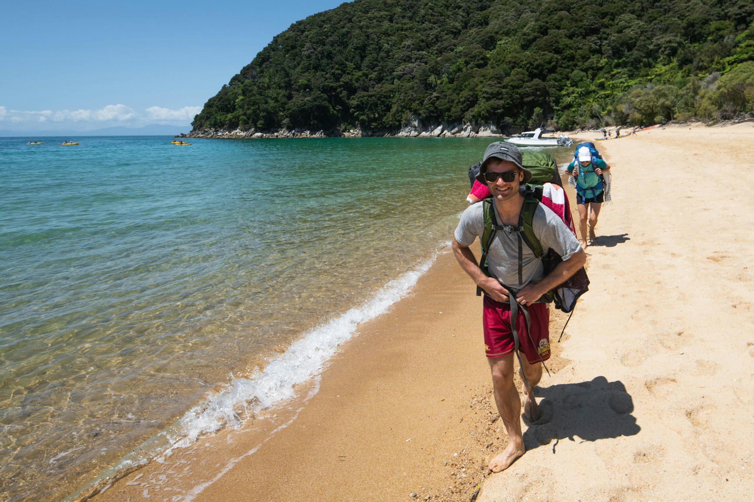
I guess it’s no surprise then that my favourite tramp incorporates my love of the ocean and forest, and no tramp does that better than the Abel Tasman Coast Track.
Where my childhood beaches of Northland have largely been cleared for campgrounds, homes or farming, Abel Tasman is like looking back in time.
The forest grows right down to the shore, spilling its leaves onto the shells and sand.
It’s the meeting of two worlds, green and blue, separated only by the park’s iconic peach sand.
Weka waddle with oystercatchers, pīwakawaka flit anxiously beside floating gulls. The water’s surface is frequently broken by fish, seals and dolphins.
Since first visiting the park in 2015, I’ve walked overnight sections of the track four times, and completed it twice.
It doesn’t hurt that my visits have been blessed with perfect weather, but honestly, it’s just a hard spot to beat.
When I close my eyes, I can walk the track by memory, ticking off the beaches, swingbridges and waterfalls as I go.
It’s as close as you can get to a tramper’s holiday.
On the track, you can completely relax. The biggest threats here are sunburn, weka and overeating – there are no avalanches, whiteouts or below zero temperatures to endure. It’s just sunshine, crystal waters, idyllic streams and lush forest.
Sure, there are more visitors than many of our readers will care for, but I’m the type of tramper who enjoys meeting new people on the trail – it’s always nice to share a tea and a snack with a stranger on day one, and swap contact details on day four. It’s all part of what makes tramping wonderful.
And at the risk of inciting true trampers to tear out this page, you simply can’t beat a tramp that boasts a sidetrack to a pub in the woods.
For the price of a 20-minute detour and a small dent to the wallet, weary hikers can enjoy a cold beer and snacks at the Awaroa Lodge outdoor pizzeria.
It is heavenly.
So that’s my favourite tramp. Read on to discover the favourites of the Kiwis with the busiest boots.
Time 3-5 days Distance 60km Grade Easy
Chloe Beer, Hillary Outdoors Guide
Waitawheta Pipeline Track to Daly’s Clearing Hut, Kaimai Mamaku Conservation Park
On my first solo overnight tramp in the Kaimais, I explored beautiful kauri forest and streams, and saw no one until late at night at Waitawheta Hut.
I visited the Kaimais as I hadn’t really explored there before, and I missed the kauri forests I’d grown up exploring in Whangarei.
I enjoyed it so much, I returned a few weeks later with three friends to explore new trails.
We began at Karangahake Gorge and walked the Waitawheta Pipeline Track, where there is a long gold mining tunnel to scramble through.
The walk along the Waitawheta River is stunning. One of my friends recognised a favourite childhood swimming hole that she hadn’t been able to recall where it was until then.
Further along, we crossed Mangakino Stream which was thigh-deep and very cool in early July. A great opportunity to teach my friends safe river crossing skills.
We arrived at Daly’s Clearing Hut – it was cosy and had everything we needed.
That evening, a couple of groups arrived, including an all-girl group doing a Graeme Dingle Foundation outdoor course for year 10 students, called Project K.
While waiting to use the long drop, they asked what we were doing there. When we told them we were tramping with friends, they looked shocked and one replied: “You’re doing this for fun?”.
We laughed and explained how we all lived in different parts of the North Island and tramping was a great way to come together and leave behind the stresses of daily life.
We walked out to Franklin Road, where I’d started my first tramp in the range a few weeks prior.
On that occasion I encountered an enormous bull in a paddock and got caught up in the electric fence.
Fortunately, no bull and no need to climb through the electric fence this time.
Time 4-5hr Distance 12.4km Grade Easy
Jan Finlayson, FMC president
Mt Harper, Hakatere Conservation Park
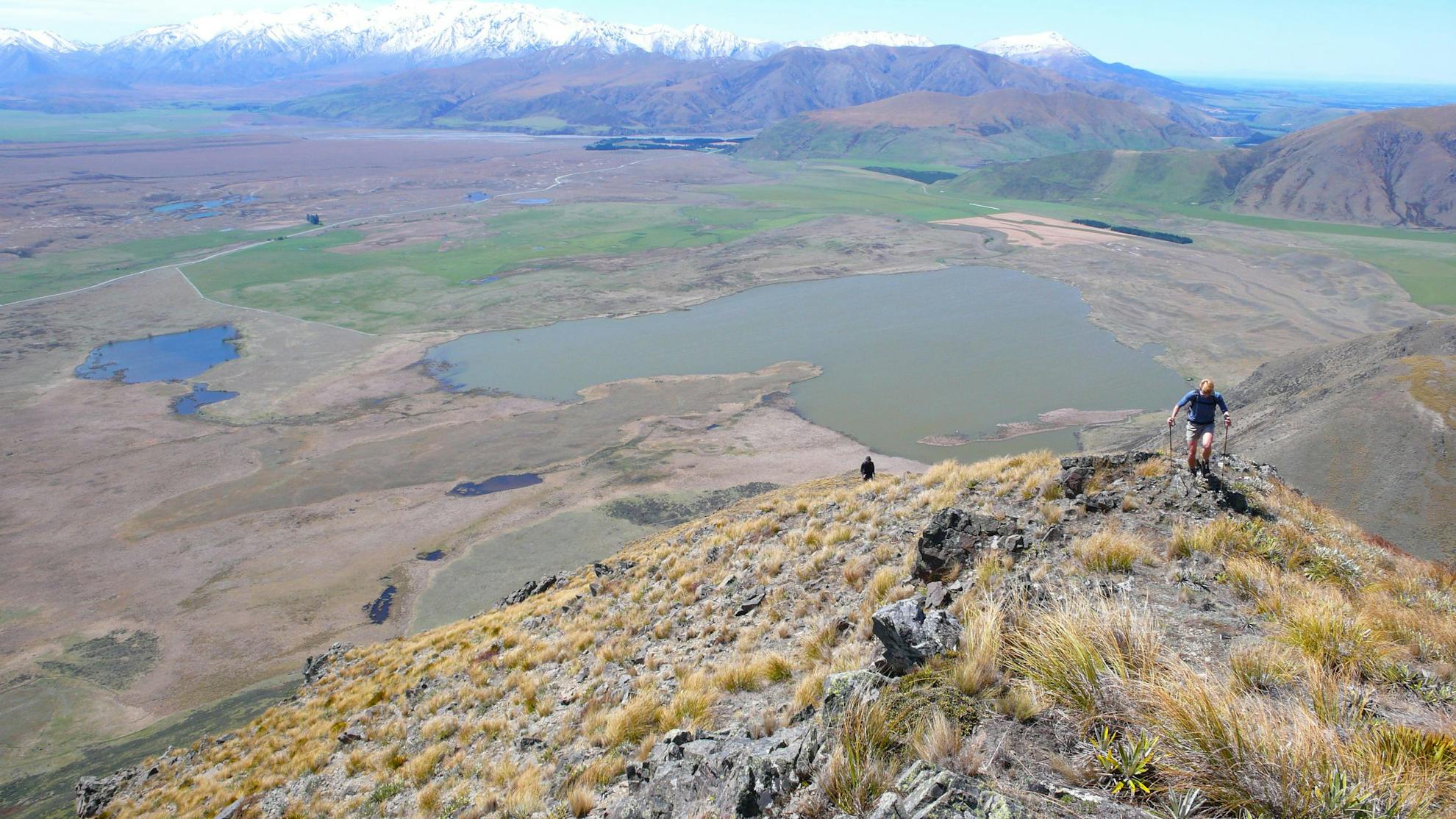
Mt Harper/Mahaanui sits, solid, between the Rangitata’s braids and the Ashburton Lakes area on the margin of Hakatere Conservation Park – it’s wide-open tussock-and-scree country.
Mt Harper hits a sweet spot. A return or loop past the 1829m summit fits readily into a full day from central – and south Canterbury starting points.
Rewards are myriad, from scents of hardscrabble plants in bloom and glimpses of cryptic wildlife to the unfolding imposing landscape; the biggest peaks of the Southern Alps are revealed as you near the top. And, close by, there’s rich human history.
In addition to the Māori resource-gathering and the later pastoral farming that has taken place in the area, Mt Harper once hosted what may have been the first and largest ice rink in the southern hemisphere. Operating in the lee of the hill’s south faces from the early1930s until the mid-1950s, the rink was so popular that one day 3000 people attended.
To climb Mt Harper, the usual approaches are via lakes Roundabout and Emma off the Hakatere Potts Road, and from Lake Camp, a little further west on the same road.
You can start climbing anywhere here. My favourite follows Balmacaan Stream to Balmacaan Saddle; if using this trail, take care to go most of the way to the saddle before turning eastward for the summit, as the matagouri enjoys exuberant health lower down.
I like to descend along a spur to the north-west, where views to lakes Camp and Clearwater and the Alps are splendid.
Balmacaan Saddle also provides a good route to the site of the ice rink, which was accessed by boat and swingbridge from the Rangitata River’s true right for most of its commercial life.
Time 5-8hr Distance 11.1km to summit Grade Moderate
Shaun Barnett, Author and Wilderness roving editor
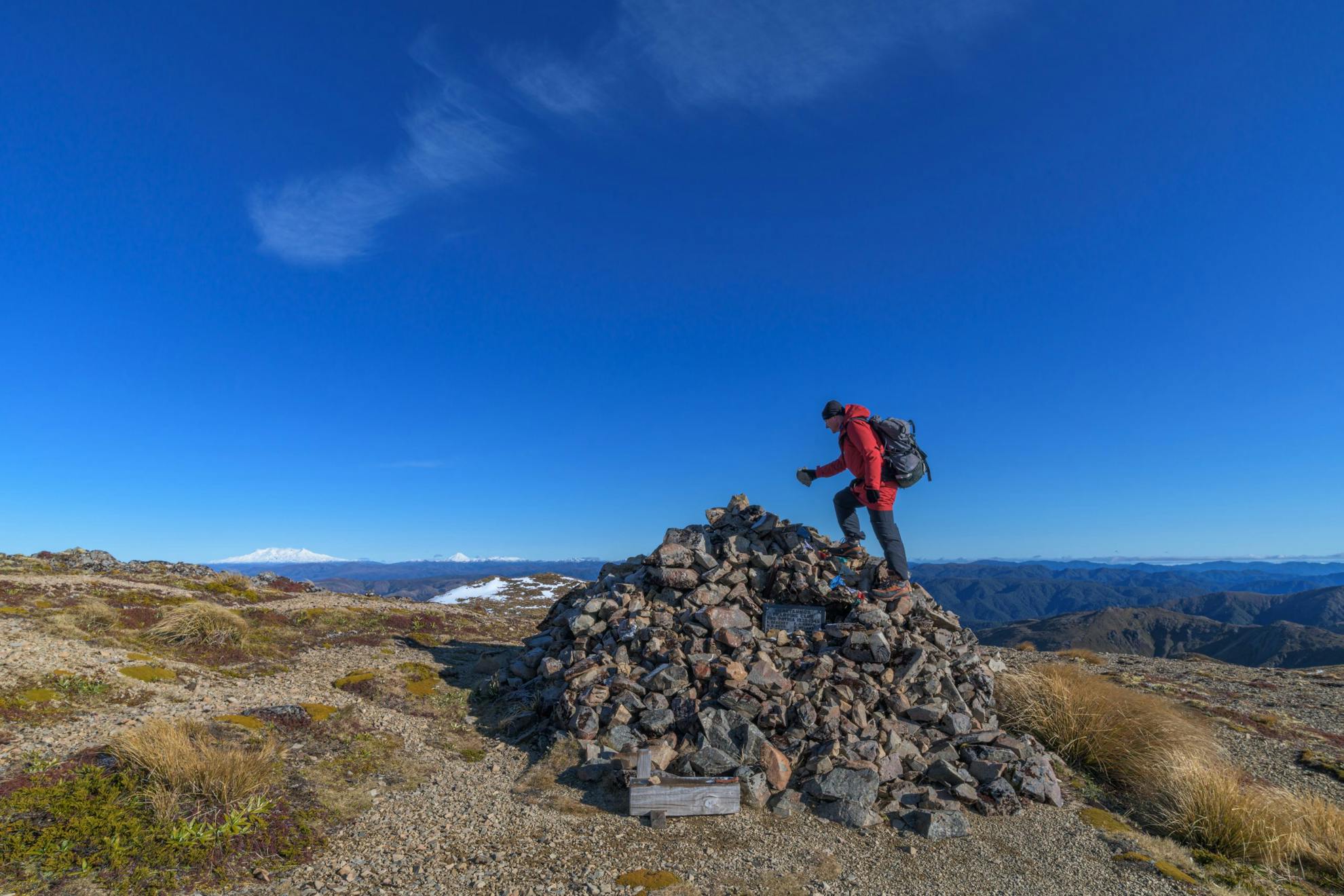
Kaweka J, Kaweka Forest Park Hawke’s Bay
‘Location, location, location’ is of course a big factor in why anybody might pick a favourite tramp.
And Kaweka J, the highest point in Hawke’s Bay’s Kaweka Range, ticks a lot of boxes.
Extensive views? Yes, right across the vast array of ridges all the way to the volcanoes of Tongariro National Park.
Historic interest? The memorial cairn on the summit was erected by members of the Heretaunga Tramping Club to commemorate those from their ranks who died in the Second World War.
Natural history? Despite at first glance seeming a bit barren, the high tops of the Kaweka Range offer a delightful variety of alpine plants, including several species of buttercup and mountain daisy.
Accessibility? Kaweka J, at 1724m, is one of the highest of the North Island’s non-volcanic summits, but has the real advantage of a starting point of 1000m, at Makahu Saddle. That means you can reach the summit within 3hr. And the drive into Makahu Saddle, along a winding and high road, is a journey in itself, right into the heart of the Hawke’s Bay highlands.
But there’s always another factor when choosing your favourite tramp, and that is memory.
Overlaying the more obvious factors of scenery and views are those past experiences; what this place has meant to you over the course of your tramping life.
Kaweka J was the first significant summit I reached, and it offered my earliest experiences of navigating in mist, of tramping in snow, of appreciating just how vast the range of mountains are here.
Despite not having lived in Hawke’s Bay for more than 30 years, I’ve been going back regularly, and each trip feels like coming home.
Reaching the summit does involve a fair amount of old-fashioned grunt, although Trials Spur has some zigzags to take the sting out of it. The tops are exposed, but the route is well poled. Take water, as there’s precious little until some tiny tarns near the top.
Tips for making the trip the best it can be: tramp up to Dominie Biv and spend the night here, allowing you to head for the summit at sunrise. Or extend the trip with a stay at Back Ridge Hut.
Perhaps even better: join a Heretaunga Tramping Club trip when they make their annual pilgrimage to add stones to the memorial cairn.
Time 2.5-3hr to summit via Trails Spur Distance 3.67km Grade Moderate
Mark Sedon, IFMGA guide and NZ Mountain Film and Book Festival director
Breast Hill, Hāwea Conservation Park
The track to Breast Hill, via the Pakatui Hut, blows my mind every time I hike it – which is often because it’s only a stone’s throw from my home
It’s not just sentimental value that draws me to it – it’s a good cardio workout, scenic beyond belief and never busy.
The trek is a good grind for the first 500m as the trail rises steeply from the shores of Lake Hawea, but the higher you get, the more the views distract you from the gradient.
There are a few exposed steps around a clifftop and then you’re away up a narrow ridge.
After the first 90min, the angle eases and the walking becomes more interesting with native shrubs and eventually views of Mt Aspiring/Tititea.
If you’re going for the 1578m summit of Breast Hill, ignore the signs to the hut and carry on up the ridge to the left.
The final kilometre to the summit is a spectacular gradual ridge with large rock formations and gob-smacking views to Lake Hāwea, over to the Lindis Pass and, if you’re lucky, to the Southern Alps.
There’s a small trig on the summit and just past it a grassy bowl to lie in and enjoy the location.
But what I really love to do is roll out my paraglider and fly back to the lake.
I strongly suggest standing in the lake up to your thighs for 20 minutes when you get down – it will significantly lesson the following day’s sore muscles.
Time 3-5hr Distance 5.94km Grade Moderate
Pat Barrett, Tramping author and Wilderness contributor
Faust, Lewis Pass National Reserve
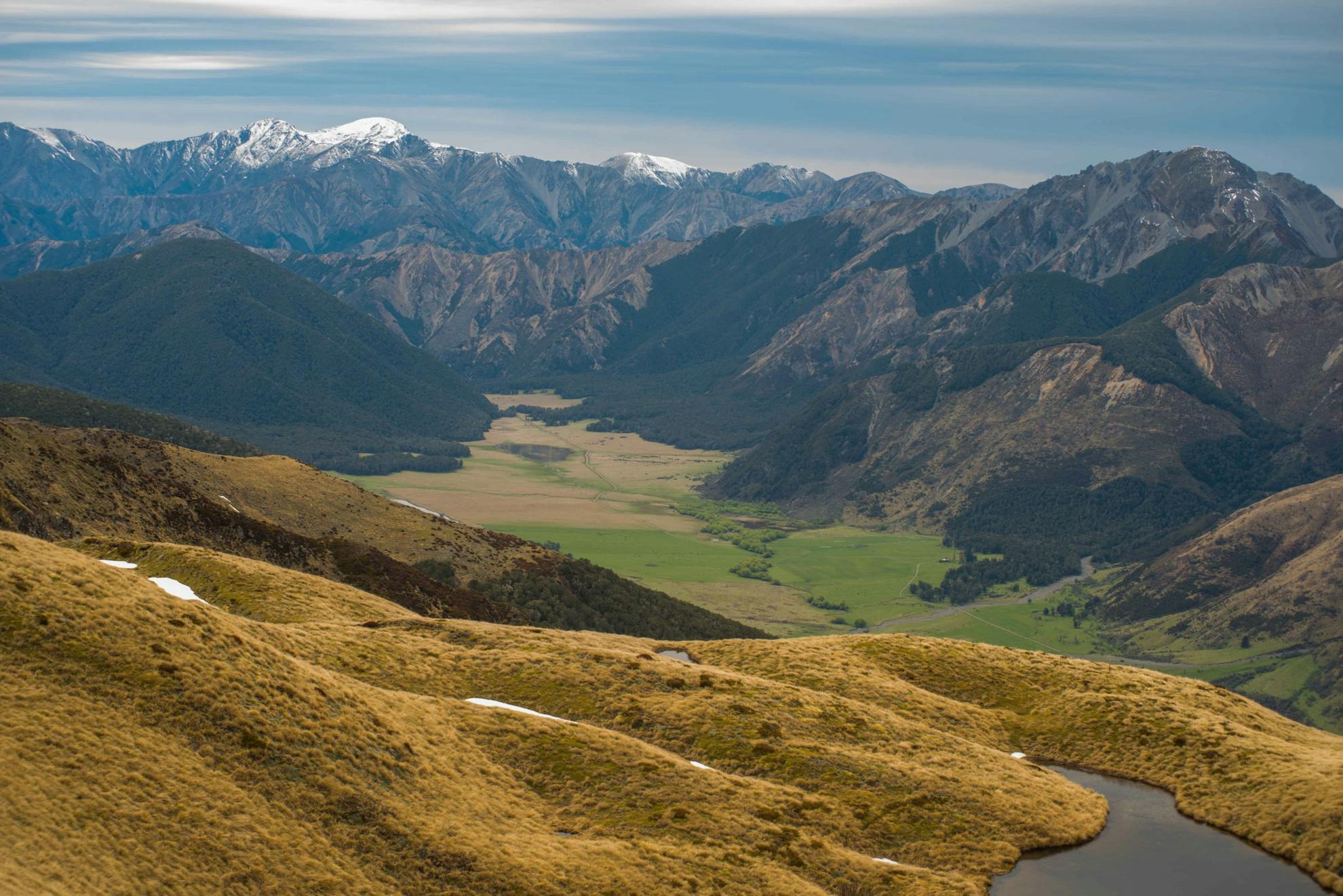
Out along the open tops in Lewis Pass National Reserve is a tramp I often do – Faust and the tops of the Libretto Range.
It’s moderate, seldom-visited, has panoramic views, and is often clear of the weather that regularly dogs the mountain peaks further north and west. Yet more than this, I love the thrill of the open tops, of changing seasons, light, and ambience, and where the ridge runs north and east, there’s an opening to distant peaks and the promise of trips to come as you trek the tussocky trail.
Memories are rich here. There’s the Spenser Mountains to the north where I have sometimes summited and sometimes been thwarted. There’s the St James Walkway meandering through the valleys below where I once walked with my dad and brother and where I now walk with my family and oftentimes alone and with rifle. There’s the Doubtful and Nina valleys beyond the highway to the west where I have tramped every pass and many a peak and still have a hankering to visit again. But Faust is first.
I can take a Friday night and drive from Christchurch, camp at the foot of the ridge, near the Boyle Lodge. Get away early on Saturday, skirt the forest, tramp the bush terrace and climb steadily to the bush edge. It never seems a bother, the ridge is easy-angled, pleasant and sheltered and takes barely two hours. A few random poles lead on, past some beautiful tarns and tempting hollows, away above the Boyle Valley to the summit.
A rest is mandatory here, and then to consider the way down, as the trip lends itself both to day trips and overnight options. If a day is all I have, then almost any leading spur will take me to the St James Walkway without too much bother – one has a track, others have deer trails that can be followed with care into the lower valley.
If time is not so pressing, and a camp or hut is the destination, then the full ridge is the way ahead – all the way to Boyle Flats Hut where a comfortable bunk awaits. The route to the hut from the tops is now marked and tracked from the bush edge below Pt1627m, making this a speedy and easy descent.
It’s an easy stoll out along the St James from Boyle Flats Hut to the highway and will take 3-4hr, making that second day a nice gentle walk.
Time 3-5hr return Distance 13km return Grade Moderate
Karllie Clifton, Walking Legends Guide
Windy Canyon to Kaitoke Hot Springs via Hirakimata/Mt Hobson, Great Barrier Island
They say you don’t choose the Barrier, but the Barrier chooses you.
I became hooked after my first visit in 2011 and have been returning ever since.
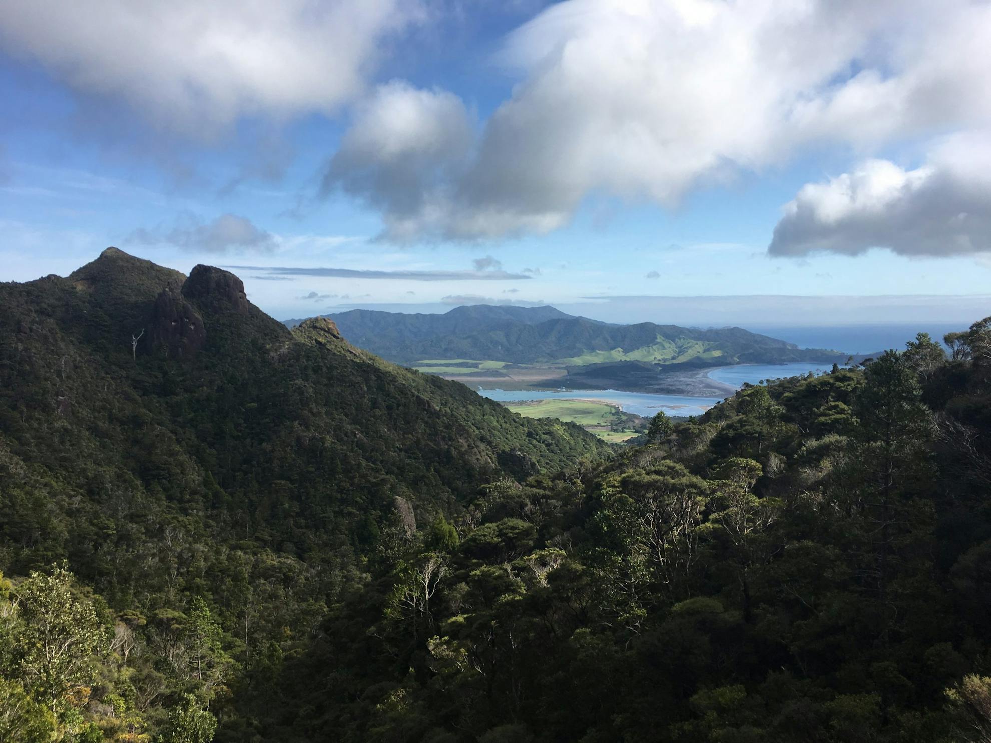
Over the past eight years, I have walked just about every track on the island and definitely have a few favourites. I often get asked what I would recommend if I only had one day to go hiking on Aotea. There are so many fantastic tracks to choose from but there is only one way to see and experience it in just a day – Windy Canyon to Kaitoke Hot Springs via Hirakimata/Mt Hobson and Mt Heale Hut.
The entrance to Windy Canyon is on Aotea Road between Awana and Okiwi. You will find wash stations at the start and end of the tracks, for cleaning and spraying footwear to help prevent the transfer of kauri dieback.
The Windy Canyon walk is a great way to start the day. There’s dramatic andesitic rock formations through the canyon as you climb the staircase to the lookout, and incredible views.
From the Windy Canyon Lookout, it’s about an hour along the exposed ridgeline of Palmer’s Track, towards the summit of Hirakimata. The last part of the climb is under tree cover with stairs and boardwalks to protect the burrows of black petrel. This petrel is an endemic ocean bird that travels as far as South America but only nests on Aotea and Hauturu/Little Barrier Island.
The summit of Hirakimata offers spectacular views of Port Fitzroy and the Hauraki Gulf.
Mt Heale Hut is half an hour from the summit. It’s a great place to stop for lunch or overnight.
From the hut, descend down Peach Tree Track, a nice 1-2hr walk through regenerating forest.
This track meets up with the Tramline Track and the edge of the Kaitoke Wetlands. From here, it’s just 30 minutes to Kaitoke Hot Springs. Stopping here to soak in the warm waters of these natural springs is the best way to end a remarkable day.
From the hot springs, it’s an easy half-hour walk to Whangaparapara Road and the end of the best one day walk on Aotea.
Time 5hr (3hr to Mt Heale Hut) Distance 12.2km Grade Easy-moderate
Dulkara Martig, Outdoor instructor
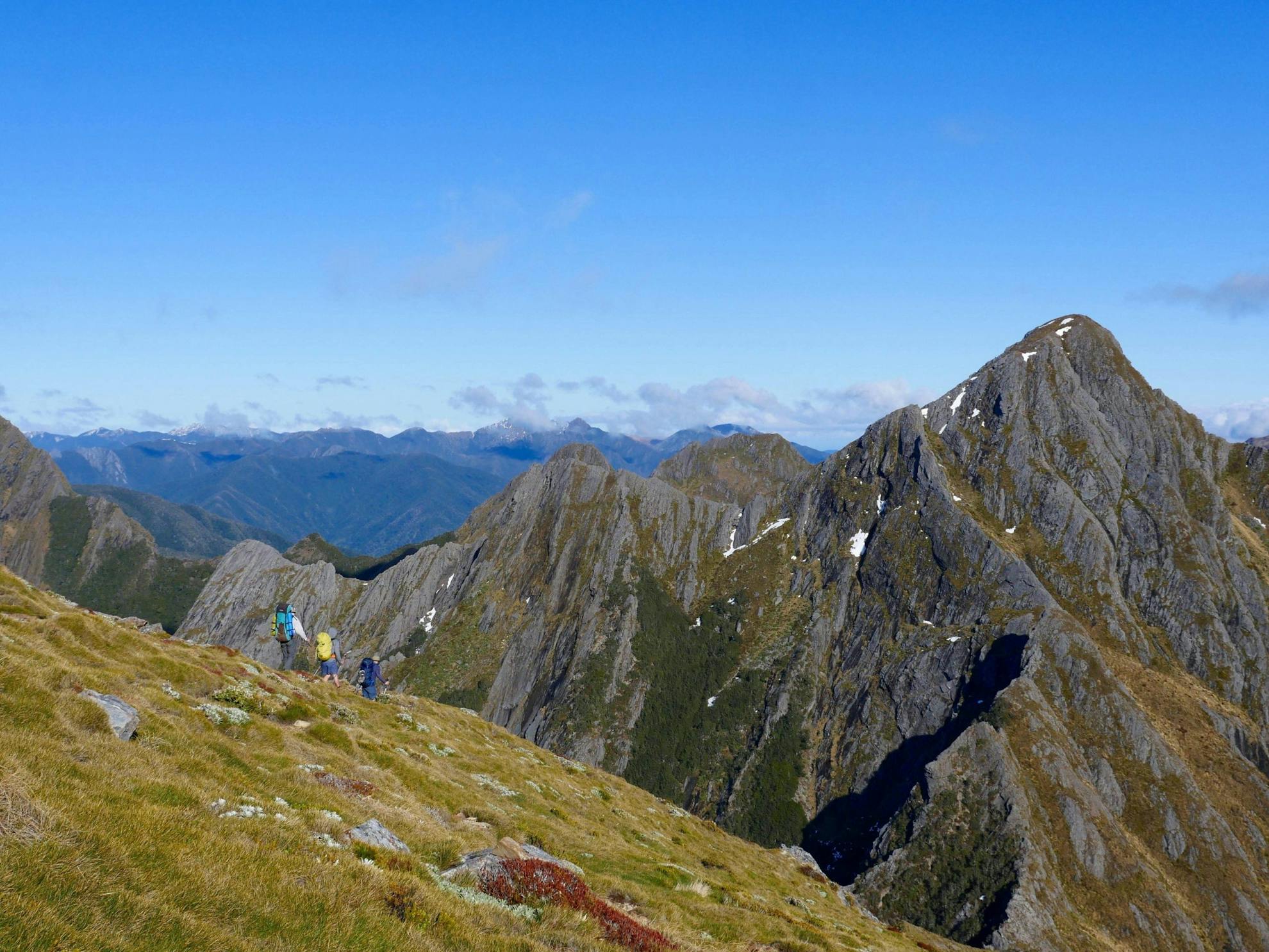
Anatoki River to Baton Valley via the Dragons Teeth, Kahurangi National Park
Recently, some friends and I went on a week-long wander from Anatoki River to Baton Valley via the Douglas and Peel ranges.
The journey began by sidling above the Anatoki River to Anatoki Forks Hut – one of the only huts in New Zealand with a wetback and shower. From there, it’s a steep marked track to the tops beneath Yuletide, with wonderful camping and where views of the Dragons Teeth command attention. Looking across at the imposing rock you find yourself wondering, ‘how on earth are we going to negotiate that?’
Adelaide Tarn Hut is magical, tucked into the rocks above the tarn. The section between the Dragons Teeth and Lonely Lake is stunning alpine tramping with open tussock basins and lovely rock features. We dropped our packs for a quick ascent of The Drunken Sailors, with views over Tasman Bay and a sea of thick forest and mountains spreading out towards the West Coast.
Lonely Lake Hut is a wonderful example of the rich human history in the park and incredible shelters that have been left behind. Tales of those who came before us fill the hut books, a collection which dates back several decades. We read of epic storms, misfortune on the high traverse of the Dragon’s Teeth and complaints from men in the 1960s about the lack of women in the mountains.
We continued along the tops past Kakapo Peak before dropping to Fenella Hut, marking the end of the Douglas Range. This is a common exit point but with so many trail options, why stop there?
After a night at Chaffey Hut, one of my all-time favourites, we bashed our way onto the Peel Range.
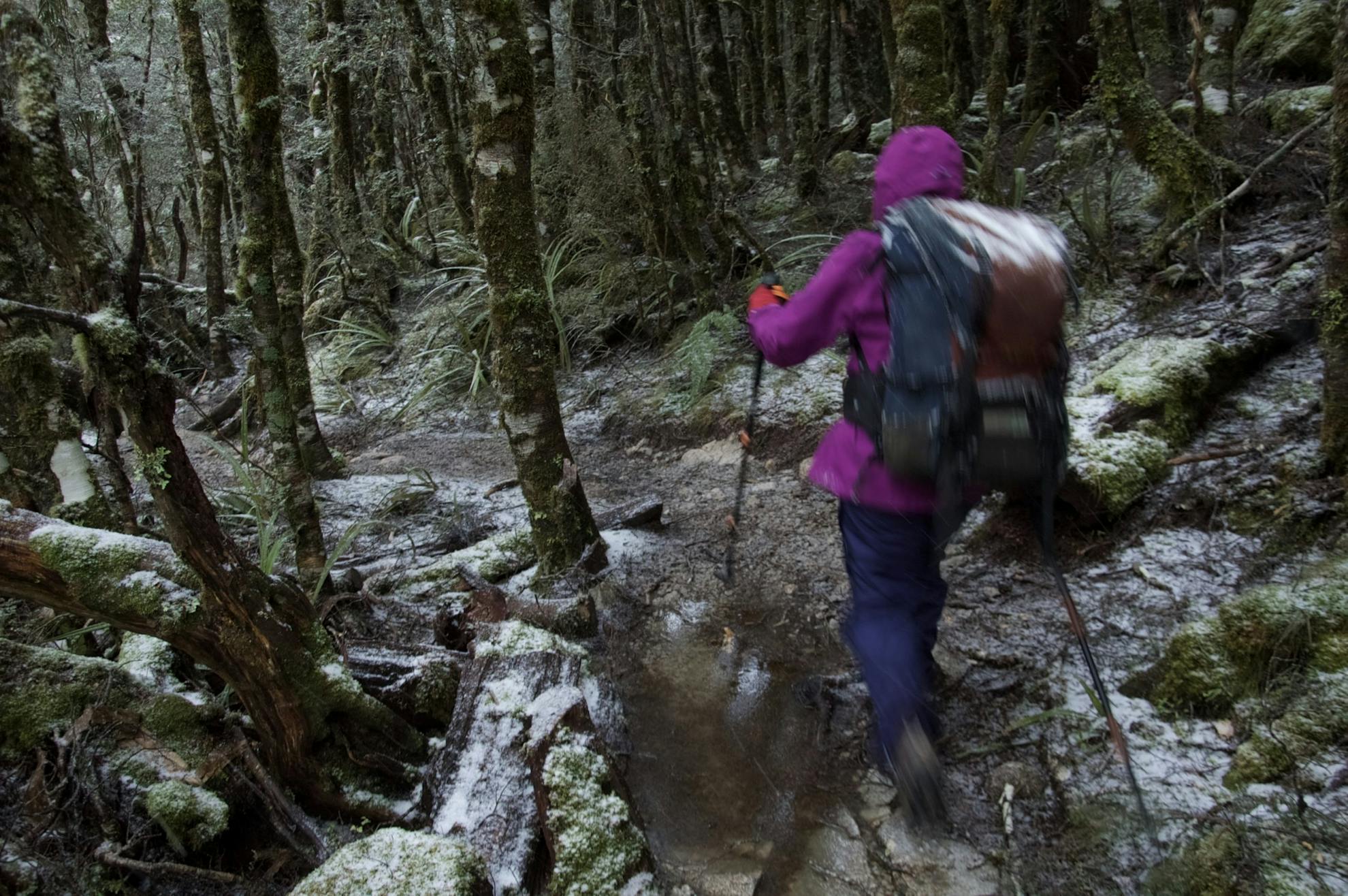
The country is rugged, full of exposed rock sections and we encountered thin layers of snow on tussock – a dodgy combination.
Kakapo Spur is one of the best routes off the Peel Range into the Karamea, via Roaring Lion River Hut. We walked up the Karamea to intercept the Wangapeka Track, continuing for a short section before climbing the ‘Wilkinson Horror’ Track to Baton Saddle.
True to the style of this particular trip, we turned north and headed to The Twins for a final night camping on the tops, before backtracking and descending the Loveridge Spur into the Baton.
Time 7 days Grade Difficult. (Note: Due to the amount of off-track travel we have not created an online map for this trip.)
Jen Riley, NZOIA assessor
Grampians Reserve Nelson
My work as a contract outdoor instructor takes me into the bush with polytech students, navigating in steep terrain, plugging through snow, skipping along the tops and wading across rivers.
I’ve had many memorable tramps, but one which jumped to mind when asked to name my favourite is much closer to home, and at a much slower pace.
I look across at the Grampians from my kitchen window, a hill covered in native and exotic trees, that can be seen from anywhere in Nelson. Ned, my four-year-old son, theorises that the huge aerial on top is the Smartest Giant’s walking stick, and the satellite dishes are his drums.
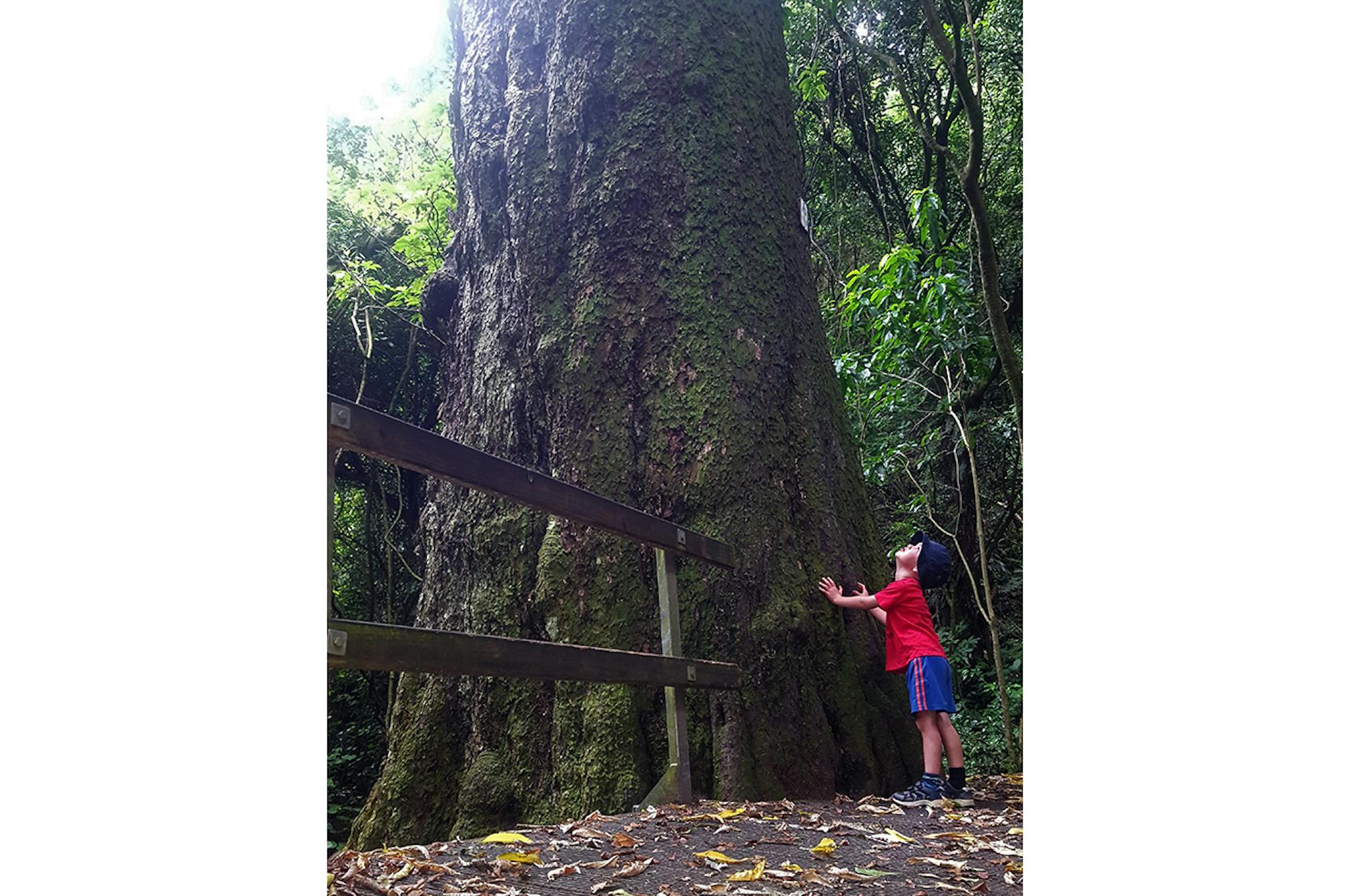
The Kahikatea Track starts from Market Road on the south side of the Grampians. It winds up through huge kahikatea, buttressed pukatea, matai and tree ferns, to the viewing platform and summit. I feel so lucky to be able to walk through lush native bush, so close to home, to the top of a ‘mountain’.
I walked up here when pregnant with Ned, my pace getting slower as my belly grew, then with him sleeping in a sling, faster as I regained my fitness. Then he was carried on my back, chattering in my ear about what he was noticing and thinking – we had competitions for who would notice stoat traps first and how many we could count.
Now we walk up the hill together, sometimes side by side stopping to pick up cool rocks, to drag a big stick behind us to ‘vacuum’ the track or to examine holes in a tree trunk and wonder what lives within. Sometimes he runs ahead to trip-trap over the rickety bridges to scare the trolls away. And at the top, we eat our snacks, look out over Nelson and wonder if the Smartest Giant is sitting nearby, too.
Time 1hr Distance 1.1km Grade Easy
Marios Gavalas, Adventure and hiking guide
The Old Ghost Road, West Coast
Guests often ask, ‘Which is your favourite walk?’.
It’s like asking, ‘Who is your favourite child?’.
Every walk, like every human, has its own character and qualities. But rather than evading the question, I often end up waxing lyrical about one tramp in particular – The Old Ghost Road.
Why do I get excited about this tramp? We are spoiled for choice in New Zealand. What are the ingredients which make a tramp stand tall above the talented alternatives? In my view, there are several.
Interesting geology abounds on the OGR, with a mix of granite, limestone and greywacke, all completely shattered by faults which riddle this landscape. In the Earnest Valley, the whole flank of a mountainside was dislodged in the 1968 Inangahua Earthquake. It has created a primaeval landscape around the section known as the ‘Boneyard’.
Varied vegetation – with lofty beech up the Lyell watershed, alpine communities on the tops and a fine podocarp forest in the Mokihinui.
Bountiful birdlife inhabits the treetops from robins to kakariki to karearea.
Human stories of hardship also define this raw landscape – explorer Thomas Brunner spent a wet autumn in the Buller. Gold was hard-won up the Lyell. This spirit of resilience is echoed in the massive efforts of the Mokihinui-Lyell Backcountry Trust, which has tirelessly followed its vision of connecting the two roads surveyed by the pioneers with New Zealand’s longest single track.
With roll-up-your-sleeves and get-stuck-in Kiwi grit, the trust has created a beautiful track. All the while in the shadow of a proposed dam at Mokihinui, which was declined by the courts. The area was later added to Kahurangi National Park.
On my last winter trip, while tramping through clearing showers in the dense forests at the toe of the Glasgow Range, my imagination zoomed, like Google Earth, and I realised I was utterly alone.
A strong feeling of being ‘in the present’ followed and my spirit felt empowered.
Because ultimately, our feelings for a place are what connect us to it, and those places we develop a strong relationship with are those which strengthen us. Indeed, this absence of connection with whenua is a major ill of our current culture. Let tramping help us re-connect with place.
Time 4-5 days Distance 85km Grade Moderate
