


Two Wellington tracks combine to make one of the best ridge-tops rides in New Zealand
On a fine day with little or no wind, the Skyline Walkway and Red Rocks Track would have to be one of the best ridge-top point-to-point rides in New Zealand. The track remains a long-time favourite of both walkers and mountain bikers.
The tracks combine to join the dots from Johnsonville’s Old Coach Road, undulating over Kaukau Peak, Makara Peak, Wrights Hill and Hawkins Hill before zooming down to Sinclair Head and the Red Rocks at the southern tip of the Wellington coast.
It starts innocently enough from a small reserve at the end of Carmichael Street in the quiet suburb of Johnsonville. Cyclists then pedal through the reserve and up a gentle climb on the Old Coach Road. After just a few hundred metres, it’s time to hang a left onto a poled route and a steep granny gear climb that traverses up to Kaukau Peak.
Expansive views of the harbour and the city are the reward at the top. A large map board lays out the track ahead, judiciously marked as Skyline Walkway and Te Araroa Trail, along with the rest of the local network that radiates down to the city and suburbs.
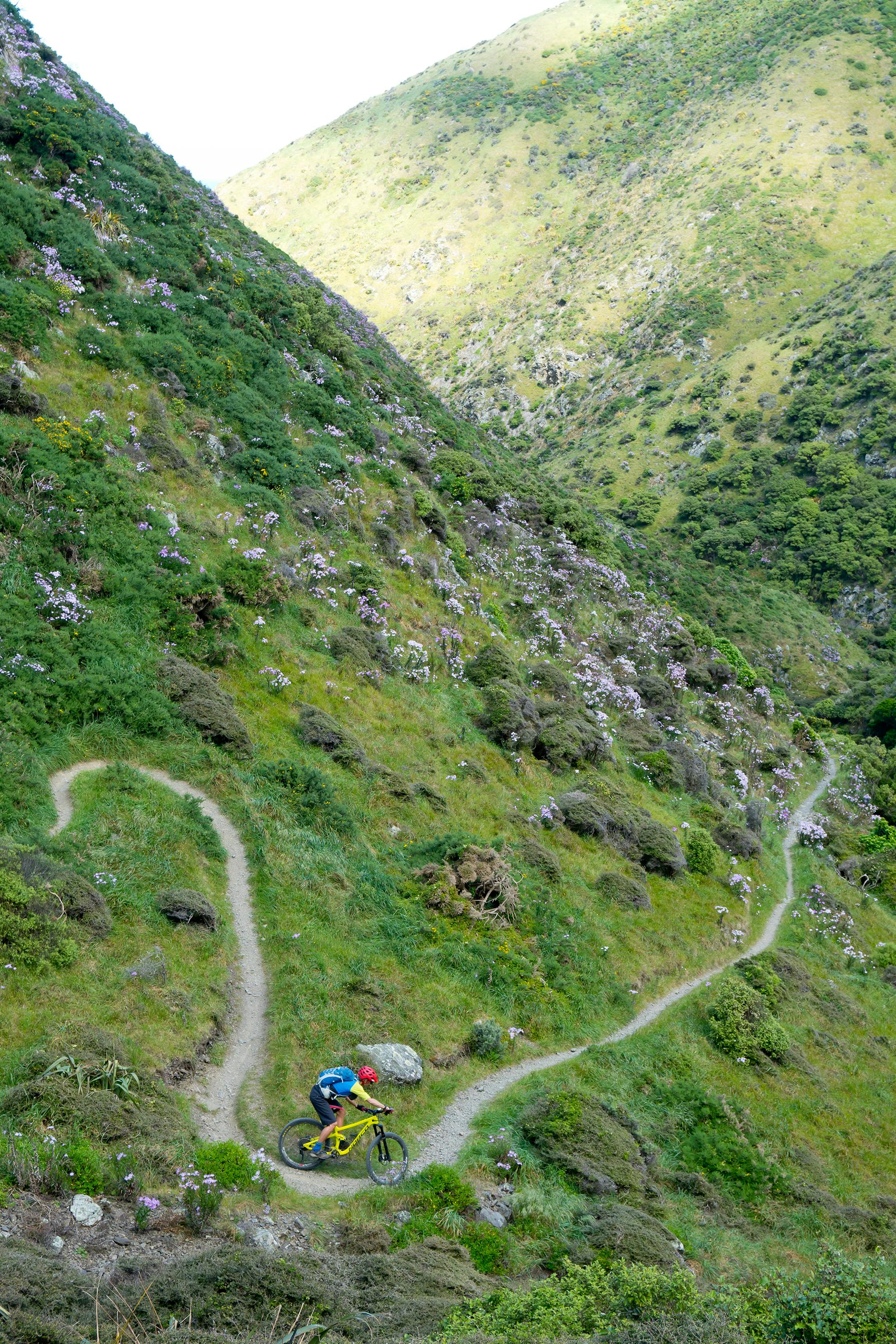
Follow the yellow reflector-topped markers and descend the south-west ridge through open farmland and short native scrub. This is a magic carpet ride on a mix of single track, stock track and farm track with some technical climbs and traverses thrown in.
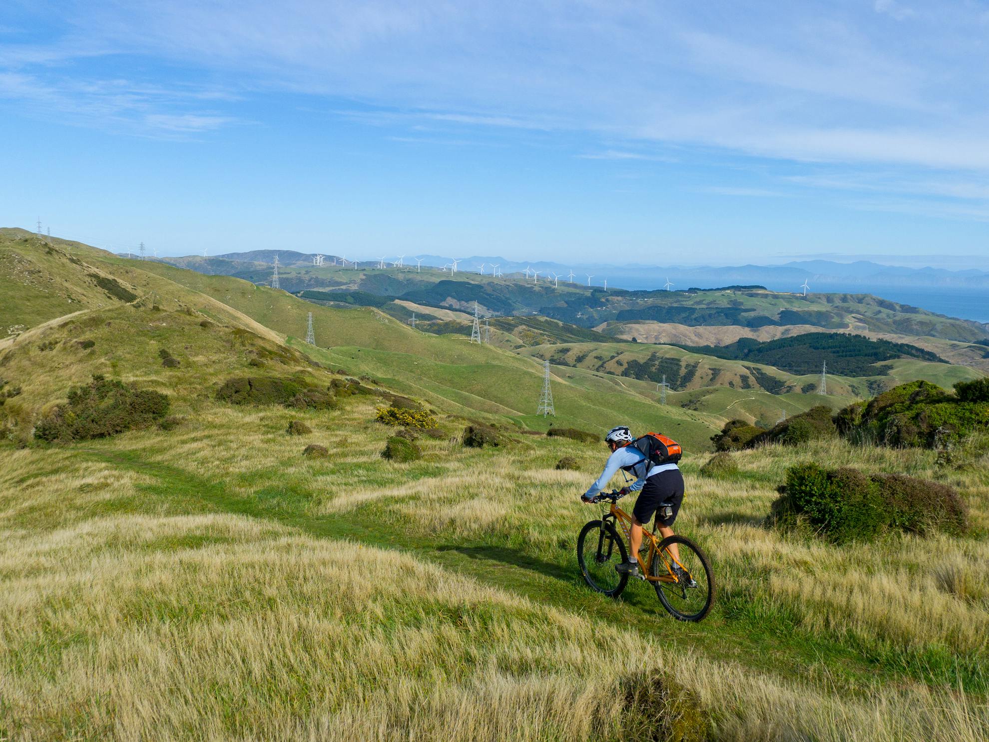
The amazing rows of slowly-turning wind generators on Wellington’s western hills are a good indicator of wind and riding conditions to come, and they follow riders all the way to Makara Hill.
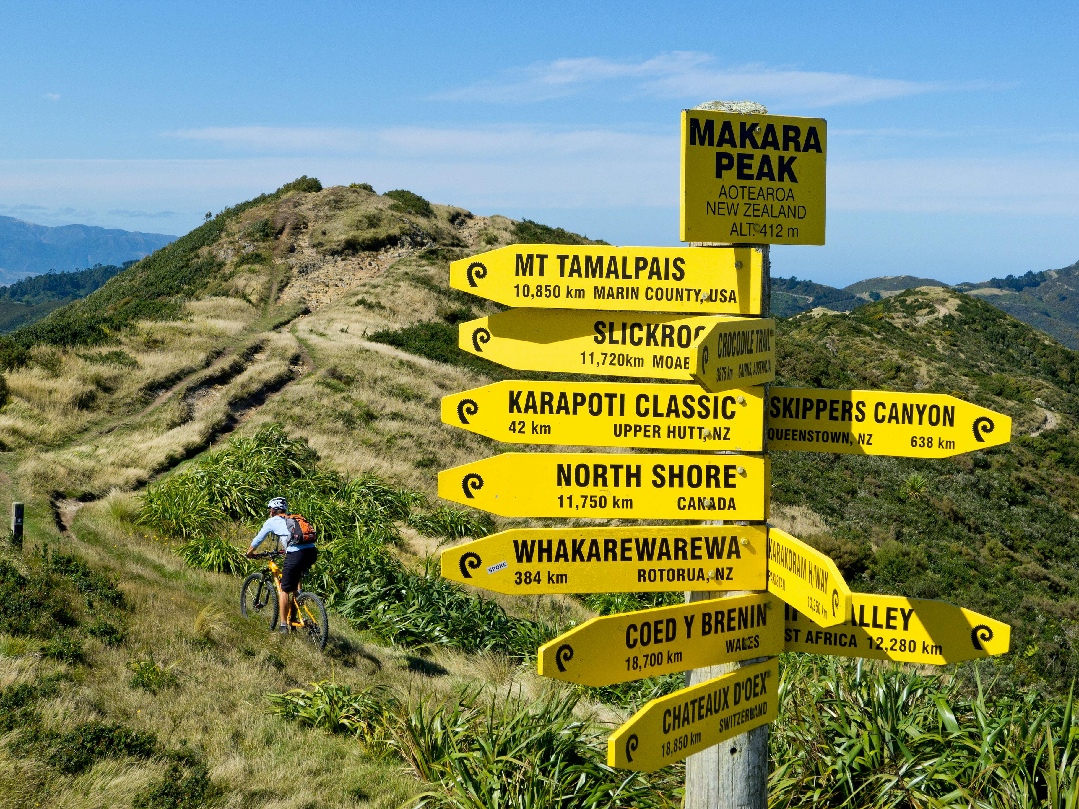
Purpose-built single track winds its way around the edge of one of the highest sections of Karori and then descends through a pine block to the sealed Makara Road, where you turn right and head a short distance to the Makara Peak MTB sign. Go past the large metal gate and climb steeply to the water tank above, where there’s a trail map beside the start of Varley’s Track. Ride on and zigzag up to Zac’s Track through short regenerating natives. Zac’s Track leads all the way to the top with excellent open views across Wellington’s west coast and foothills.
Straight ahead is the Ridge Line Track, which begins with a short climb followed by an exciting descent. Follow it onto either Swig or Lazy Fern track for a roller coaster ride all the way down to the Makara Peak Car Park where there is a picnic area.
Many kilometres of magic singletrack flow around this peak and are being constantly added to and improved. Re-fuel and pedal right onto the sealed road, turning left up Hazelwood Avenue and right onto Fitzgerald Avenue. Follow this to a green space at the bush edge where there is a large map board.
Take the Salvation Track and climb the northern ridge of Wrights Hill almost to the top. Dappled light filters through the native bush, and thick leaf litter blankets much of terra firma. This is an honest climb that delivers you to a sealed road where you head right for a short distance then left onto John’s Track. This is a superb section of single track that climbs almost to the top of the hill, where historic Second World War bunkers and a parade ground are situated. Follow the arrows up the Lookout Track to the Karori Sanctuary fence line – a marvel of predator-proof engineering and mainland conservation.
Follow the fence line on an undulating dirt track that climbs more than it descends and steepens markedly nearing the top just when the legs are needing a rest.
At the road, head right and climb towards 495m Hawkins Hill, with its golf ball and a mysterious castle perched in the clouds. Head south onto the Fenceline Track to the lone windmill, then hook onto the Barking Emu Track. This climbs towards Hawkins Hill and the start of the Red Rocks Track.
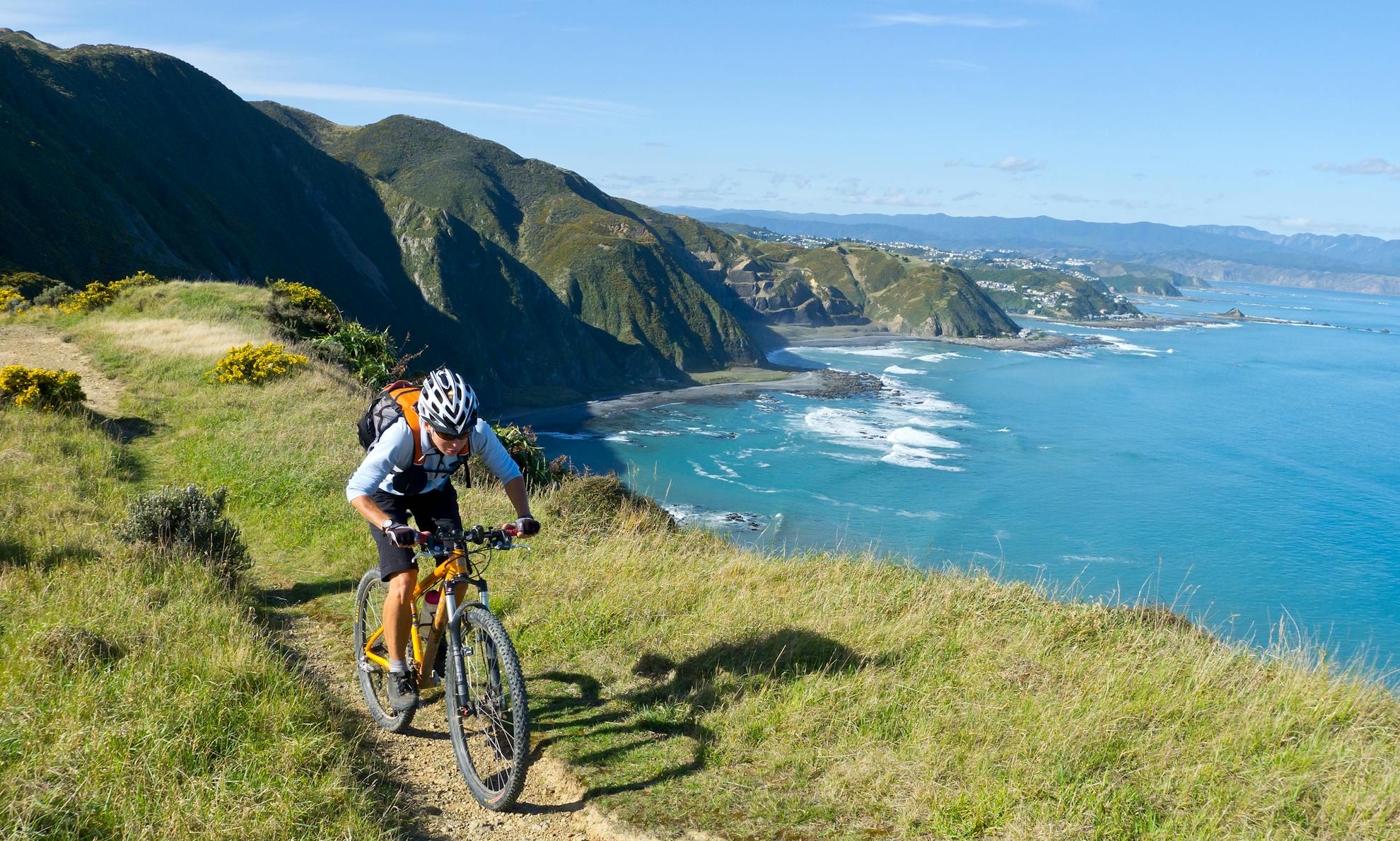
From the end of Barking Emu, go left for a short distance on Tip Track and right onto the Red Rocks Track. This climbs before descending the ridge between coastal shrubland and stunning airy views across the rugged southern coast. About halfway down, peel off the ridge and navigate a series of switchbacks into the stream gully for a final technical blast to the coast.
The rugged coastal track heads east past a rustic old bach, the Red Rocks and a massive quarry above a surf-pounded beach. The off-road fun ends at the Owhiro Bay car park where your return car-shuttle is waiting. If you haven’t got a car, pedal over Happy Valley and Ohiro Roads into town and catch the train back to Johnsonville for a short climb back to the start.
It’s a big day out with lots of fantastic views, single-track and climbing.
- Distance
- 47km
- Total Ascent
- 1300m
- Grade
- Moderate / Difficult
- Time
- 6-9hr
- Access
- At the end of Carmichael Street
- Map
- BQ31, BQ32
GPX File
- Skyline Track to Red Rocks (gpx, 29 KB)
GPX File
- Your device does not support GPX files. Please try a different device.
