


- Area
- Ahuriri Conservation Park
- Distance
- 11.8km
- Time
- 5-6hr. Car park to Top Dingle Burn Hut, 3-4hr; Top Dingle Burn Hut to Ben Avon Hut, 2hr
- Grade
- Easy/Moderate
- Access
- Birchwood Road leaves SH8 17km west of Omarama. Track is signposted after 30km
- Map
- BZ14, BZ13
Ben Avon Hut via Top Dingle Burn Hut, Ahuriri Conservation Park
We’ve all had those conversations. “You must do this trip”, “You’ve got to get to that place”. Occasionally, you get “don’t do that trip, it’s not worth it”.
And so a library of ideas builds up and is filed away for future reference. But nobody had ever suggested that I should – or shouldn’t – go to the upper Dingle Burn Valley. So I went with no expectations.
We’d headed up the dusty road of the Ahuriri Valley and eased the car up a grassy track to the bottom of the bush. The sky was cloudless and the temperature already warm, so it was clear that we were going to be in for a scorcher.
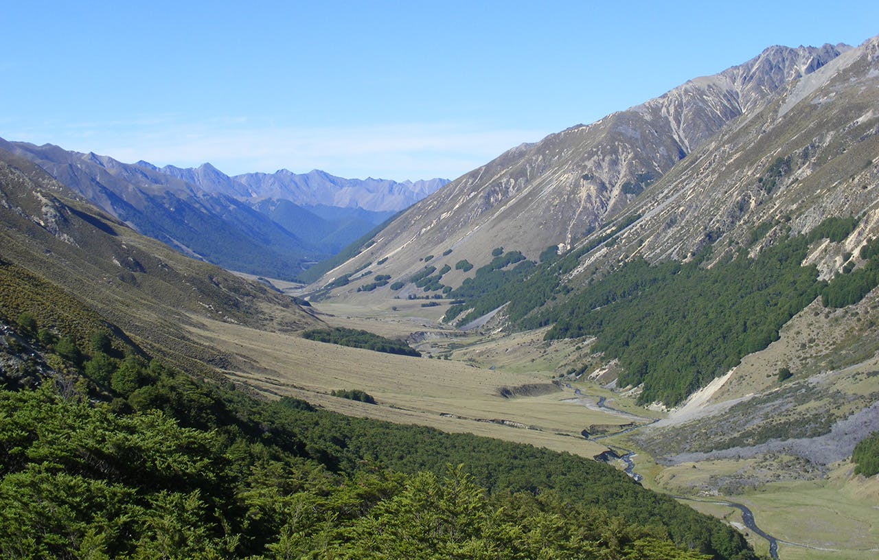
Twenty minutes climbing through the shade of the beech trees brought us to where we could see our first objective – the ridgeline just a kilometre distant but nearly five hundred metres above us. An old bulldozed track zigzagged its way up the gully in a way that wasn’t as fierce as the numbers suggest. Once on the ridge, the views opened up. Mt Barth, with its southern cloak, the Thurneysen Glacier, appeared beyond Canyon Creek, while the Barrier Range from Mt Maitland to Mt St Mary dominated the view across the Ahuriri. In the other direction, the upper reaches of Dingle Burn stretched below us, a pleasing mix of bush and open flats ringed by an array of mostly unnamed peaks carrying the remnants of a few late spring snowfalls.
A cool breeze dissuaded us from lingering. The change to downhill was immediately noticeable to Paul, who was suffering the effects of a recent knee injury. Although the trip was much tamer than our original plan for the weekend, I’m not sure that two 600m descents was what his physio had contemplated when he suggested “a little bit of light tramping” was in order. He decided to persevere and by the time 12-year-old Chris had mentioned lunch for the fourth time, we were at a great down-valley viewpoint out of the wind and perfect for a rest.
A straightforward descent through beech forest brought us onto the grassy flats of the Dingle. A few minutes downstream led to Top Dingle Hut, an ex-Forest Service hut. Although it’s got six bunks, it’s not the standard NZFS70 design and I wondered whether it had started life as a four-bunker.
It was far too early to stop, so we decided on a dash down-valley to the historic Ben Avon Hut. This was mostly on open flats and we suffered the full heat of the sun for much of the afternoon. A couple of hours brought us to the 82-year-old hut. It’s managed as an historic site, with the sign on the door proclaiming that the ubiquitous health and safety reasons prevent its use for accommodation.
Returning to the top hut, we found that the population had swelled. Two families were camping just downstream and a couple of anglers were upstream, but we had the hut to ourselves. With the number of sandflies massing outside and only a tent fly if we chose to camp, the hut was a welcome respite. On hearing we had left our rice behind, our neighbours kindly offered us some surplus pasta.
Next morning we began the climb through the bush and on to the saddle before the heat became too intense. This time there was no wind on top, so we took the opportunity for a long break to drink in the view. Another knee-jarring descent took us back to the car by midday.
Quite why it took me more than 30 years to discover the charms of this easily accessible spot, I’m not sure. But it’s highly likely I’ll be back.
